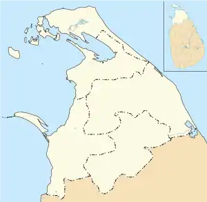
Mannar Island
Mannar Island (/məˈnɑːr/ mə-NAR; Tamil: மன்னார் தீவு, romanized: Maṉṉār tīvu; Sinhala: මන්නාරම් දූපත, romanized: Mannāram dūpata), formerly spelt Manar Island, which lies off the north-western coast of Sri Lanka, is part of Mannar District, Sri Lanka. It is linked to the main island of Sri Lanka by a causeway and the Mannar Bridge, which carries the A14 highway, and a railway bridge . It has an area of about 130 square kilometres (50 sq mi), mainly covered with vegetation and sand.
Mannar Island
Manar Island | |
|---|---|
 Mannar Island 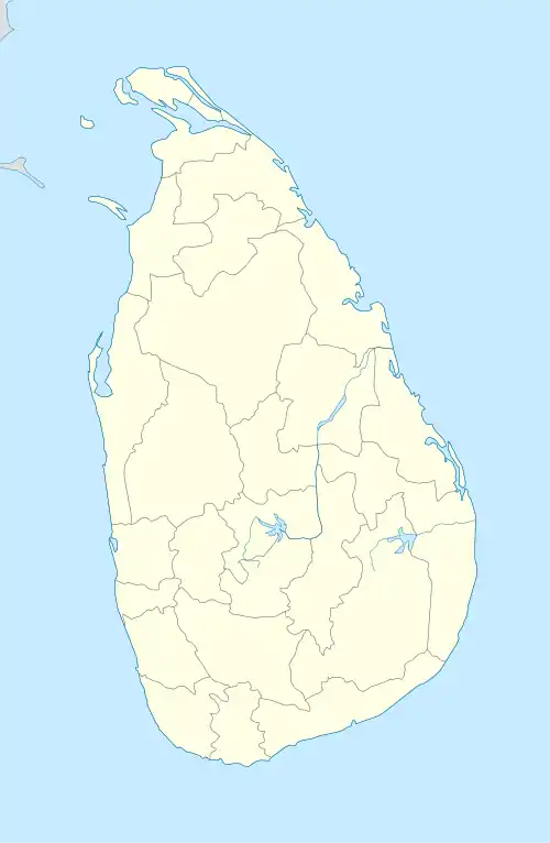 Mannar Island | |
| Coordinates: 9°03′0″N 79°50′0″E | |
| Country | Sri Lanka |
| Province | Northern |
| District | Mannar |
| DS Division | Mannar |
History
During the Sri Lankan civil war (1983–2009), Muslim inhabitants of the island were forced to leave by the Tamil Tigers, but some have returned since.[1]
Geography
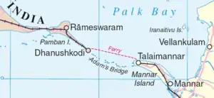
The island lies at the eastern end of Adam's Bridge (Tamil: ஆதம் பாலம், romanized: Ātam pālam),[2] a chain of limestone shoals between Pamban Island (also known as Rameswaram Island), off the south-eastern coast of Tamil Nadu, India, and Mannar Island. Geological evidence suggests that this may have been a land connection between India and Sri Lanka.
Fishing is an important part of the economy.[2]
Settlements and transport
The main settlements on the island are Mannar and Erukkulampiddi on its eastern coast, and Pesalai on its northern coast, all connected by the A14 road which leads across the bridge to mainland Sri Lanka.
Talaimannar, on the north-western coast of the island, is the terminus for the Mannar railway line.[3]
Between 1914 and 1964, there was a train and ferry link from mainland India via Dhanushkodi and Talaimannar to Colombo, but this was not resumed after the disastrous damage caused by a cyclone in 1964. The Palk Strait bridge was proposed in June 2015, to link mainland India to Mannar.
Environment
The island is home to baobab trees, brought from Africa by Arab merchants centuries ago. The island is within the Central Asian Flyway, a heavily used route for migratory birds, and the Vankalai Bird Sanctuary is just south of the island on the mainland. It is protected by the Sri Lankan Government and is recognised under the Ramsar Convention on Wetlands of International Importance Especially as Waterfowl Habitat as an important area for both local and migratory birds.[1]
The island's ecology, agriculture and fishing areas may be easily damaged by disruption to the environment.[1]
Sand mining
The mineral ilmenite, from which titanium dioxide is made, is plentiful in the islands sand. Titanium dioxide is a white pigment with a variety of uses, including in paint, plastics and cosmetics. The Perth-based Australian company, Titanium Sands, has been doing exploratory drilling and has estimated reserves of up to 265 million tonnes of ilmenite and have started the process of applying for a permit to mine the sand. However, environmental scientists are concerned about the impact of future drilling on birds and other wildlife. The company has said that an environmental impact assessment, followed by public consultation, would be undertaken before a mining licence can be granted.[1]
References
- Kilvert, Nick (22 December 2020). "Mannar Island is a bird paradise that survived Sri Lanka's civil war. Now an Australian mining company wants its sand". ABC News. Australian Broadcasting Corporation. Retrieved 30 December 2020.
- Murray, Lorraine. "Mannar Island". Encyclopedia Britannica. Retrieved 30 December 2020.
- "PM Narendra Modi Flags off Train Service at Talaimannar in Sri Lanka". NDTV.com. 14 March 2015. Retrieved 30 December 2020.