Margery Hill
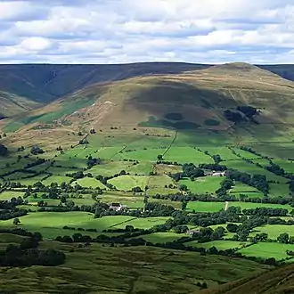
Margery Hill /ˈmɑːrɡəri/ is a 546-metre (1,791 ft) hill on the Howden Moors in South Yorkshire, England. It lies towards the northern boundary of the Peak District National Park, between Langsett Reservoir to the northeast and Howden Reservoir to the southwest. The area is managed by the National Trust as part of their High Peak Estate.
| Margery Hill | |
|---|---|
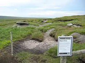 Margery Hill cairn | |
| Highest point | |
| Elevation | 546 m (1,791 ft) [1] |
| Prominence | 19 m [1] |
| Parent peak | Kinder Scout |
| Coordinates | 53°27′27″N 1°43′00″W |
| Geography | |
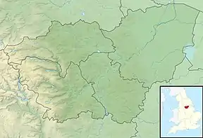 Margery Hill Margery Hill in South Yorkshire | |
| Location | South Yorkshire, England |
| Parent range | Peak District |
| OS grid | SK189956 |
Peat near the summit cairn has been dated to a uniform age of about 3,500 years old, indicating that it was constructed rather than natural;[2] it is believed to have been part of a Bronze Age burial mound.[3] The area has been designated a Scheduled Ancient Monument by English Heritage.[3]
Margery Hill is the highest marked point within the boundaries of Sheffield. The land rises slightly to 548 metres (1,798 ft) about 0.9 miles (1.5 km) to the south, near High Stones.
References
- "Margery Hill", hill-bagging.co.uk, retrieved 11 March 2016
- Margery Hill Cairn (notice; viewed 18 June 2006), High Peak Estate, The National Trust
- Historic England. "Round cairn 200m west of Margery Hill triangulation pillar (1020415)". National Heritage List for England. Retrieved 6 January 2017.