Shining Tor
Shining Tor is a hill with a height of 559 metres (1,834 ft) above sea level in the Peak District of England, between the towns of Buxton and Macclesfield, lying on the modern administrative border between Derbyshire and Cheshire East (though historically it was entirely within Cheshire). Its summit is the highest point in the unitary council area of Cheshire East and in the former administrative county of Cheshire (1974–2009). However, it is not as often stated the (historic) county top of Cheshire, as this title belongs to Black Hill (height 582 metres (1,909 ft)) near Crowden. The word tor means a high rock, and is a loan word from Old Brythonic. The hill forms a long moorland ridge running north–south between Whaley Bridge and the A537 road to the west of the Cat and Fiddle Inn, which also includes Cats Tor (519 metres (1,703 ft) high) to the north.
| Shining Tor | |
|---|---|
 The trig point and former ladder stile at the summit of Shining Tor. | |
| Highest point | |
| Elevation | 559 m (1,834 ft) [1] |
| Prominence | 236 m [1] |
| Parent peak | Kinder Scout |
| Listing | Marilyn, County Top, Dewey |
| Coordinates | 53°15′38″N 2°00′34″W |
| Geography | |
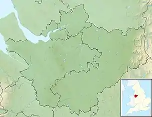 Shining Tor Shining Tor in Cheshire | |
| Location | Cheshire, England |
| Parent range | Peak District |
| OS grid | SJ994737 |
| Topo map | OS Landranger 118 |
(There is another hill named Shining Tor, above Dovedale in Derbyshire, at grid reference SK145545.)
Ascent
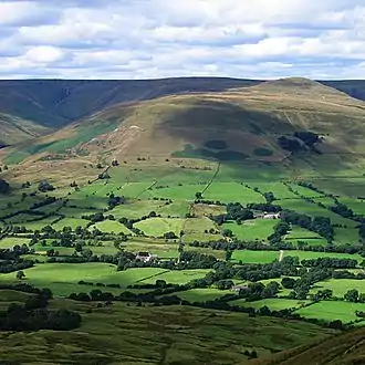
The hill offers very pleasant walking and can be climbed by many routes, perhaps most commonly from the Upper Goyt Valley by Errwood reservoir, perhaps combined with a walk along the ridge north from Shining Tor over Cats Tor. It can also be gained with less climbing from the Cat and Fiddle Inn.
Views
As it is the highest point around (it is some 8 metres (26 ft) higher than the summit of Axe Edge Moor above Buxton), the views are pleasant, though the relatively flat uplands mean they are not extensive in all directions: the view to the southwest of the peak of Shutlingsloe above Wildboarclough is particularly notable, and in clear conditions Winter Hill near Bolton, the city of Manchester and much of the Cheshire Plain can be seen, including the radio telescopes at Jodrell Bank 20 kilometres (12 mi) to the west. In very clear but not unusual conditions North Wales and even Snowdonia can be seen.[2] The hill is used by amateur radio operators for Summits On The Air activations (G/SP-004, 2 points).[3]

Geology
The north–south ridge of Shining Tor including the summit itself is formed from the Chatsworth Grit, a thick sandstone of Namurian age which occurs widely across the Peak District. The beds dip moderately steeply to the east into a north–south-aligned syncline known as the Goyt Trough. Shining Tor is thought to have stood above the ice sheet during the last ice age and so is free from glacial deposits. The eastern dipslope and shallower parts of its western flanks are covered by peat up to several metres deep.[4]
References
- Shining Tor at www.hill-bagging.co.uk. Retrieved 11 March 2016.
- "Shining Tor". viewfinderpanoramas.org. Retrieved 10 August 2012.
- Summits on the Air - Shining Tor - G/SP-004
- British Geological Survey map sheet 111 'Buxton' & accompanying memoir