Marotiri, New Zealand
Marotiri is a rural community in the Taupo District and Waikato region of New Zealand's North Island.[1]
Marotiri | |
|---|---|
Rural locality | |
| |
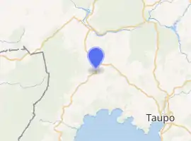
| Coordinates: 38.543840°S 175.817962°E | |
| Country | New Zealand |
| Region | Waikato |
| Territorial authority | Taupo District |
| Ward | Mangakino-Pouakani |
| Population (2018) | |
| • Total | 327 |
| Postcode(s) | 3492 |
The community has an annual family agricultural day each November.[2]
Demographics
| Year | Pop. | ±% p.a. |
|---|---|---|
| 2006 | 2,310 | — |
| 2013 | 2,214 | −0.60% |
| 2018 | 2,391 | +1.55% |
| Source: [3] | ||
The statistical area of Marotiri, which at 744 square kilometres is much larger than this community and includes Mangakino, Whakamaru, and Mokai, had a population of 2,391 at the 2018 New Zealand census, an increase of 177 people (8.0%) since the 2013 census, and an increase of 81 people (3.5%) since the 2006 census. There were 843 households. There were 1,236 males and 1,158 females, giving a sex ratio of 1.07 males per female. The median age was 35 years (compared with 37.4 years nationally), with 582 people (24.3%) aged under 15 years, 471 (19.7%) aged 15 to 29, 1,065 (44.5%) aged 30 to 64, and 276 (11.5%) aged 65 or older.
Ethnicities were 71.3% European/Pākehā, 40.5% Māori, 3.3% Pacific peoples, 5.6% Asian, and 1.5% other ethnicities (totals add to more than 100% since people could identify with multiple ethnicities).
The proportion of people born overseas was 13.3%, compared with 27.1% nationally.
Although some people objected to giving their religion, 59.2% had no religion, 26.6% were Christian, 0.5% were Hindu, 1.0% were Muslim, 0.4% were Buddhist and 7.0% had other religions.
Of those at least 15 years old, 174 (9.6%) people had a bachelor or higher degree, and 480 (26.5%) people had no formal qualifications. The median income was $28,600, compared with $31,800 nationally. The employment status of those at least 15 was that 888 (49.1%) people were employed full-time, 333 (18.4%) were part-time, and 93 (5.1%) were unemployed.[3]
Marotiri is in meshblocks 1293200, 1293302 and 4004316, which had a population of 327 in the 2018 census.[4]
Education
Marotiri School is a co-educational state primary school,[5] with a roll of 142 as of March 2020.[6][7] The school opened in 1961.[8]
References
- Hariss, Gavin. "Marotiri, Waikato". topomap.co.nz. NZ Topo Map.
- "Ag Day for Marotiri kids". Stuff. Taupo and Turangi Weekender. 1 November 2018.
- "Statistical area 1 dataset for 2018 Census". Statistics New Zealand. March 2020. Marotiri (187700). 2018 Census place summary: Marotiri
- "Meshblock Electoral Populations 2020 for proposed boundaries data". Statistics New Zealand. April 2020. Meshblocks 1293200, 1293302 and 4004316.
- "Marotiri School Ministry of Education School Profile". educationcounts.govt.nz. Ministry of Education.
- "New Zealand Schools Directory". New Zealand Ministry of Education. Retrieved 26 April 2020.
- "Marotiri School Education Review Office Report". ero.govt.nz. Education Review Office.
- "Untitled". Hawkes Bay Today. 15 December 2010.
