Mata-Mata, Brunei
Mata-Mata, locally known in Malay as Kampung Mata-Mata or Kampong Mata-Mata, is a populated place in Brunei-Muara District, Brunei. It is a group of settlements on the outskirts of Bandar Seri Begawan, the capital of Brunei, comprising the original settlement of Mata-Mata, the Perpindahan Mata-Mata settlement and the Mata-Mata public housing areas of the Landless Indigenous Citizens' Housing Scheme (Malay: Skim Tanah Kurnia Rakyat Jati or simply STKRJ).
Mata-Mata
Kampung Mata-Mata Kampong Mata-Mata | |
|---|---|
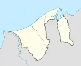
 Location in Brunei | |
| Coordinates: 4°54′06.7″N 114°53′22.9″E | |
| Country | Brunei |
| District | Brunei-Muara |
| Mukim | Gadong 'B' |
| Sub-areas |
|
| Postcodes | BE1718, BE1918, BE4119, BE4319, BE4519 |
Geography
Mata-Mata is located in the central part of Brunei-Muara District. It is also located on the outskirts of Bandar Seri Begawan, thus functions as a suburb of the capital. It neighbours the settlements of Katok to the north and Beribi to the south-east.[1]
Mata-Mata consists of three main clusters of settlements, namely: Mata-Mata (original settlement), Perpindahan Mata-Mata and Mata-Mata Landless Indigenous Citizens' Housing Scheme. Perpindahan Mata-Mata (literally 'Mata-Mata Relocation') is a housing area established for a group of village residents in Kampong Ayer who had been relocated to live on land.[2] Mata-Mata Landless Indigenous Citizens' Housing Scheme is also known as Katok 'B' Landless Indigenous Citizens' Housing Scheme even though the settlement is not contiguous to the original Katok settlement area.
Administration
The area of Mata-Mata is currently divided into five sub-areas and they are designated as village administrative divisions, the third and lowest subdivisions of Brunei. The community of each subdivision is led by a ketua kampung or village head. The subdivisions serve the smallest population census by territory. Each subdivision is also a designated postcode area, thus has its own postcode. All 'villages' are subdivisions of Gadong 'B', a mukim or subdistrict of Brunei-Muara.
| Name | Name in Malay[1] | Postcode[3] |
|---|---|---|
| Mata-Mata | Kampung Mata-Mata | BE1718 |
| Perpindahan Mata-Mata | Kampung Perpindahan Mata-Mata | BE1918 |
| Mata-Mata (Katok 'B') Landless Indigenous Citizens' Housing Scheme Area 1 | Skim Tanah Kurnia Rakyat Jati Kampung Mata-Mata (Katok 'B') Kawasan 1 | BE4119 |
| Mata-Mata (Katok 'B') Landless Indigenous Citizens' Housing Scheme Area 2 | Skim Tanah Kurnia Rakyat Jati Kampung Mata-Mata (Katok 'B') Kawasan 2 | BE4319 |
| Mata-Mata (Katok 'B') Landless Indigenous Citizens' Housing Scheme Area 3 | Skim Tanah Kurnia Rakyat Jati Kampung Mata-Mata (Katok 'B') Kawasan 3 | BE4519 |
Education
The levels of education available in Mata-Mata only include primary and secondary. There are a few public primary schools as well as Katok Secondary School which are run by the government's education ministry.
The Ugama or Islamic religious primary education, which has been made compulsory for Muslim pupils in Brunei, is also available in Mata-Mata. They are provided in a few religious schools which share grounds with the primary schools in Mata-Mata and they are run by the Ministry of Religious Affairs.
Within Mata-Mata is also located Raja Isteri Pengiran Anak Hajah Saleha Girls' Secondary Arabic Religious School (Malay: Sekolah Ugama Arab Menengah Perempuan Raja Isteri Pengiran Anak Hajah Saleha), a government secondary school. However, it is a specialised school providing Islamic religious education and taught in Arabic; it is also run by the religious affairs ministry.
Religion
Place of worship
There are two mosques in Mata-Mata, namely Kampong Perpindahan Mata-Mata Mosque and the Balai Ibadat of Kampong Mata-Mata. They primarily serve the Muslim residents for the Jumu'ah or weekly Friday prayers.
See also
References
- Brunei Darussalam street directory : quick & easy reference maps., Brunei Press Sdn. Bhd., 2014, pp. 72–74, ISBN 9789991732411, OCLC 932264901
- "Rencana - Asal usul Kampung Perpindahan Mata-Mata". www.pelitabrunei.gov.bn (in Malay). Retrieved 2018-02-19.
- "Brunei Postal Services - postcodes". post.gov.bn. Retrieved 2018-02-19.