Matamata
Matamata [ˈmataˌmata] is a town in the Waikato region of New Zealand's North Island. It is located near the base of the Kaimai Ranges, and is a thriving farming area known for Thoroughbred horse breeding and training pursuits. It is part of the Matamata-Piako District, which takes in the surrounding rural areas as well as Morrinsville and Te Aroha. State Highway 27 and the Kinleith Branch railway run through the town. The town has a population of 8,460 as of June 2020.[1]
Matamata | |
|---|---|
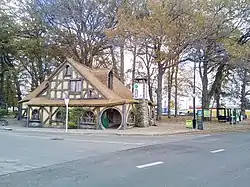 Matamata information centre | |
| |
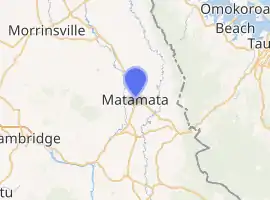
| Coordinates: 37°49′S 175°46′E | |
| Country | New Zealand |
| Region | Waikato |
| Territorial authority | Matamata-Piako District |
| Electorate | Waikato |
| Government | |
| • Mayor | Ash Tanner |
| Elevation | 63 m (207 ft) |
| Population (June 2020)[1] | |
| • Urban | 8,460 |
| Time zone | UTC+12 (NZST) |
| • Summer (DST) | UTC+13 (NZDT) |
| Postcode | 3400 |
| Area code(s) | 07 |
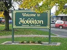
A nearby farm was the location for the Hobbiton Movie Set in Peter Jackson's The Lord of the Rings. The New Zealand government decided to leave the Hobbit holes built on location as tourist attractions, since they were designed to blend seamlessly into the environment. During the period between the filming of The Lord of the Rings: The Return of the King and The Hobbit: An Unexpected Journey they had no furniture or props, but could be entered with vistas of the farm viewed from inside them.[2] A "Welcome to Hobbiton" sign has been placed on the main road. In 2011 parts of Hobbiton began to close in preparation for the three new movies based on the first Tolkien novel, The Hobbit.
Demographics
| Year | Pop. | ±% p.a. |
|---|---|---|
| 2006 | 6,297 | — |
| 2013 | 7,086 | +1.70% |
| 2018 | 7,806 | +1.95% |
| Source: [3] | ||
Matamata, comprising the statistical areas of Matamata North and Matamata South, had a population of 7,806 at the 2018 New Zealand census, an increase of 720 people (10.2%) since the 2013 census, and an increase of 1,509 people (24.0%) since the 2006 census. There were 3,111 households. There were 3,717 males and 4,089 females, giving a sex ratio of 0.91 males per female, with 1,374 people (17.6%) aged under 15 years, 1,314 (16.8%) aged 15 to 29, 2,934 (37.6%) aged 30 to 64, and 2,187 (28.0%) aged 65 or older.
Ethnicities were 84.5% European/Pākehā, 15.7% Māori, 1.7% Pacific peoples, 5.9% Asian, and 1.4% other ethnicities (totals add to more than 100% since people could identify with multiple ethnicities).
The proportion of people born overseas was 16.6%, compared with 27.1% nationally.
Although some people objected to giving their religion, 49.2% had no religion, 37.2% were Christian, 1.0% were Hindu, 0.2% were Muslim, 0.7% were Buddhist and 3.0% had other religions.
Of those at least 15 years old, 678 (10.5%) people had a bachelor or higher degree, and 1,848 (28.7%) people had no formal qualifications. The employment status of those at least 15 was that 2,763 (43.0%) people were employed full-time, 849 (13.2%) were part-time, and 198 (3.1%) were unemployed.[3]
History
In the early nineteenth century, the area including and surrounding the present-day Matamata township was part of the territory of the Ngāti Hinerangi iwi and Ngāti Hauā. The Matamata pā itself was actually located near the present-day settlement of Waharoa, approximately 6 kilometres (4 miles) to the north.
The first European thought to have visited the Matamata area was the trader Phillip Tapsell in about 1830.[4] In 1833 the Reverend Alfred Nesbit Brown visited the area and in 1835 opened a mission near Matamata Pa, but this closed the following year when intertribal warfare broke out.[4] In 1865 Josiah Firth negotiated with Ngāti Hauā leader Wiremu Tamihana and leased a large area of land, including the future site of the town which he named after the pā.[4] Firth constructed a dray road to Cambridge and cleared the Waihou River so that it was navigable by his (small) boats.[4]
Peria, on the outskirts of Matamata, was the scene of the Kīngitanga meeting of 1863.[5][6]
Firth's estate later failed and by 1904 had been wholly obtained by the Crown and was subdivided into dairy farm units[7] to take advantage of the new technology of refrigeration.[8] It became a dependent Town District in 1917, an independent Town District in 1919 and was constituted a borough in 1935.[4] With the re-organisation of territorial authorities in New Zealand in 1989, Matamata became part of the Matamata-Piako District.
Railway station
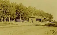
Matamata was a station on the Kinleith Branch, from 8 March 1886,[11] initially 40 minutes north of the temporary terminus at Oxford and about an hour from Morrinsville.[12] It was 6.03 km (3.75 mi) south of Waharoa, 7.91 km (4.92 mi) north of Hinuera[13] and for a while seems to have become a flag station,[14][15] though it did have a goods shed.[16] It had two members of staff from 1913[17] and by 1950 8,868 tickets were sold at Matamata and it transported 42,322 sheep and pigs.[18] It closed to passengers on 12 November 1968,[11] but reopened to serve the Geyserland Express[19] from 9 December 1991 until 7 October 2001.
The station building was replaced in the 1960s[9] and has been the Railside by the Green community centre since 2002,[20] though it is fenced off from the platform.[21] Occasional excursions still use the platform.[22][23]
Media
Matamata is the home of various media outlets, including studios for tvCentral, TV Rotorua and iTV Live, which is unusual for a town of such size.
- Matamata Chronicle
- Scene
Sports
Matamata is home to the Matamata Swifts soccer team, who compete in the Lotto Sport Italia NRFL Division 1A.
Schools
Matamata College is the town's co-educational state secondary school,[24][25] with a roll of 740 as of March 2020.[26]
Matamata Intermediate is the town's co-educational state intermediate school,[27][28] with a roll of 397.[29]
There are two co-educational state primary schools: Matamata Primary School,[30][31] with a roll of 415;[32] and Firth School,[33] with a roll of 193.[34] The motto for Firth School is E Tipu E Rea, which translates as Grow and Flourish.[35]
Matamata Christian School is a co-educational state integrated Christian primary school,[36][37] with a roll of 81.[38]
St Joseph's Catholic School is a co-educational state integrated Catholic school,[39] with a roll of 35.[40]
_aerial_photo_(probably_1940s).tif.jpg.webp) Aerial view of Matamata College in the 1940s
Aerial view of Matamata College in the 1940s_in_1950s_postcard.tif.jpg.webp) Front of Matamata College in the 1950s
Front of Matamata College in the 1950s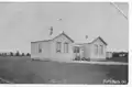 Matamata Public School from around 1909.
.jpg.webp) Matamata Public School around 1919.
Matamata Public School around 1919.
Notable people
Nearby towns
Smaller towns nearby are:
- Hinuera
- Peria
- Turanga-O-Moana
- Te Poi
- Waharoa
- Walton, New Zealand
- Wardville, New Zealand
References
- "Population estimate tables - NZ.Stat". Statistics New Zealand. Retrieved 22 October 2020.
- "Matamata Area Guide". Archived from the original on 17 February 2009. Retrieved 7 January 2009.
- "Statistical area 1 dataset for 2018 Census". Statistics New Zealand. March 2020. Matamata North (174900) and Matamata South (175000). 2018 Census place summary: Matamata North 2018 Census place summary: Matamata South
- 'MATAMATA', from An Encyclopaedia of New Zealand, edited by A. H. McLintock, originally published in 1966. Te Ara – the Encyclopedia of New Zealand, updated 22 April 2009
- Peria Topo Map
- "Maori Report Of The Speeches At The Meeting At Peria". Press. 3 January 1863. p. 3. Retrieved 20 June 2016.
- D. B. Waterson. 'Firth, Josiah Clifton', from the Dictionary of New Zealand Biography. Te Ara – the Encyclopedia of New Zealand, updated 18-Sep-2013
- Waterson, D. B. (1969). "The Matamata Estate, 1904-1959: Land Transfers and Subdivision in the Waikato" (PDF). New Zealand Journal of History. 3 (1): 36.
- "Matamata railway station with the Plantation behind (pre-1919)". Retrieved 31 May 2018.
- "Matamata-Piako District Plan". www.mpdc.govt.nz. Retrieved 31 May 2018.
- Scoble, Juliet (2010). "Names & Opening & Closing Dates of Railway Stations" (PDF). Rail Heritage Trust of New Zealand.
- "Page 7 Advertisements Column 4". Te Aroha News. 29 May 1886. p. 7. Retrieved 31 May 2018.
- Yonge, John Roger; Company, Quail Map (1993). New Zealand Railway and Tramway Atlas. Quail Map Company. ISBN 9780900609923.
- "Matamata". nzetc.victoria.ac.nz. 1902. Retrieved 31 May 2018.
- Representatives, New Zealand Parliament House of (1908). Parliamentary Debates.
- "Railway Station Matamata, showing two steam locomotive trains stopped". www.aucklandcity.govt.nz. Retrieved 31 May 2018.
- "Parliamentary Papers | Appendix to the Journals of the House of Representatives | 1913 Session I". paperspast.natlib.govt.nz. Retrieved 31 May 2018.
- "Parliamentary Papers | Appendix to the Journals of the House of Representatives | 1950 Session I". paperspast.natlib.govt.nz. Retrieved 31 May 2018.
- "Inter-regional Rail service distances and times". www.bettertransport.org.nz. Retrieved 31 May 2018.
- "home". www.railsidematamata.co.nz. Retrieved 31 May 2018.
- "Matamata: New Zealand's re-cycled Station". Phillip Overton. 13 December 2013. Retrieved 31 May 2018.
- "Photos – Silver Fern to Matamata". nzrailphotos.co.nz. Retrieved 31 May 2018.
- "Glenbrook to Matamata & Return – Waikato Explorer – RES Excursions – Glenbrook Vintage Railway". www.gvr.co.nz. Retrieved 31 May 2018.
- "Matamata College Official School Website". matamatacollege.school.nz.
- "Matamata College Ministry of Education School Profile". educationcounts.govt.nz. Ministry of Education.
- "Matamata College Education Review Office Report". ero.govt.nz. Education Review Office.
- "Matamata Intermediate Official School Website". matamataintermediate.school.nz.
- "Matamata Intermediate Ministry of Education School Profile". educationcounts.govt.nz. Ministry of Education.
- "Matamata Intermediate Education Review Office Report". ero.govt.nz. Education Review Office.
- "Matamata Primary School Official School Website". matamataprimary.school.nz.
- "Matamata Primary School Ministry of Education School Profile". educationcounts.govt.nz. Ministry of Education.
- "Matamata Primary School Education Review Office Report". ero.govt.nz. Education Review Office.
- "Firth School Ministry of Education School Profile". educationcounts.govt.nz. Ministry of Education.
- "Firth School Education Review Office Report". ero.govt.nz. Education Review Office.
- "Firth School Official School Website". firth.school.nz.
- "Matamata Christian School Official School Website". matamata.school.nz.
- "Matamata Christian School Ministry of Education School Profile". educationcounts.govt.nz. Ministry of Education.
- "Matamata Christian School Education Review Office Report". ero.govt.nz. Education Review Office.
- "St Joseph's Catholic School Ministry of Education School Profile". educationcounts.govt.nz. Ministry of Education.
- "St Joseph's Catholic School Education Review Office Report". ero.govt.nz. Education Review Office.