Matatiele
Matatiele is a town located in the northern part of the Eastern Cape Province of South Africa. According to the South African National Census of 2011, its 12,466 (1,113.44 per km²) residents and 4,107 (366.83 per km²) households make Matatiele the largest populated town (South African Main Place No 295171) in the Matatiele Local Municipality.[2]
Matatiele | |
|---|---|
 Matatiele  Matatiele | |
| Coordinates: 30°20′32″S 28°48′22″E | |
| Country | South Africa |
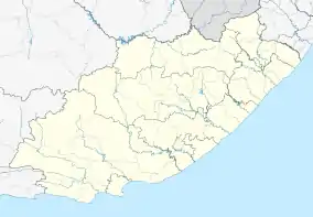
| Province | Eastern Cape |
| District | Alfred Nzo |
| Municipality | Matatiele |
| Area | |
| • Total | 11.20 km2 (4.32 sq mi) |
| Population (2011)[1] | |
| • Total | 12,466 |
| • Density | 1,100/km2 (2,900/sq mi) |
| Racial makeup (2011) | |
| • Black African | 83.5% |
| • Coloured | 9.5% |
| • Indian/Asian | 2.6% |
| • White | 4.1% |
| • Other | 0.4% |
| First languages (2011) | |
| • Xhosa | 48.3% |
| • Sotho | 23.5% |
| • English | 14.3% |
| • Afrikaans | 7.5% |
| • Other | 6.4% |
| Time zone | UTC+2 (SAST) |
| Postal code (street) | 4730 |
| PO box | 4730 |
| Area code | 039 |
Once dominated by wetlands and marshes, Matatiele derives its name from the Sotho language words “matata”, meaning wild ducks, and “ile”, meaning gone. When taken together, Matatiele conveys a message that “ducks have flown”. [3] In Phuthi language, the town name is pronounced “Madadiyela”. The common informal name for the town in any of the languages mentioned, including English, is “Matat”. And those born here call it “sweet Matat”. [4]
Today, its area of 11.20 km² – tucked in the shadows of the Matatiele Mountains – is predominately farmland, where 100% organic red meat is on offer, and tourism is a primary source of income. As one of the top 12 towns among South Africa’s popular tourist attractions Route 56, Matatiele provides many activities for fishers, hikers, bikers, bird watchers, etc. Moreover, the Matatiele Museum (a former Dutch Reformed Church that opened in 1993) – displays dinosaur fossils, San peoples (also known as the Bushmen], missionaries, and town's history from its 19th century gun runners and smugglers to a quaint town filled with friendly locals serving authentic Xosha people cuisine.
History
Evidence of Stone Age inhabitants in the form of art adorning rocks is found throughout the area. In the early 1860s, the Griquas settled here after migrating across the Drakensberg from Philippolis. The town was the centre of cattle rustling and gun-running, and order was only restored in 1874 by the Cape Mounted Riflemen. The town became a municipality in 1904.
The town was a part of the Cape Province until it was transferred to the Natal in 1978. In 2005, the municipality was moved from the KwaZulu-Natal province to the Eastern Cape as part of the Twelfth Amendment of the Constitution of South Africa, over the objections of the majority of residents, some of whom in response founded the African Independent Congress. On 18 August 2006, the Constitutional Court ruled that the part of the Twelfth Amendment dealing with the transfer of Matatiele from KwaZulu-Natal to the Eastern Cape was invalid due to insufficient consultation with stakeholders.[5] The situation was eventually resolved, and Matatiele was confirmed as part of Eastern Cape province under the Thirteenth Amendment.[6]
Notable people of Matatiele
- Mosiuoa Lekota, politician leader of the Congress of the People
- Andile Jali, footballer
- Thulas Nxesi, Minister of Employment and Labour
- Chris Jafta, judge of the Constitutional Court of South Africa
- Emtee, hip hop musician and record producer
- Innocent Mdledle, footballer for Supersport United
- Siyabonga Siphika, former footballer for Bush Buscks F.C. & Maritzburg United F.C.
- Innocent Mdledle, left back footballer for Supersport United FC
- Ntsikelelo Nyauza, footballer for Orlando Pirates FC
- Zola Nombona, Actress
References
- "Main Place Matatiele". Census 2011.
- "A Geo-referenced Census Frame of Dwellings for the 2011 census of the Republic of South Africa." United Nations Statistics Division (Census Knowledge Base ). Retrieved 8 November 2011. [http://unstats.un.org/unsd/censuskb20/KnowledgebaseArticle10237.aspx]
- Matatiele Local Municipality Government Home Page [https://www.matatiele.gov.za/]
- Matatiele Local Municipality government quick facts [https://matatiele.co.za/quick-facts-about-matatiele/]
- "Archived copy". Archived from the original on 2007-09-30. Retrieved 2007-07-19.CS1 maint: archived copy as title (link)
- http://www.justice.gov.za/legislation/acts/const13th-2007gg.pdf
Municipalities and communities of Alfred Nzo District Municipality, Eastern Cape | ||
|---|---|---|
District seat: Mount Ayliff | ||
| Matatiele | .svg.png.webp) Alfred Nzo District within South Africa | |
| Umzimvubu | ||
| Mbizana | ||
| Ntabankulu | ||
