Mayhill, New Mexico
Mayhill is an unincorporated community in Otero County, New Mexico, United States.[1] It is surrounded by the Lincoln National Forest on the eastern slope of the Sacramento Mountains, at the confluence of James Canyon and Rio Penasco, approximately 17 miles east of Cloudcroft.[2] The elevation is 6581 feet.
Mayhill, New Mexico | |
|---|---|
 Mayhill, New Mexico Location within the state of New Mexico | |
| Coordinates: 32°53′23″N 105°28′41″W | |
| Country | United States |
| State | New Mexico |
| County | Otero |
| Elevation | 6,581 ft (2,006 m) |
| Time zone | UTC-7 (MST) |
| • Summer (DST) | UTC-6 (MDT) |
References
- "Mayhill, New Mexico". Geographic Names Information System. United States Geological Survey.
- "Mayhill, New Mexico". Archived from the original on 2016-04-01. Retrieved 2010-02-12.
Municipalities and communities of Otero County, New Mexico, United States | ||
|---|---|---|
| City | 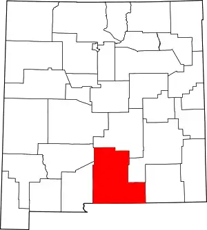 Map of New Mexico highlighting Otero County | |
| Villages | ||
| CDPs | ||
| Other unincorporated communities | ||
| Indian reservation | ||
| Footnotes | ‡This populated place also has portions in an adjacent county or counties | |
| ||
This article is issued from Wikipedia. The text is licensed under Creative Commons - Attribution - Sharealike. Additional terms may apply for the media files.
