Mayoworth, Wyoming
Mayoworth is an unincorporated place in the southwestern part of Johnson County in north-central Wyoming, United States.[1] It lies in the eastern valleys of the Bighorn Mountains. Mayoworth is at the western terminus of Wyoming Highway 191, approximately 12 miles west of the Kaycee exit off Interstate 25 (with U.S. Route 87).[2]
Mayoworth, Wyoming
Mayoworth Junction | |
|---|---|
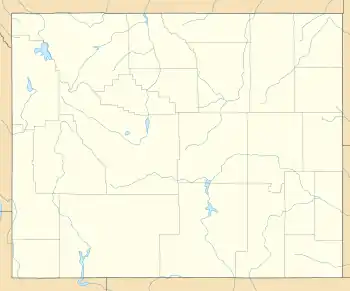 Mayoworth Location of Mayoworth in Wyoming | |
| Coordinates: 43°49′55″N 106°47′31″W | |
| Country | United States |
| State | Wyoming |
| County | Johnson |
| Elevation | 5,230 ft (1,594 m) |
| Time zone | UTC-7 (MST) |
| • Summer (DST) | UTC-6 (MDT) |
| ZIP code | 82639 |
| GNIS feature ID | 1597396 |
Mayoworth is on the North Fork of the Powder River, which experienced severe flooding in 1992.[3]
The Mayoworth Number Ten clay mine is just to the northwest of town.[4]
Barnum is several miles south of Mayoworth, and Big Trails is the nearest place over the Bighorn range.
History
Nearby Dull Knife Battlefield is the site of an 1876 battle between the U.S. Army and Cheyenne.
From the late 1860s to about 1910, the Hole-in-the-Wall mountain pass was used by outlaws such as Butch Cassidy. Several gangs kept a cabin nearby.
Further reading
- Richardson, Albert L. (1950). Geology of the Mayoworth Region, Johnson County, Wyoming (M.A., Geology). University of Wyoming.
References
- U.S. Geological Survey Geographic Names Information System: U.S. Geological Survey Geographic Names Information System: Mayoworth, Wyoming
- Official State Highway Map of Wyoming (Map). Wyoming Department of Transportation. 2014.
|access-date=requires|url=(help) - Vigil, Jeff C. (1993). "Water-Supply Paper 2499. Summary of Floods of 1992 June 14-15, 1992, Along the North Fork Powder River Below Pass Creek, Near Mayoworth, Wyoming". U.S. Geological Survey. Retrieved 22 November 2014.
- U.S. Geological Survey Geographic Names Information System: U.S. Geological Survey Geographic Names Information System: Mayoworth Number Ten Mine
Municipalities and communities of Johnson County, Wyoming, United States | ||
|---|---|---|
| City | 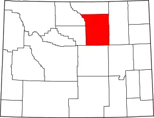 | |
| Town | ||
| Unincorporated communities | ||
| ||
