Maysville, Colorado
Maysville is an unincorporated community and a census-designated place (CDP) located in and governed by Chaffee County, Colorado, United States. The population of the Maysville CDP was 135 at the United States Census 2010.[4] The Salida post office (Zip Code 81201) serves the area.[3]
Maysville, Colorado | |
|---|---|
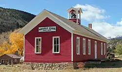 The Maysville School in Maysville. | |
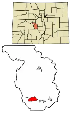 Location of the Maysville CDP in Chaffee County, Colorado. | |
 Maysville Location of the Maysville CDP in the United States. | |
| Coordinates: 38°31′50″N 106°12′56″W[1] | |
| Country | |
| State | |
| County | Chaffee County |
| Area | |
| • Total | 12.433 sq mi (32.201 km2) |
| • Land | 12.420 sq mi (32.167 km2) |
| • Water | 0.013 sq mi (0.034 km2) |
| Elevation | 9,504 ft (2,897 m) |
| Population (2010) | |
| • Total | 135 |
| • Density | 11/sq mi (4/km2) |
| Time zone | UTC-7 (MST) |
| • Summer (DST) | UTC-6 (MDT) |
| ZIP Code[3] | Salida 81201 |
| Area code(s) | 719 |
| GNIS feature[2] | Maysville CDP |
Geography
The Maysville CDP has an area of 7,957 acres (32.201 km2), including 8.4 acres (0.034 km2) of water.[1]
Demographics
The United States Census Bureau initially defined the Maysville CDP for the United States Census 2010.
| Year | Pop. | ±% |
|---|---|---|
| 2010 | 135 | — |
| 2020 | — | |
| Source: United States Census Bureau | ||
See also
- Outline of Colorado
- State of Colorado
- Colorado cities and towns
- Colorado counties
References
- "State of Colorado Census Designated Places - BAS20 - Data as of January 1, 2020". United States Census Bureau. Retrieved December 20, 2020.
- "U.S. Board on Geographic Names: Domestic Names". United States Geological Survey. Retrieved December 20, 2020.
- "Zip Code 81201 Map and Profile". zipdatamaps.com. 2020. Retrieved December 20, 2020.
- "2010: DEC Summary File 1". United States Census Bureau. Retrieved December 20, 2020.
External links
- Maysville @ ColoradoArtifactual.com
- Maysville @ GhostTowns.com
- Maysville School
- Chaffee County website
Municipalities and communities of Chaffee County, Colorado, United States | ||
|---|---|---|
| City | 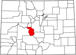 Map of Colorado highlighting Chaffee County | |
| Towns | ||
| CDPs | ||
| Unincorporated communities | ||
| ||
This article is issued from Wikipedia. The text is licensed under Creative Commons - Attribution - Sharealike. Additional terms may apply for the media files.
