Medicine Lake, Montana
Medicine Lake is a town in Sheridan County, Montana, United States. The population was 225 at the 2010 census.[4]
Medicine Lake, Montana | |
|---|---|
 Location of Medicine Lake, Montana | |
| Coordinates: 48°30′2″N 104°30′11″W | |
| Country | United States |
| State | Montana |
| County | Sheridan |
| Area | |
| • Total | 0.40 sq mi (1.02 km2) |
| • Land | 0.40 sq mi (1.02 km2) |
| • Water | 0.00 sq mi (0.00 km2) |
| Elevation | 1,959 ft (597 m) |
| Population | |
| • Total | 225 |
| • Estimate (2019)[3] | 223 |
| • Density | 564.56/sq mi (217.90/km2) |
| Time zone | UTC-7 (Mountain (MST)) |
| • Summer (DST) | UTC-6 (MDT) |
| ZIP code | 59247 |
| Area code(s) | 406 |
| FIPS code | 30-48775 |
| GNIS feature ID | 0774077 |
| Website | www |
On July 5, 1937, Medicine Lake recorded a temperature of 117 °F (47 °C), setting the record for the highest temperature ever recorded in Montana.[5]
On November 14, 2020, the high school football team, which co-ops with Froid, known as the RedHawks, won the 6-man State Championship by defeating White Sulpher Springs 44-19 to finish the season 10-0.
It was the first football state title for the school, which had finished 2nd in 1952, 1985 and 2000, when they were known as the Honkers.
Geography
Medicine Lake is located at 48°30′2″N 104°30′11″W (48.500438, -104.503079).[6]
According to the United States Census Bureau, the town has a total area of 0.40 square miles (1.04 km2), all land.[7]
Climate
According to the Köppen Climate Classification system, Medicine Lake has a semi-arid climate, abbreviated "BSk" on climate maps.[8]
| Climate data for Medicine Lake, Montana | |||||||||||||
|---|---|---|---|---|---|---|---|---|---|---|---|---|---|
| Month | Jan | Feb | Mar | Apr | May | Jun | Jul | Aug | Sep | Oct | Nov | Dec | Year |
| Record high °F (°C) | 60 (16) |
68 (20) |
77 (25) |
92 (33) |
103 (39) |
107 (42) |
117 (47) |
107 (42) |
101 (38) |
91 (33) |
75 (24) |
68 (20) |
117 (47) |
| Average high °F (°C) | 19.7 (−6.8) |
26.1 (−3.3) |
37.8 (3.2) |
56.1 (13.4) |
68.5 (20.3) |
77.0 (25.0) |
84.4 (29.1) |
83.7 (28.7) |
71.8 (22.1) |
58.4 (14.7) |
38.7 (3.7) |
25.7 (−3.5) |
54.0 (12.2) |
| Average low °F (°C) | −3.0 (−19.4) |
2.9 (−16.2) |
14.6 (−9.7) |
29.3 (−1.5) |
40.6 (4.8) |
49.8 (9.9) |
54.4 (12.4) |
52.2 (11.2) |
41.8 (5.4) |
30.8 (−0.7) |
16.5 (−8.6) |
4.2 (−15.4) |
27.8 (−2.3) |
| Record low °F (°C) | −51 (−46) |
−58 (−50) |
−38 (−39) |
−15 (−26) |
8 (−13) |
22 (−6) |
30 (−1) |
30 (−1) |
9 (−13) |
−7 (−22) |
−31 (−35) |
−46 (−43) |
−58 (−50) |
| Average precipitation inches (mm) | 0.38 (9.7) |
0.30 (7.6) |
0.45 (11) |
1.02 (26) |
1.82 (46) |
2.91 (74) |
2.17 (55) |
1.48 (38) |
1.25 (32) |
0.74 (19) |
0.40 (10) |
0.35 (8.9) |
13.25 (337) |
| Average snowfall inches (cm) | 5.8 (15) |
4.0 (10) |
4.3 (11) |
2.7 (6.9) |
0.2 (0.51) |
0.0 (0.0) |
0.0 (0.0) |
0.0 (0.0) |
0.1 (0.25) |
1.0 (2.5) |
3.5 (8.9) |
5.3 (13) |
26.9 (68) |
| Source: [9] | |||||||||||||
Demographics
| Historical population | |||
|---|---|---|---|
| Census | Pop. | %± | |
| 1920 | 292 | — | |
| 1930 | 384 | 31.5% | |
| 1940 | 396 | 3.1% | |
| 1950 | 454 | 14.6% | |
| 1960 | 452 | −0.4% | |
| 1970 | 393 | −13.1% | |
| 1980 | 408 | 3.8% | |
| 1990 | 357 | −12.5% | |
| 2000 | 269 | −24.6% | |
| 2010 | 225 | −16.4% | |
| 2019 (est.) | 223 | [3] | −0.9% |
| U.S. Decennial Census[10] 2015 Estimate[11] | |||
2010 census
As of the census[2] of 2010, there were 225 people, 109 households, and 65 families residing in the town. The population density was 562.5 inhabitants per square mile (217.2/km2). There were 167 housing units at an average density of 417.5 per square mile (161.2/km2). The racial makeup of the town was 90.7% White, 0.9% African American, 4.0% Native American, and 4.4% from two or more races.
There were 109 households, of which 24.8% had children under the age of 18 living with them, 40.4% were married couples living together, 12.8% had a female householder with no husband present, 6.4% had a male householder with no wife present, and 40.4% were non-families. 38.5% of all households were made up of individuals, and 14.7% had someone living alone who was 65 years of age or older. The average household size was 2.06 and the average family size was 2.74.
The median age in the town was 48.1 years. 24.4% of residents were under the age of 18; 4.6% were between the ages of 18 and 24; 17.8% were from 25 to 44; 34.8% were from 45 to 64; and 18.7% were 65 years of age or older. The gender makeup of the town was 49.3% male and 50.7% female.
2000 census
As of the census[12] of 2000, there were 269 people, 120 households, and 72 families residing in the town. The population density was 658.8 people per square mile (253.3/km2). There were 165 housing units at an average density of 404.1 per square mile (155.4/km2). The racial makeup of the town was 92.19% White, 3.72% Native American, 0.37% Asian, 0.37% Pacific Islander, and 3.35% from two or more races.
There were 120 households, out of which 28.3% had children under the age of 18 living with them, 50.0% were married couples living together, 6.7% had a female householder with no husband present, and 40.0% were non-families. 40.0% of all households were made up of individuals, and 15.0% had someone living alone who was 65 years of age or older. The average household size was 2.24 and the average family size was 2.97.
In the town, the population was spread out, with 26.4% under the age of 18, 7.1% from 18 to 24, 22.3% from 25 to 44, 28.3% from 45 to 64, and 16.0% who were 65 years of age or older. The median age was 41 years. For every 100 females there were 116.9 males. For every 100 females age 18 and over, there were 108.4 males.
The median income for a household in the town was $28,750, and the median income for a family was $35,694. Males had a median income of $26,000 versus $26,250 for females. The per capita income for the town was $16,405. About 7.2% of families and 7.2% of the population were below the poverty line, including 6.5% of those under the age of eighteen and 3.4% of those 65 or over.
References
- "2019 U.S. Gazetteer Files". United States Census Bureau. Retrieved July 26, 2020.
- "U.S. Census website". United States Census Bureau. Retrieved 2012-12-18.
- "Population and Housing Unit Estimates". United States Census Bureau. May 24, 2020. Retrieved May 27, 2020.
- "2010 Census Redistricting Data (Public Law 94-171) Summary File". American FactFinder. United States Census Bureau. Retrieved 2 May 2011.
- "Record Highest Temperatures by State" (PDF). National Climatic Data Center. Retrieved 9 May 2011.
- "US Gazetteer files: 2010, 2000, and 1990". United States Census Bureau. 2011-02-12. Retrieved 2011-04-23.
- "US Gazetteer files 2010". United States Census Bureau. Archived from the original on 2012-01-25. Retrieved 2012-12-18.
- Climate Summary for Medicine Lake, Montana
- "MEDICINE LAKE 3 SE, MONTANA (245572)". Western Regional Climate Center. Retrieved August 3, 2016.
- United States Census Bureau. "Census of Population and Housing". Retrieved July 14, 2016.
- "Population Estimates". United States Census Bureau. Archived from the original on October 19, 2016. Retrieved July 14, 2016.
- "U.S. Census website". United States Census Bureau. Retrieved 2008-01-31.
External links
Municipalities and communities of Sheridan County, Montana, United States | ||
|---|---|---|
| City | 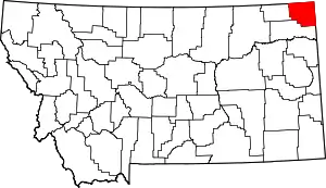 Sheridan County map | |
| Towns | ||
| CDPs | ||
| Unincorporated communities | ||
| Ghost town | ||
| Indian reservations | ||
| Footnotes | ‡This populated place also has portions in an adjacent county or counties | |
| ||