Melcher-Dallas, Iowa
Melcher-Dallas is a city in Marion County, Iowa, United States. The population was 1,288 at the 2010 census.

Melcher-Dallas, Iowa | |
|---|---|
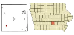 Location of Melcher-Dallas, Iowa | |
| Coordinates: 41°13′36″N 93°14′23″W | |
| Country | |
| State | |
| County | Marion |
| Government | |
| • Mayor | Barb Van Wyk |
| Area | |
| • Total | 1.00 sq mi (2.58 km2) |
| • Land | 1.00 sq mi (2.58 km2) |
| • Water | 0.00 sq mi (0.00 km2) |
| Elevation | 948 ft (289 m) |
| Population | |
| • Total | 1,288 |
| • Estimate (2019)[3] | 1,244 |
| • Density | 1,249.00/sq mi (482.46/km2) |
| Time zone | UTC-6 (Central (CST)) |
| • Summer (DST) | UTC-5 (CDT) |
| ZIP code | 50163 |
| Area code(s) | 641 |
| FIPS code | 19-50935 |
| GNIS feature ID | 0458955 |
| Website | http://melcherdallasiowa.org |
History
Melcher and Dallas were separate cities until they merged into one city in 1986.[4][5]
In 1919, the Red Rock Coal Company's mine near Melcher was the third largest coal mine in the state. This mine produced 187,427 tons of coal that year and employed 345 men.[6]
Geography
Melcher-Dallas is located at 41°13′36″N 93°14′23″W (41.226718, -93.239777).[7]
According to the United States Census Bureau, the city has a total area of 1.00 square mile (2.59 km2), all of it land.[8]
Demographics
| Year | Pop. | ±% |
|---|---|---|
| 1940 | 1,290 | — |
| 1950 | 898 | −30.4% |
| 1960 | 867 | −3.5% |
| 1990 | 1,302 | +50.2% |
| 2000 | 1,298 | −0.3% |
| 2010 | 1,288 | −0.8% |
| 2019 | 1,244 | −3.4% |
| Source:"U.S. Census website". United States Census Bureau. Retrieved 2020-03-29. and Iowa Data Center Source: | ||
2010 census
As of the census[2] of 2010, there were 1,288 people, 527 households, and 357 families living in the city. The population density was 1,288.0 inhabitants per square mile (497.3/km2). There were 584 housing units at an average density of 584.0 per square mile (225.5/km2). The racial makeup of the city was 97.7% White, 0.2% African American, 0.2% Native American, 1.2% from other races, and 0.7% from two or more races. Hispanic or Latino of any race were 2.1% of the population.
There were 527 households, of which 30.2% had children under the age of 18 living with them, 54.3% were married couples living together, 8.0% had a female householder with no husband present, 5.5% had a male householder with no wife present, and 32.3% were non-families. 28.5% of all households were made up of individuals, and 12.2% had someone living alone who was 65 years of age or older. The average household size was 2.44 and the average family size was 2.99.
The median age in the city was 39.6 years. 24.5% of residents were under the age of 18; 8.5% were between the ages of 18 and 24; 23.8% were from 25 to 44; 25.8% were from 45 to 64; and 17.5% were 65 years of age or older. The gender makeup of the city was 49.6% male and 50.4% female.
2000 census
As of the census[10] of 2000, there were 1,298 people, 517 households, and 359 families living in the city. The population density was 1,297.1 people per square mile (501.2/km2). There were 565 housing units at an average density of 564.6 per square mile (218.1/km2). The racial makeup of the city was 98.69% White, 0.08% African American, 0.08% Native American, 0.39% Asian, 0.08% Pacific Islander, 0.08% from other races, and 0.62% from two or more races. Hispanic or Latino of any race were 0.23% of the population.
There were 517 households, out of which 32.9% had children under the age of 18 living with them, 55.7% were married couples living together, 9.5% had a female householder with no husband present, and 30.4% were non-families. 26.9% of all households were made up of individuals, and 16.2% had someone living alone who was 65 years of age or older. The average household size was 2.51 and the average family size was 3.06.
In the city, the population was spread out, with 28.0% under the age of 18, 6.8% from 18 to 24, 24.7% from 25 to 44, 22.6% from 45 to 64, and 18.0% who were 65 years of age or older. The median age was 38 years. For every 100 females, there were 97.0 males. For every 100 females age 18 and over, there were 93.6 males.
The median income for a household in the city was $36,207, and the median income for a family was $42,167. Males had a median income of $32,788 versus $22,500 for females. The per capita income for the city was $15,600. About 6.1% of families and 8.2% of the population were below the poverty line, including 11.2% of those under age 18 and 9.8% of those age 65 or over.
Education
The Melcher-Dallas Community School District operates local public schools.[11]
References
- "2019 U.S. Gazetteer Files". United States Census Bureau. Retrieved July 17, 2020.
- "U.S. Census website". United States Census Bureau. Retrieved 2012-05-11.
- "Population and Housing Unit Estimates". United States Census Bureau. May 24, 2020. Retrieved May 27, 2020.
- Orszag, Peter (2008). Estimated Costs of U. S. Operations in Iraq and Afghanistan and of Other Activities Related to the War on Terrorism. DIANE Publishing. p. III-3. ISBN 9781428988040.
- Clapp, Charles L. (February 28, 1989). "Docket No. A89-2". Postal Rate Commission. Retrieved March 5, 2014.
- H. E. Pride, Iowa Coal, Bulletin No. 48, Iowa State College of Agriculture and Mechanic Arts Engineering Extension Department, Oct. 6, 1920.
- "US Gazetteer files: 2010, 2000, and 1990". United States Census Bureau. 2011-02-12. Retrieved 2011-04-23.
- "US Gazetteer files 2010". United States Census Bureau. Archived from the original on 2012-01-25. Retrieved 2012-05-11.
- "Census of Population and Housing". Census.gov. Retrieved June 4, 2015.
- "U.S. Census website". United States Census Bureau. Retrieved 2008-01-31.
- "MELCHER-DALLAS" (PDF). Iowa Department of Education. Retrieved 2020-08-04.
Municipalities and communities of Marion County, Iowa, United States | ||
|---|---|---|
| Cities | Map of Iowa highlighting Marion County | |
| Unincorporated communities | ||
| ||