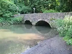
Mells River
The Mells River flows through the eastern Mendip Hills in Somerset, England. It rises at Gurney Slade and flows east joining the River Frome at Frome.
| Mells River | |
|---|---|
 Bridge over the Mells River at Great Elm | |
| Location | |
| Country | England |
| County | Somerset |
| Cities | Gurney Slade, Mells, Great Elm, Frome |
| Physical characteristics | |
| Source | |
| • location | Somerset, England |
| • elevation | 2 m (6 ft 7 in) |
| Mouth | River Frome |
• location | Frome, Somerset, England |
• coordinates | 51°14′50″N 2°19′14″W |
| Basin features | |
| Tributaries | |
| • right | Finger Stream, Whatley Brook, Nunney Brook |
The river forms one of the boundaries of Mells Park, a country house estate in Mells.[1] A few kilometres downstream it flows between the pre-Roman fortifications of Wadbury Camp to the north and Tedbury Camp to the south.[2] The river flows through the western part of the Harridge Woods nature reserve.[3]
Mells River also powered the Old Ironstone Works[4] and several other mills set up by James Fussell III in 1744.[5] It is now a 0.25 hectare biological Site of Special Scientific Interest, as it is used by both Greater and Lesser Horseshoe Bats.[6][7]
Vobster Inn Bridge, which carries the lane over the Mells River, is dated 1764, and is Grade II listed.[8] At Great Elm the Murtry Aqueduct,[9] built around 1795, carried the Dorset and Somerset Canal over the river.
The river takes the outfall from Whatley Quarry.[10] Downstream of the outfall is the Mells River Sink. This acts as a spring when the water table is high and as a sink into underground aquifers, through the Limestone, when the water table is low.[11] Water tracing showed this to be part of an underground part of the river 2.5 kilometres (1.6 mi) long. Archaeological investigations found the remains of woolly rhinoceros bones and a 1st-century bronze brooch.[12]
References
- "Park, Mells". Somerset Historic Environment Record. Somerset County Council. Retrieved 2009-09-25.
- Phelps, William (1836), The History and Antiquities of Somersetshire: Being a General and Parochial Survey of that Interesting County. To which is Prefixed an Historical Introduction, with a Brief View of Ecclesiastical History; and an Account of the Druidical, Belgic-British, Roman, Saxon, Danish, and Norman Antiquities, Now Extant, J.B. Nichols and son, p. 105, retrieved 2016-08-19
- Harridge Woods Leafet (PDF), Somerset Wildlife Trust, retrieved 2016-08-22
- "The Case for Extending the Mendip Hills Area of Outstanding Natural Beauty". Mendip Hills Society. 2005. Retrieved 2010-10-16.
- Atthill, Robin (1964). Old Mendip. Newton Abbott: David and Charles. ISBN 0-7153-5171-0.
- "English Nature citation sheet" (PDF). 2006. Retrieved 2006-07-25.
- Thornes, Robin (2010). Men of iron. The Fussells of Mells. Frome Society for Local Study. ISBN 978-0-9565869-1-9.
- "Vobster Inn Bridge". historicengland.org.uk. Retrieved 2006-11-14.
- "Murtry Aqueduct". historicengland.org.uk. English Heritage. Retrieved 2009-09-25.
- "Quarry control helps maintain river levels". ABB. Retrieved 2009-09-25.
- "Mells and the Wadbury Valley". British Geological Survey. Retrieved 2009-09-25.
- Stanton, W.I. (1982). "Mells River Sink: A spelaeological curiosity in east mendip Somerset" (PDF). Proceedings of the University of Bristol Spelæological Society. 16 (2): 93–104.