Meriden, Kansas
Meriden is a city in Jefferson County, Kansas, United States. As of the 2010 census, the city population was 813.[6]
Meriden, Kansas | |
|---|---|
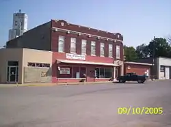 Downtown Meriden (2005) | |
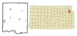 Location within Jefferson County and Kansas | |
 KDOT map of Jefferson County (legend) | |
| Coordinates: 39°11.4′N 95°34.1′W | |
| Country | United States |
| State | Kansas |
| County | Jefferson |
| Founded | 1872 |
| Incorporated | 1891 |
| Named for | Meriden, New Hampshire |
| Area | |
| • Total | 0.77 sq mi (1.98 km2) |
| • Land | 0.76 sq mi (1.96 km2) |
| • Water | 0.01 sq mi (0.02 km2) |
| Elevation | 974 ft (297 m) |
| Population | |
| • Total | 813 |
| • Estimate (2019)[3] | 780 |
| • Density | 1,031.75/sq mi (398.25/km2) |
| Time zone | UTC-6 (CST) |
| • Summer (DST) | UTC-5 (CDT) |
| ZIP code | 66512 |
| Area code | 785 |
| FIPS code | 20-45950 [4] |
| GNIS ID | 0478474 [5] |
| Website | meridenks.com |
History
Meriden was founded in 1872.[7] It was named by a pioneer settler for his former hometown of Meriden, New Hampshire.[8]
Geography
Meriden is located at 39°11.4′N 95°34.1′W (39.1890, -95.5684).[9] According to the United States Census Bureau, the city has a total area of 0.79 square miles (2.05 km2), of which 0.78 square miles (2.02 km2) is land and 0.01 square miles (0.03 km2) is water.[10]
Demographics
| Historical population | |||
|---|---|---|---|
| Census | Pop. | %± | |
| 1880 | 103 | — | |
| 1900 | 433 | — | |
| 1910 | 467 | 7.9% | |
| 1920 | 422 | −9.6% | |
| 1930 | 390 | −7.6% | |
| 1940 | 421 | 7.9% | |
| 1950 | 378 | −10.2% | |
| 1960 | 402 | 6.3% | |
| 1970 | 472 | 17.4% | |
| 1980 | 707 | 49.8% | |
| 1990 | 622 | −12.0% | |
| 2000 | 706 | 13.5% | |
| 2010 | 813 | 15.2% | |
| 2019 (est.) | 780 | [3] | −4.1% |
| U.S. Decennial Census | |||
Meriden is part of the Topeka, Kansas Metropolitan Statistical Area.
2010 census
As of the census[2] of 2010, there were 813 people, 315 households, and 215 families living in the city. The population density was 1,042.3 inhabitants per square mile (402.4/km2). There were 336 housing units at an average density of 430.8 per square mile (166.3/km2). The racial makeup of the city was 96.8% White, 1.4% Native American, 0.2% Asian, and 1.6% from two or more races. Hispanic or Latino of any race were 2.2% of the population.
There were 315 households, of which 43.2% had children under the age of 18 living with them, 43.5% were married couples living together, 15.2% had a female householder with no husband present, 9.5% had a male householder with no wife present, and 31.7% were non-families. 25.7% of all households were made up of individuals, and 9.2% had someone living alone who was 65 years of age or older. The average household size was 2.58 and the average family size was 3.12.
The median age in the city was 33.5 years. 30.3% of residents were under the age of 18; 9.5% were between the ages of 18 and 24; 26.8% were from 25 to 44; 25.3% were from 45 to 64; and 8.2% were 65 years of age or older. The gender makeup of the city was 51.2% male and 48.8% female.
2000 census
As of the census[4] of 2000, there were 706 people, 260 households, and 198 families living in the city. The population density was 1,986.0 people per square mile (757.2/km2). There were 279 housing units at an average density of 784.8 per square mile (299.2/km2). The racial makeup of the city was 97.17% White, 0.99% Native American, 0.14% from other races, and 1.70% from two or more races. Hispanic or Latino of any race were 0.99% of the population.
There were 260 households, out of which 45.4% had children under the age of 18 living with them, 54.6% were married couples living together, 16.9% had a female householder with no husband present, and 23.5% were non-families. 20.4% of all households were made up of individuals, and 6.9% had someone living alone who was 65 years of age or older. The average household size was 2.72 and the average family size was 3.14.
In the city, the population was spread out, with 32.4% under the age of 18, 7.8% from 18 to 24, 33.7% from 25 to 44, 16.9% from 45 to 64, and 9.2% who were 65 years of age or older. The median age was 31 years. For every 100 females, there were 101.7 males. For every 100 females age 18 and over, there were 94.7 males.
The median income for a household in the city was $40,221, and the median income for a family was $45,278. Males had a median income of $35,515 versus $25,769 for females. The per capita income for the city was $16,008. About 4.5% of families and 5.9% of the population were below the poverty line, including 7.5% of those under age 18 and 1.8% of those age 65 or over.
Education
The community is served by Jefferson West USD 340 public school district.
References
- "2019 U.S. Gazetteer Files". United States Census Bureau. Retrieved July 24, 2020.
- "U.S. Census website". United States Census Bureau. Retrieved 2012-07-06.
- "Population and Housing Unit Estimates". United States Census Bureau. May 24, 2020. Retrieved May 27, 2020.
- "U.S. Census website". United States Census Bureau. Retrieved 2008-01-31.
- "US Board on Geographic Names". United States Geological Survey. 2007-10-25. Retrieved 2008-01-31.
- "2010 City Population and Housing Occupancy Status". U.S. Census Bureau. Retrieved April 6, 2012.
- Kansas State Historical Society (1916). Biennial Report of the Board of Directors of the Kansas State Historical Society. Kansas State Printing Plant. pp. 209.
- Capace, Nancy (2000). Encyclopedia of Kansas. Somerset Publishers. p. 235. ISBN 9780403093120.
- "US Gazetteer files: 2010, 2000, and 1990". United States Census Bureau. 2011-02-12. Retrieved 2011-04-23.
- "US Gazetteer files 2010". United States Census Bureau. Archived from the original on 2012-01-25. Retrieved 2012-07-06.
External links
| Wikimedia Commons has media related to Meriden, Kansas. |
Municipalities and communities of Jefferson County, Kansas, United States | ||
|---|---|---|
| Cities |  Map of Kansas highlighting Jefferson County | |
| Unincorporated communities | ||
| Townships | ||
| Footnotes | †This populated place is designated a Census-Designated Place (CDP) by the United States Census Bureau | |
| ||
| Authority control |
|---|