Mexico, Ohio
Mexico is an unincorporated community in northeastern Tymochtee Township, Wyandot County, Ohio, United States.[2] Located at 40°59′11″N 83°11′36″W (40.9864448, -83.1932520), it lies at an elevation of 810 feet (247 m).[1]
Mexico, Ohio | |
|---|---|
 Location of Mexico, Ohio | |
| Coordinates: 40°59′11″N 83°11′36″W | |
| Country | United States |
| State | Ohio |
| County | Wyandot |
| Township | Tymochtee |
| Elevation | 810 ft (250 m) |
| Time zone | UTC-5 (Eastern (EST)) |
| • Summer (DST) | UTC-4 (EDT) |
| GNIS feature ID | 1048970[1] |
History
Mexico was laid out and platted in 1832.[3] The community was named in commemoration of the Mexican War of Independence.[4] The community was located in Crawford County until land the town site occupies was given to form Wyandot County in 1845.[5] A post office was established at Mexico in 1837, and remained in operation until 1902.[6]
References
- "Mexico, Wyandot County, Ohio". Geographic Names Information System. United States Geological Survey.
- DeLorme. Ohio Atlas & Gazetteer. 7th ed. Yarmouth: DeLorme, 2004, p. 47. ISBN 0-89933-281-1.
- Marvin Jr., Ronald I. (24 August 2015). A Brief History of Wyandot County, Ohio. History Press. p. 56. ISBN 978-1-62585-535-0.
- Peacefull, Leonard (1996). A Geography of Ohio. Kent State University Press. p. 219. ISBN 9780873385251. Retrieved 8 December 2013.
- Perrin, William Henry; Battle, J. H.; Goodspeed, Weston Arthur (1881). History of Crawford County and Ohio: Containing a History of the State of Ohio, from Its Earliest Settlement to the Present Time. Baskin & Battey. p. 966.
- "Wyandot County". Jim Forte Postal History. Retrieved 7 December 2015.
Municipalities and communities of Wyandot County, Ohio, United States | ||
|---|---|---|
| City | 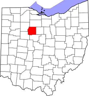 Map of Ohio highlighting Wyandot County | |
| Villages | ||
| Townships | ||
| CDP | ||
| Unincorporated communities | ||
| Footnotes | ‡This populated place also has portions in an adjacent county or counties. | |
| ||
This article is issued from Wikipedia. The text is licensed under Creative Commons - Attribution - Sharealike. Additional terms may apply for the media files.
