Middleport Township, Iroquois County, Illinois
Middleport Township is one of twenty-six townships in Iroquois County, Illinois, USA. As of the 2010 census, its population was 4,375 and it contained 2,099 housing units.[2] Middleport Township changed its name to Watseka Township in September 1863, but then changed back to Middleport Township on an unknown date.
Middleport Township | |
|---|---|
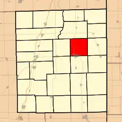 Location in Iroquois County | |
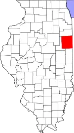 Iroquois County's location in Illinois | |
| Coordinates: 40°49′01″N 87°42′29″W | |
| Country | United States |
| State | Illinois |
| County | Iroquois |
| Established | November 6, 1855 |
| Area | |
| • Total | 36.48 sq mi (94.5 km2) |
| • Land | 36.39 sq mi (94.2 km2) |
| • Water | 0.09 sq mi (0.2 km2) 0.25% |
| Elevation | 633 ft (193 m) |
| Population (2010) | |
| • Estimate (2016)[1] | 4,140 |
| • Density | 120.2/sq mi (46.4/km2) |
| Time zone | UTC-6 (CST) |
| • Summer (DST) | UTC-5 (CDT) |
| ZIP codes | 60951, 60966, 60970 |
| FIPS code | 17-075-48814 |
Geography
According to the 2010 census, the township has a total area of 36.48 square miles (94.5 km2), of which 36.39 square miles (94.2 km2) (or 99.75%) is land and 0.09 square miles (0.23 km2) (or 0.25%) is water.[2]
Cities, towns, villages
- Watseka (the county seat) (north half)
Unincorporated towns
Cemeteries
The township contains these five cemeteries: Chamberlain, Gard Army of the Republic, Lyman, Oak Hill and Roberts.
Major highways
Airports and landing strips
- Songwood Inn Airport
Landmarks
- Forest Park
- Kay Park
- Peters Park
- Shagbark Airport
School districts
- Donovan Community Unit School District 3
- Iroquois County Community Unit School District 9
Political districts
- Illinois' 15th congressional district
- State House District 105
- State Senate District 53
References
- "Middleport Township, Iroquois County, Illinois". Geographic Names Information System. United States Geological Survey. Retrieved 2010-01-17.
- United States Census Bureau 2007 TIGER/Line Shapefiles
- United States National Atlas
- "Population and Housing Unit Estimates". Retrieved June 9, 2017.
- "Population, Housing Units, Area, and Density: 2010 - County -- County Subdivision and Place -- 2010 Census Summary File 1". United States Census. Archived from the original on 2020-02-12. Retrieved 2013-05-28.
- "Census of Population and Housing". Census.gov. Retrieved June 4, 2016.
External links
Places adjacent to Middleport Township, Iroquois County, Illinois | |
|---|---|
Municipalities and communities of Iroquois County, Illinois, United States | ||
|---|---|---|
| Cities | Map of Illinois highlighting Iroquois County | |
| Villages | ||
| Townships | ||
| Unincorporated communities | ||
| Footnotes | ‡This populated place also has portions in an adjacent county or counties | |
| ||
This article is issued from Wikipedia. The text is licensed under Creative Commons - Attribution - Sharealike. Additional terms may apply for the media files.