Mier y Noriega
Mier y Noriega is a municipality situated in the far southern region of the Mexican state of Nuevo León.
Mier y Noriega | |
|---|---|
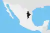
Mier y Noriega Location of Mier y Noriega in Mexico | |
| Coordinates: 23°25′20″N 100°07′01″W | |
| Country | |
| State | Nuevo León |
| Established | 1849 |
| Government | |
| • Municipal President | Pedro Cortéz Briones (PRI) |
| Area | |
| • Total | 1,006.78 km2 (388.72 sq mi) |
| Elevation | 1,669 m (5,476 ft) |
| Population (2010) | |
| • Total | 7,095 |
| • Density | 7.0/km2 (18/sq mi) |
| Data source: INEGI | |
| Time zone | UTC-6 (CST) |
| • Summer (DST) | UTC-5 (CDT) |
| Source: Enciclopedia de los Municipios de México | |
It borders the municipality of Doctor Arroyo to the north, the only municipality it borders in Nuevo León; the municipality also borders San Luis Potosí and Tamaulipas.[1]
The municipality has 7,095 inhabitants, of which 1,214 live in the town of Mier y Noriega, the seat of the municipality. Other settlements with more than 500 residents include La Cardona, Cerros Blancos, Las Palomas, and Tapona Morena.
History
The municipality was founded in 1849 and is named for Servando Teresa de Mier Noriega y Guerra, a Monterrey native who helped draft the Mexican Constitution of 1824. The first colonial settlement took place at the end of the 19th century by agave farmers, though there had been previous indigenous settlement.[1]
References
- (in Spanish) Mier y Noriega
Monterrey (capital) | ||
| Topics |
|  |
| Municipalities |
| |
| Regions |
| |
