Milestone Mountain
Milestone Mountain is a thirteener on the Great Western Divide,[1] a subrange of the Sierra Nevada. The summit marks a point on the boundary between Sequoia and Kings Canyon national parks. It is 0.6 miles (0.97 km) south of Midway Mountain and 3.8 miles (6.1 km) northeast of Triple Divide Peak. It takes its name from the shape of the obelisk on its peak, and has been called this since at least 1873.[6]
| Milestone Mountain | |
|---|---|
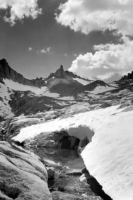 Milestone Mountain, July 1932 (East Side) | |
| Highest point | |
| Elevation | 13,644 ft (4,159 m) NAVD 88[1] |
| Prominence | 711 ft (217 m) [1] |
| Listing | |
| Coordinates | 36°38′05″N 118°29′07″W [4] |
| Geography | |
 Milestone Mountain  Milestone Mountain | |
| Location | Tulare County, California, U.S. |
| Parent range | Great Western Divide, Sierra Nevada |
| Topo map | USGS Mount Brewer |
| Climbing | |
| First ascent | July 14, 1912 via Southwest Ridge, by William E. Colby, Francis Farquhar and Robert Price.[5] |
| Easiest route | Southwest Ridge, East Side, or Northwest Face (all class 3 scrambles)[5] |
References
- "Milestone Mountain, California". Peakbagger.com. Retrieved 2009-09-10.
- "Sierra Peaks Section List" (PDF). Angeles Chapter, Sierra Club. Retrieved 2009-09-10.
- "Western States Climbers List". Climber.org. Retrieved 2016-03-25.
- "Milestone Mountain". Geographic Names Information System. United States Geological Survey. Retrieved 2009-09-10.
- Secor, R.J. (2009). The High Sierra Peaks, Passes, and Trails (3rd ed.). Seattle: The Mountaineers. pp. 119–120. ISBN 9780898869712.
- Farquhar, Francis P. (1926). Place Names of the High Sierra. San Francisco: Sierra Club. Retrieved 2009-09-10.
External links
- "Milestone Mountain". SummitPost.org.
This article is issued from Wikipedia. The text is licensed under Creative Commons - Attribution - Sharealike. Additional terms may apply for the media files.