Minnesota State Highway 267
Minnesota State Highway 267 (MN 267) is a 5.353-mile-long (8.615 km) highway in southwest Minnesota, which runs from its intersection with Murray County State-Aid Highway 4 (Grace Avenue) in Iona and continues north to its northern terminus at its intersection with State Highway 30, 1.5 miles west of Slayton.
| ||||
|---|---|---|---|---|
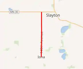
MN 267 highlighted in red | ||||
| Route information | ||||
| Defined by MS § 161.115(198) | ||||
| Maintained by MnDOT | ||||
| Length | 5.353 mi (8.615 km) | |||
| Existed | July 1, 1949[1]–present | |||
| Major junctions | ||||
| South end | ||||
| North end | ||||
| Location | ||||
| Counties | Murray | |||
| Highway system | ||||
| ||||

Route description
Highway 267 serves as a north–south connector route in southwest Minnesota between Iona and State Highway 30 near Slayton.
Highway 267 follows Parnell Street in Iona. The route is also known as 140th Avenue in Iona Township and Slayton Township.
It passes by the runway for the Slayton Municipal Airport near its northern terminus.[2]
The route is legally defined as Route 267 in the Minnesota Statutes.[3]
History
Highway 267 was authorized on July 1, 1949.[1]
The route was paved in 1951.[4][5]
Highway 267 is slated for turnback by 2023.[6]
Major intersections
The entire route is in Murray County.
| Location | mi | km | Destinations | Notes | |
|---|---|---|---|---|---|
| Iona | 0.000 | 0.000 | |||
| Slayton Township | 2.348 | 3.779 | |||
| 4.354 | 7.007 | ||||
| 5.360 | 8.626 | ||||
| 1.000 mi = 1.609 km; 1.000 km = 0.621 mi | |||||
References
- "Chapter 663-H.F. No. 1792", Session Laws of Minnesota for 1949, Earl L. Berg, Commissioner of Administration, pp. 1177–1185
- General Highway Map of Murray County (PDF) (Map). Minnesota Department of Transportation. 2010. Archived from the original (PDF) on December 5, 2008. Retrieved May 2, 2010.
- "161.115, Additional Trunk Highways". Minnesota Statutes. Office of the Revisor of Statutes, State of Minnesota. 2010. Retrieved January 21, 2011.
- 1951 Official Road Map of Minnesota (Map). Cartography by The H.M. Gousha Company. Minnesota Department of Highways. January 1, 1951. § D19. Archived from the original on August 25, 2011. Retrieved January 20, 2011.
- 1952 Official Road Map of Minnesota (Map). Cartography by The H.M. Gousha Company. Minnesota Department of Highways. January 1, 1952. § D19. Archived from the original on July 21, 2011. Retrieved January 20, 2011.
- (PDF) https://www.dot.state.mn.us/govrel/reports/2018/2018-turnback-program-report.pdf. Missing or empty
|title=(help)