Murray County, Minnesota
Murray County is a county in the U.S. state of Minnesota. The population was 8,725 at the 2010 United States Census.[1] Its county seat is Slayton.[2]
Murray County | |
|---|---|
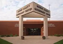 Murray County Government Center in Slayton, Minnesota | |
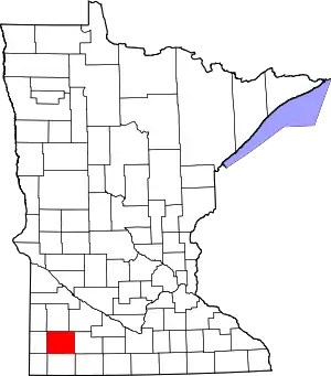 Location within the U.S. state of Minnesota | |
 Minnesota's location within the U.S. | |
| Coordinates: 44°01′N 95°46′W | |
| Country | |
| State | |
| Founded | May 23 (created) June 17, 1872 (organized) |
| Named for | William Pitt Murray |
| Seat | Slayton |
| Largest city | Slayton |
| Area | |
| • Total | 720 sq mi (1,900 km2) |
| • Land | 705 sq mi (1,830 km2) |
| • Water | 15 sq mi (40 km2) 2.1%% |
| Population (2010) | |
| • Total | 8,725 |
| • Estimate (2019) | 8,194 |
| • Density | 11.8/sq mi (4.6/km2) |
| Time zone | UTC−6 (Central) |
| • Summer (DST) | UTC−5 (CDT) |
| Congressional district | 7th |
| Website | www |
History
In 1853 the Minnesota Territory legislature created Blue Earth County from unorganized Dakota Territory lands. In 1855 the legislature partitioned a portion of western Blue Earth to create Brown County. Then on May 23, 1857, a portion of Brown was partitioned off to create Murray County, although it was not organized at that time. On June 17, 1872 the county government was effected, with Currie, which had been founded that same year, as county seat. The county was named for William Pitt Murray (1825-1910), a prominent civic and political figure in Minnesota during its nascent era.
Also in 1872 the township of Center was platted (so named for its central position in the county). This settlement grew rapidly, and its residents soon began agitating to have the county seat moved there.[3] In 1882 the town was renamed as Slayton, and a county vote changed the county seat to Slayton effective June 1, 1889.[4]
In the history of record keeping, Minnesota has been struck by two F-5 tornadoes, and both occurred in Murray County: the Chandler-Lake Wilson Tornado (June 16, 1992) and the Tracy Tornado (June 13, 1968) that began in Murray County before crossing north into Lyon County.
Geography
The county terrain consists of low rolling hills, dotted with lakes and ponds, with all available area devoted to agriculture.[5] The terrain slopes to the south and east. However, its highest elevation occurs on Buffalo Ridge, a promontory extending about two miles along the crest of the Coteau des Prairies in central Chanarambie Township. The bluff rises a few hundred feet above the adjacent valleys.[4] The county has a total area of 720 square miles (1,900 km2), of which 705 square miles (1,830 km2) is land and 15 square miles (39 km2) (2.1%) is water.[6]
The Mississippi-Missouri watershed divide runs through the western part of the county, near Chandler, along Buffalo Ridge. The county's highest point is on that ridge, at 1,920' ASL.[7]
Major highways
Airports[5]
- Slayton Municipal Airport (DVP) - southwest of Slayton, Minnesota
Adjacent counties
- Lyon County - north
- Redwood County - northeast
- Cottonwood County - east
- Nobles County - south
- Rock County - southwest
- Pipestone County - west
Protected areas[5]
- Badger Lake State Wildlife Management Area
- Bergman State Wildlife Management Area
- Big Slough State Wildlife Management Area
- Buffalo Lake State Wildlife Management Area
- Chandler State Wildlife Management Area
- County Line State Wildlife Management Area
- Current Lake State Wildlife Management Area
- Great Oasis State Wildlife Management Area
- Haberman State Wildlife Management Area
- Hjermstad Lake State Wildlife Management Area
- Irruption State Wildlife Management Area
- Klinker State Wildlife Management Area
- Lake Shetek State Park
- Lange State Wildlife Management Area
- Leeds State Wildlife Management Area
- Lowville State Wildlife Management Area
- Mason State Wildlife Management Area
- McCord-Laible State Wildlife Management Area
- Nelson State Wildlife Management Area
- Northern Tallgrass Prairie National Wildlife Refuge
- Peters State Wildlife Management Area
- Phelan State Wildlife Management Area
- Reinhold State Wildlife Management Area
- Rupp State Wildlife Management Area
- Ruthton State Wildlife Management Area
- Schoeberl State Wildlife Management Area
- Shetek State Wildlife Management Area
- Sweetman State Wildlife Management Area
- Tutt State Wildlife Management Area
- Van Eck State Wildlife Management Area
Lakes[5]
- Bear Lake (drained)
- Bloody Lake
- Buffalo Lake
- Corabelle Lake
- Current Lake
- Fox Lake
- Fulda First Lake
- Iron Lake
- Julia Lake (part)
- Lake Louisa
- Lake Maria
- Lake Sarah
- Lake Shetek
- Lake Wilson
- Lime Lake (formerly known as Lizzard Lake and Lake St. Rose)[9]
- Long Lake (part)
- North Badger Lake
- Round Lake
- Smith Lake
- South Badger Lake
- Summit Lake
- Talcot Lake (part)
Demographics
| Historical population | |||
|---|---|---|---|
| Census | Pop. | %± | |
| 1860 | 29 | — | |
| 1870 | 209 | 620.7% | |
| 1880 | 3,604 | 1,624.4% | |
| 1890 | 6,692 | 85.7% | |
| 1900 | 11,911 | 78.0% | |
| 1910 | 11,755 | −1.3% | |
| 1920 | 13,631 | 16.0% | |
| 1930 | 13,902 | 2.0% | |
| 1940 | 15,060 | 8.3% | |
| 1950 | 14,801 | −1.7% | |
| 1960 | 14,743 | −0.4% | |
| 1970 | 12,508 | −15.2% | |
| 1980 | 11,507 | −8.0% | |
| 1990 | 9,660 | −16.1% | |
| 2000 | 9,165 | −5.1% | |
| 2010 | 8,725 | −4.8% | |
| 2019 (est.) | 8,194 | [10] | −6.1% |
| US Decennial Census[11] 1790-1960[12] 1900-1990[13] 1990-2000[14] 2010-2019[1] | |||
2000 census
As of the 2000 United States Census, there were 9,165 people, 3,722 households, and 2,601 families in the county. The population density was 13/sqmi (5.02/km2). There were 4,357 housing units at an average density of 6.18/sqmi (2.39/km2). The racial makeup of the county was 98.34% White, 0.10% Black or African American, 0.22% Native American, 0.21% Asian, 0.02% Pacific Islander, 0.45% from other races, and 0.67% from two or more races. 1.47% of the population were Hispanic or Latino of any race. 47.3% were of German, 12.9% Norwegian, 12.5% Dutch and 5.1% Swedish ancestry.
There were 3,722 households, out of which 29.00% had children under the age of 18 living with them, 62.50% were married couples living together, 4.60% had a female householder with no husband present, and 30.10% were non-families. 27.10% of all households were made up of individuals, and 15.30% had someone living alone who was 65 years of age or older. The average household size was 2.42 and the average family size was 2.94.
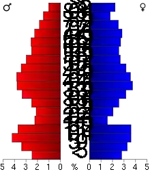
The county population contained 25.00% under the age of 18, 5.90% from 18 to 24, 23.30% from 25 to 44, 24.70% from 45 to 64, and 21.20% who were 65 years of age or older. The median age was 42 years. For every 100 females there were 98.50 males. For every 100 females age 18 and over, there were 97.00 males.
The median income for a household in the county was $34,966, and the median income for a family was $40,893. Males had a median income of $27,101 versus $19,636 for females. The per capita income for the county was $17,936. About 6.30% of families and 8.30% of the population were below the poverty line, including 8.40% of those under age 18 and 9.40% of those age 65 or over.
Communities
Census-designated place
Unincorporated communities
Townships
- Belfast Township
- Bondin Township
- Cameron Township
- Chanarambie Township
- Des Moines River Township
- Dovray Township
- Ellsborough Township
- Fenton Township
- Holly Township
- Iona Township
- Lake Sarah Township
- Leeds Township
- Lime Lake Township
- Lowville Township
- Mason Township
- Moulton Township
- Murray Township
- Shetek Township
- Skandia Township
- Slayton Township
Government and politics
In the past, Murray County presented a balanced precinct, but in the past decade has become Republican-oriented. In 60% of national elections since 1980, the county selected the Republican Party candidate (as of 2020).
| Year | Republican | Democratic | Third parties |
|---|---|---|---|
| 2020 | 68.7% 3,363 | 29.6% 1,449 | 1.7% 84 |
| 2016 | 63.7% 2,974 | 27.7% 1,295 | 8.6% 399 |
| 2012 | 52.5% 2,504 | 45.3% 2,160 | 2.2% 103 |
| 2008 | 48.2% 2,320 | 48.7% 2,345 | 3.1% 148 |
| 2004 | 54.4% 2,719 | 44.4% 2,218 | 1.2% 61 |
| 2000 | 50.6% 2,407 | 44.0% 2,093 | 5.3% 253 |
| 1996 | 39.2% 1,907 | 44.6% 2,173 | 16.2% 789 |
| 1992 | 30.9% 1,609 | 38.2% 1,993 | 30.9% 1,611 |
| 1988 | 44.4% 2,316 | 54.5% 2,840 | 1.1% 56 |
| 1984 | 49.9% 2,780 | 49.2% 2,741 | 1.0% 54 |
| 1980 | 48.6% 3,004 | 43.9% 2,714 | 7.6% 468 |
| 1976 | 40.7% 2,605 | 57.6% 3,685 | 1.7% 109 |
| 1972 | 49.9% 2,959 | 48.8% 2,893 | 1.3% 75 |
| 1968 | 49.4% 2,906 | 45.2% 2,662 | 5.4% 320 |
| 1964 | 37.8% 2,325 | 62.1% 3,822 | 0.1% 5 |
| 1960 | 52.6% 3,357 | 47.2% 3,009 | 0.2% 11 |
| 1956 | 54.6% 3,261 | 45.1% 2,695 | 0.3% 15 |
| 1952 | 65.2% 4,054 | 34.5% 2,145 | 0.4% 24 |
| 1948 | 34.8% 1,951 | 64.2% 3,594 | 1.0% 57 |
| 1944 | 50.7% 2,585 | 48.9% 2,495 | 0.4% 22 |
| 1940 | 48.5% 3,044 | 51.0% 3,203 | 0.5% 34 |
| 1936 | 27.3% 1,601 | 67.1% 3,926 | 5.6% 328 |
| 1932 | 28.2% 1,314 | 70.1% 3,264 | 1.7% 80 |
| 1928 | 55.3% 2,602 | 44.1% 2,078 | 0.6% 29 |
| 1924 | 45.8% 2,034 | 7.5% 334 | 46.7% 2,073 |
| 1920 | 79.2% 3,270 | 16.9% 698 | 4.0% 163 |
| 1916 | 46.6% 1,137 | 48.9% 1,193 | 4.4% 108 |
| 1912 | 17.2% 388 | 34.3% 775 | 48.5% 1,095 |
| 1908 | 60.3% 1,293 | 35.5% 762 | 4.2% 90 |
| 1904 | 70.9% 1,464 | 26.0% 537 | 3.2% 65 |
| 1900 | 60.7% 1,358 | 36.5% 816 | 2.9% 64 |
| 1896 | 52.3% 1,204 | 45.8% 1,054 | 2.0% 46 |
| 1892 | 36.9% 586 | 32.6% 517 | 30.5% 485 |
| Position | Name | District | Next Election | |
|---|---|---|---|---|
| Commissioner | James Jens | District 1 | 2020 | |
| Commissioner | Lori Gunnink | District 2 | 2020 | |
| Commissioner and Chairperson | Dennis Welgraven | District 3 | 2022 | |
| Commissioner | Jim Kluis | District 4 | 2022 | |
| Commissioner | Dave Thiner | District 5 | 2020 | |
| Position | Name | Affiliation | District | |
|---|---|---|---|---|
| Senate | Bill Weber[17] | Republican | District 22 | |
| House of Representatives | Rod Hamilton[18] | Republican | District 22B | |
| Position | Name | Affiliation | District | |
|---|---|---|---|---|
| House of Representatives | Collin Peterson[19] | Democrat | 7th | |
| Senate | Amy Klobuchar[20] | Democrat | N/A | |
| Senate | Tina Smith[21] | Democrat | N/A | |
References
- "State & County QuickFacts". United States Census Bureau. Archived from the original on June 7, 2011. Retrieved September 1, 2013.
- "Find a County". National Association of Counties. Retrieved June 7, 2011.
- Early W. Murray Co. MN Hist., pp. 76-77, retrieved August 3, 2007
- Upham, Warren. Minnesota Geographic Names (1920), pp. 364-370 (accessed April 19, 2019)
- Murray County MN Google Maps (accessed April 19, 2019)
- "2010 Census Gazetteer Files". US Census Bureau. August 22, 2012. Archived from the original on September 21, 2013. Retrieved October 21, 2014.
- "Buffalo Ridge, Minnesota". Retrieved June 24, 2013.
- Nelson, Steven (2011). Savanna Soils of Minnesota. Minnesota: Self. pp. 69-70. ISBN 978-0-615-50320-2.
- Murray County Minnesota - Lime Lake Archived September 28, 2007, at the Wayback Machine, retrieved August 3, 2007
- "Population and Housing Unit Estimates". Retrieved March 26, 2020.
- "U.S. Decennial Census". US Census Bureau. Retrieved October 21, 2014.
- "Historical Census Browser". University of Virginia Library. Retrieved October 21, 2014.
- "Population of Counties by Decennial Census: 1900 to 1990". United States Census Bureau. Retrieved October 21, 2014.
- "Census 2000 PHC-T-4. Ranking Tables for Counties: 1990 and 2000" (PDF). US Census Bureau. Retrieved October 21, 2014.
- Leip, David. "Atlas of US Presidential Elections". uselectionatlas.org. Retrieved October 10, 2018.
- "Cottonwood County :: County Commissioners". www.co.cottonwood.mn.us. Retrieved 2020-06-25.
- "MN State Senate". www.senate.mn. Retrieved 2020-06-25.
- "Rep. Rod Hamilton (22B) - Minnesota House of Representatives". www.house.leg.state.mn.us. Retrieved 2020-06-25.
- "Congressman Collin Peterson". Congressman Collin Peterson. Retrieved 2020-06-24.
- "U.S. Senator Amy Klobuchar". www.klobuchar.senate.gov. Retrieved 2020-06-24.
- "Home". Senator Tina Smith. Retrieved 2020-06-24.
External links
Places adjacent to Murray County, Minnesota | ||||||||||
|---|---|---|---|---|---|---|---|---|---|---|
| ||||||||||
Municipalities and communities of Murray County, Minnesota, United States | ||
|---|---|---|
| Cities | Map of Minnesota highlighting Murray County | |
| Townships | ||
| CDP | ||
| Unincorporated communities | ||
| ||

| Authority control |
|---|