Mjóifjörður
Mjóifjörður is a village of 11 people in East Iceland, sitting on a fjord of the same name (meaning Narrow Fjord). It is part of the municipality of Fjarðabyggð.
Mjóifjörður | |
|---|---|
Village | |
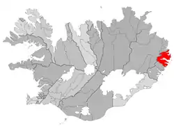 Location of the Municipality of Fjarðabyggð | |
 Mjóifjörður Location in Iceland | |
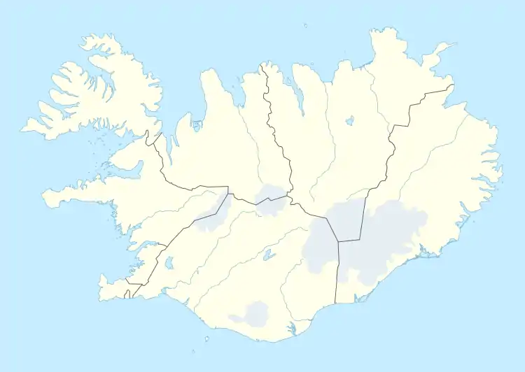
| Coordinates: 65°11′43″N 13°47′32″W | |
| Country | |
| Constituency | Northeast Constituency |
| Region | Eastern Region |
| Municipality | |
| Population (2020) | |
| • Total | 7 |
| Time zone | UTC+0 (GMT) |
| Website | Official website |
History
In the early 20th century, the village was a Norwegian whaling station. The village also hosted the Dalatangi light. It is often referred as the smallest village in the country, and one of the most diverse.
Geography
The other villages composing the municipality are: Eskifjörður (1,068 inh.), Fáskrúðsfjörður (611 inh.), Neskaupstaður (1,400 inh.),[1] Reyðarfjörður (2,238 inh.) and Stöðvarfjörður (231 inh.).[2]
Climate
| Climate data for Mjóifjörður / Dalatangi (1981-2010 normals) | |||||||||||||
|---|---|---|---|---|---|---|---|---|---|---|---|---|---|
| Month | Jan | Feb | Mar | Apr | May | Jun | Jul | Aug | Sep | Oct | Nov | Dec | Year |
| Record high °C (°F) | 18.8 (65.8) |
18.1 (64.6) |
17.5 (63.5) |
19.1 (66.4) |
21.5 (70.7) |
21.4 (70.5) |
23.5 (74.3) |
25.1 (77.2) |
25.8 (78.4) |
23.5 (74.3) |
22.7 (72.9) |
16.6 (61.9) |
25.8 (78.4) |
| Average high °C (°F) | 3.4 (38.1) |
3.2 (37.8) |
3.0 (37.4) |
4.1 (39.4) |
6.3 (43.3) |
9.0 (48.2) |
11.0 (51.8) |
11.3 (52.3) |
9.6 (49.3) |
6.6 (43.9) |
4.7 (40.5) |
3.7 (38.7) |
6.3 (43.4) |
| Daily mean °C (°F) | 1.2 (34.2) |
0.9 (33.6) |
0.8 (33.4) |
2.1 (35.8) |
4.3 (39.7) |
6.9 (44.4) |
9.0 (48.2) |
9.4 (48.9) |
7.7 (45.9) |
4.7 (40.5) |
2.7 (36.9) |
1.5 (34.7) |
4.3 (39.7) |
| Average low °C (°F) | −1.1 (30.0) |
−1.4 (29.5) |
−1.4 (29.5) |
0.0 (32.0) |
2.2 (36.0) |
4.8 (40.6) |
6.9 (44.4) |
7.5 (45.5) |
5.3 (41.5) |
2.8 (37.0) |
0.6 (33.1) |
−0.6 (30.9) |
2.1 (35.8) |
| Record low °C (°F) | −16.5 (2.3) |
−16.9 (1.6) |
−17.1 (1.2) |
−19.2 (−2.6) |
−7.6 (18.3) |
−1.9 (28.6) |
1.0 (33.8) |
1.4 (34.5) |
−1.7 (28.9) |
−8.6 (16.5) |
−10.4 (13.3) |
−15.4 (4.3) |
−19.2 (−2.6) |
| Average precipitation mm (inches) | 136.3 (5.37) |
95.1 (3.74) |
113.3 (4.46) |
87.4 (3.44) |
85.4 (3.36) |
77.7 (3.06) |
87.6 (3.45) |
115.8 (4.56) |
170.0 (6.69) |
187.5 (7.38) |
140.1 (5.52) |
112.4 (4.43) |
1,408.6 (55.46) |
| Average precipitation days | 14.6 | 11.4 | 13.1 | 11.2 | 9.8 | 8.4 | 9.2 | 10.5 | 12.9 | 14.6 | 15.0 | 14.5 | 145.2 |
| Source 1: Météo Climat (averages)[3] | |||||||||||||
| Source 2: Météo Climat (records)[4] | |||||||||||||
References
- Located in the Norðfjörður
- (in Icelandic) Infos on Fjarðabyggð municipal website Archived 2011-03-25 at the Wayback Machine
- "Météo climat stats for Islande". Météo Climat. Retrieved 11 November 2019.
- "Météo climat stats for Dalatangi (records)". Météo Climat. Retrieved 11 November 2019.
External links
![]() Media related to Mjóifjörður at Wikimedia Commons
Media related to Mjóifjörður at Wikimedia Commons
- (in Icelandic) Mjóifjörður page on Fjarðabyggð municipal website
This article is issued from Wikipedia. The text is licensed under Creative Commons - Attribution - Sharealike. Additional terms may apply for the media files.
