Modena, Utah
Modena is an unincorporated community in far western Iron County, near the Nevada border in southwestern Utah, United States.
Modena, Utah | |
|---|---|
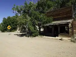 Abandoned buildings in Modena | |
 Modena  Modena | |
| Coordinates: 37°47′56″N 113°55′27″W | |
| Country | United States |
| State | Utah |
| County | Iron |
| Named for | Modena, Italy |
| Elevation | 5,476 ft (1,669 m) |
| Time zone | UTC-7 (Mountain (MST)) |
| • Summer (DST) | UTC-6 (MDT) |
| ZIP codes | 84753 |
| GNIS feature ID | 1430394[1] |
Geography
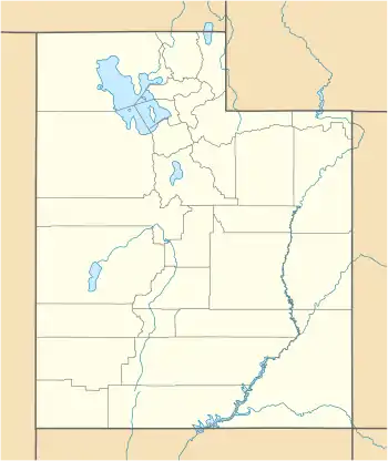
The settlement lies along State Route 56 west of the city of Parowan, the county seat of Iron County.[2] Its elevation is 5,476 feet (1,669 m).[1]
Although Modena is unincorporated, it has a post office, with the ZIP code of 84753.[3]
The Righteous Branch of the Church of Jesus Christ of Latter-day Saints, a polygamous sect, is based near Modena.
History
The settlement was established as a railroad town in 1899 by the Utah and Nevada Railway. By 1905 it was on the Los Angeles and Salt Lake Railroad route between Salt Lake City and Southern California.
Climate
According to the Köppen Climate Classification system, Modena has a semi-arid climate, abbreviated "BSk" on climate maps.[4]
Population
| Historical population | |||
|---|---|---|---|
| Census | Pop. | %± | |
| 1910 | 49 | — | |
| 1920 | 129 | 163.3% | |
| 1930 | 131 | 1.6% | |
| 1940 | 175 | 33.6% | |
| 1950 | 130 | −25.7% | |
| Source: U.S. Census Bureau[5] | |||
See also
References
- "Modena, Utah". Geographic Names Information System. United States Geological Survey. Retrieved 2008-04-12.
- Rand McNally. The Road Atlas '08. Chicago: Rand McNally, 2008, p. 102.
- Zip Code Lookup
- Climate Summary for Modena, Utah
- "Census of Population and Housing". U.S. Census Bureau. Retrieved November 7, 2011.
External links
![]() Media related to Modena, Utah at Wikimedia Commons
Media related to Modena, Utah at Wikimedia Commons
Municipalities and communities of Iron County, Utah, United States | ||
|---|---|---|
| Cities | 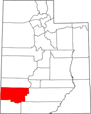 Map of Utah highlighting Iron County | |
| Towns | ||
| CDPs | ||
| Unincorporated communities | ||
| Ghost town | ||
| Indian reservation | ||
| Footnotes | ‡This populated place also has portions in an adjacent county or counties | |
| ||
| Authority control |
|---|