Mogollon-Datil volcanic field
The Mogollon-Datil volcanic field is a large (40,000 square kilometers (15,000 sq mi))[2] silicic volcanic field in western New Mexico (Mogollon Mountains-Datil, New Mexico). It is a part of an extensive Eocene to Oligocene volcanic event which includes the San Juan volcanic field in southwestern Colorado, the Trans-Pecos volcanic field in west Texas and north central Mexico, the Boot Heel volcanic field in the bootheel of southwestern New Mexico and adjacent areas of Arizona and Mexico; and the vast volcanic field of the Sierra Madre Occidental of western Mexico.[3] The Mogollon-Datil volcanic field was formed in "four discrete pulses representing synchronized activity of two separate cauldron complexes".[4]
| Mogollon-Datil volcanic field | |
|---|---|
| Highest point | |
| Coordinates | 33°30′N 108°00′W |
| Geography | |
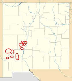
| Location | New Mexico, United States |
| Geology | |
| Age of rock | Middle Tertiary[1] |
| Mountain type | Volcanic field |
Formations
The stratigraphic framework for the Mogollon-Datil volcanic field has undergone many revisions.[5] The Datil Formation was originally defined by Winchester in 1920 to include all the extrusive units from the field.[6] The Datil Formation was later promoted to group rank with the addition of some related sedimentary formations, such as the Baca Formation[7][8][9] and the Spears Formation.[8] The base of the group, as originally defined, rests unconformably on the Mesaverde Formation, and the series is succeeded by the Popotosa Formation of the Santa Fe Group.
The stratigraphic framework proposed by Cather, Chamberlin, and Ratte in 1994 divides the units associated with the Mogollon-Datil volcanic field into three groups and removes the Baca Formation:[5]
| Volcanic Units | Sedimentary Units | ||
|---|---|---|---|
| Mogollon Group |
tuff of Turkey Springs |
Spears Group |
South Crosby Peak Formation |
| lacuna (31.4-29.0 Ma) | |||
| Datil Group |
Tadpole Ridge Tuff | ||
Cather, Chamberlin, and Ratte find that the Alum Mountain Formation in the southern part of the field may span the lacuna between the Mogollon and Datil Groups, though they suggest a tentative assignment to the Mogollon Group. Still further south, voluminous volcanic activity in northern Chihuahua took place in this time period and no lacuna exists.[5]
Clasts of the Vicks Peak and La Jencia Tuffs have been found in the gravel beds of the Benavidez Member of the Cerro Conejo Formation in the Rio Puerco valley west of Albuquerque. These suggest that the outflow sheets of the Datil-Mogollon volcanic field reached as far north as the northern edge of the younger Mount Taylor volcanic field, where they interfingered with the Chuska Sandstone and with cherty gravels eroded off the Zuni Mountains. This outflow sheet was subsequently completely eroded away north of the Rio Salado.[10]
Notable Calderas
Northern complex
Socorro-Magdalena caldera cluster
Location: West of Socorro, South of Magdalena, and Southeast of Datil.[11]
| Name | Associated tuff[12] | Coordinates | Age |
|---|---|---|---|
| Socorro Caldera | Hells Mesa Tuff | 34°00′N 107°06′W[13] | 32 Ma |
| Sawmill Canyon Caldera | La Jencia Tuff | 34°00′N 107°18′W[13] | 28.7 Ma |
| Hardy Ridge Caldera | Lemitar Tuff | 33°54′N 107°18′W[13] | 28 Ma |
| Mount Withington Caldera | South Canyon Tuff | 33°48′N 107°30′W[13] | 27.4 Ma |
| Bear Trap Caldera | tuff of Turkey Springs | 33°45′N 107°36′W[13] | 24.3 Ma |
Southern complex
Located from Las Cruces to Mogollon:
| Name | Associated tuff | Coordinates | Age |
|---|---|---|---|
| Nogal Caldera | Vicks Peak Tuff[14] | 33°36′N 107°24′W[13] | 28.4 Ma |
| Organ Caldera |
Cueva Tuff |
32°30′N 106°45′W[16] | 32 Ma |
| Emory Caldera | Kneeling Nun Tuff Fall Canyon Tuff[17] | 33°00′N 107°45′W[16] | 33 Ma |
| Twin Sisters Caldera | Tadpole Ridge Tuff Caballo Blanco Tuff[18] | 33°00′N 108°15′W[16] | 31.4 Ma |
| Schoolhouse Mountain Caldera | – | 32°45′N 108°36′W[16] | 33.5 Ma |
| Mogollon Caldera (just one fragment in the Bursum Caldera wall) | Cooney Tuff Fanney Rhyolite Apache Springs Tuff[18] | 33°30′N 108°30′W[16] | 34.0 Ma |
| Bursum Caldera | Bloodgood Canyon Tuff[17] | 33°30′N 108°30′W[16] | 28.0 Ma |
| Gila Cliff Dwellings Caldera | Davis Canyon Tuff Shelley Peak Tuff[17] | 33°30′N 108°15′W[16] | 28.1 Ma |
Note: the ages given in Chapin et al. (2004) and Ward (2009) do not match sometimes.[16][19]
Notes
- Chapin, C.E.; Wilks, M.; McIntosh, W.C. (2004). "Space-time patterns of Late Cretaceous to present magmatism in New Mexico—comparison with Andean volcanism and potential for future volcanism" (PDF). New Mexico Bureau of Geology and Mineral Resources Bulletin. 160: 13–40. Archived from the original (PDF) on 2010-06-09. Retrieved 2010-04-29.
- Elston, W.E. (1989). "Overview of the Mogollon-Datil volcanic field". New Mexico Bureau of Mines and Mineral Resources Memoir. 46: 43.
- Baldridge, W. Scott (2004). Geology of the American Southwest. Cambridge. pp. 218–223. ISBN 978-0-521-01666-7.
- McIntosh, W. C.; Chapin, C. E.; Ratte, J. C.; Sutter, J. F. (1992). "Time-stratigraphic framework for the Eocene-Oligocene Mogollon-Datil volcanic field, southwest New Mexico". GSA Bulletin. 104 (7): 851–871. Bibcode:1992GSAB..104..851M. doi:10.1130/0016-7606(1992)104<0851:TSFFTE>2.3.CO;2.
- Cather, Steven M.; Chamberlin, R.M.; Ratte, J.C. (1994). "Tertiary stratigraphy and nomenclature for western New Mexico and eastern Arizona" (PDF). New Mexico Geological Society Field Conference Series. 45: 259–266. Retrieved 27 August 2020.
- Weber, Robert H (1971). "K-Ar ages of Tertiary igneous rocks in central and western New Mexico". Isochron/West. 1 (1): 33–45.
- "Tertiary and Quaternary: Baca Formation" Open File Report 94 (1977), New Mexico Bureau of Geology & Mineral Resources, page 88
- Chapin, Charles E. et al. (1978) "Exploration framework of the Socorro geothermal area, New Mexico" pp. 114–129 In Chapin, Charles E. et al. (editors) Field guide to selected cauldrons and mining districts of the Datil-Mogollon volcanic field Special Publication NO. 7, New Mexico Geological Society, OCLC 4960990
- Winchester, Dean E. (1920) Geology of Alamosa Creek Valley, Socorro County, New Mexico with special reference to the occurrence of oil and gas U.S. Geological Survey Bulletin 716-A, OCLC 6007605
- Koning, Daniel J.; Heizler, Mattew; Jochems, Andrew (2020). "Clues from the Santa Fe Group for Oligocene-Miocene paleogeography of the southeastern Colorado Plateau near Grants,New Mexico" (PDF). New Mexico Geoloical Society Special Publication. 14: 153–166. Retrieved 23 October 2020.
- Chamberlin, Richard M., McIntosh, William C., and Chapin, Charles E., "Oligocene calderas, mafic lavas and radiating mafic dikes of the Socorro-Magdalena magmatic system, Rio Grande rift, New Mexico: surface expression of a miniplume?"
- Chamberlin, Richard M.; McIntosh, William C.; Eggleston, Ted L. (2004). "40Ar/39Ar geochronology and eruptive history of the eastern sector of the Oligocene Socorro caldera, central Rio Grande rift, New Mexico" (PDF). New Mexico Bureau of Geology and Mineral Resources Bulletin. 160: 251–279. S2CID 130665150. Retrieved 30 August 2020.
- Chamberlin, Richard M.; Chapin, Charles E.; McIntosh, William C. (2002). Poster: Westward Migrating Ignimbrite Calderas and a Large Radiating Mafi Dike Swarm of Oligocene Age, Central Rio Grande Rift, New Mexico: Surface Expression of an Upper Mantle Diapir? (PDF). New Mexico Tech, Socorro NM 87801: New Mexico Bureau of Geology and Mineral Resources. p. 22. Retrieved 2010-04-29.CS1 maint: location (link)
- Chamberlin, Richard M.; Cather, Steven M.; Anderson, Orin J.; Jones, Glen E. (1994). "Reconnaissance geologic map of the Quemado 30 x 60 Minute Quadrangle, Catron County, New Mexico" (PDF). New Mexico Bureau of Mines and Mineral Resources Open-file Report. 406. Retrieved 30 August 2020.
- Zimmerer, Matthew; McIntosh, William C. (2013). "Geochronologic evidence of upper-crustal in situ differentiation: Silicic magmatism at the Organ caldera complex, New Mexico". Geosphere. 9 (1): 155. doi:10.1130/GES00841.1.
- "Gila Cliff Dwellings National Monument". New Mexico Bureau of Geology & Mineral Resources. Retrieved 2010-04-29. citing from Chapin, C.E., McIntosh, W.C., and Chamberlin, R.M. (2004), "The Late Eocene—Oligocene peak of Cenozoic volcanism in southwestern New Mexico", in Mack, G.H.; Giles, K.A. (eds.), The Geology of New Mexico, a Geologic History, 11, New Mexico Geological Society Special Publication, pp. 271–294CS1 maint: multiple names: authors list (link)
- Ratté, J. C.; Marvin, R. F.; Naeser, C. W.; Bikerman, M. (1984). "Calderas and ash flow tuffs of the Mogollon Mountains, southwestern New Mexico". Journal of Geophysical Research. 89 (B10): 8713. doi:10.1029/JB089iB10p08713.
- Rentz, Shannon P.; Michelfelder, Gary S.; Coble, Matthew A.; Salings, Emily (2018). "U-Pb zircon geochronology of calc-alkaline ash flow tuff units in the Mogollon-Datil volcanic field, southern New Mexico". In Poland, Michael P.; Garcia, Michael O.; Camp, Victor E.; Grunder, Anita (eds.). Field Volcanology: A Tribute to the Distinguished Career of Don Swanson. Geological Society of America. pp. 409–434. doi:10.1130/SPE538. ISBN 9780813725383.
- Ward, Peter L. (2 April 2009). "Sulfur Dioxide Initiates Global Climate Change in Four Ways" (PDF). Thin Solid Films. 517 (11): 3188–3203. Bibcode:2009TSF...517.3188W. doi:10.1016/j.tsf.2009.01.005. Archived from the original (PDF) on 20 January 2010. Retrieved 2010-03-19., additional material: "Supplementary Table to P.L. Ward, Thin Solid Films (2009) Major volcanic eruptions and provinces" (PDF). Teton Tectonics. Archived from the original (PDF) on 2010-01-20. Retrieved 2010-03-16. and "Supplementary References to P.L. Ward, Thin Solid Films (2009)" (PDF). Teton Tectonics. Archived from the original (PDF) on 2010-01-20. Retrieved 2010-03-16.
Further reading
- Elston, W. E. (1976) "Glossary of stratigraphic terms of the Mogollon-Datil volcanic province" pp. 135–145 In Elston, W. E. and Northrop, S. A. Cenozoic volcanism in southwestern New Mexico: A Volume in Memory of Rodney C. Rhodes, 1943–1975 New Mexico Geological Society Special Publication No. 5, Socorro, New Mexico, OCLC 2841953