Monroe Township, Muskingum County, Ohio
Monroe Township is one of the twenty-five townships of Muskingum County, Ohio, United States. The 2000 census found 439 people in the township.[3]
Monroe Township, Muskingum County, Ohio | |
|---|---|
 Otsego United Methodist Church | |
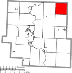 Location of Monroe Township in Muskingum County | |
| Coordinates: 40°6′54″N 81°46′5″W | |
| Country | United States |
| State | Ohio |
| County | Muskingum |
| Area | |
| • Total | 24.9 sq mi (64.6 km2) |
| • Land | 24.7 sq mi (64.0 km2) |
| • Water | 0.2 sq mi (0.5 km2) |
| Elevation | 801 ft (244 m) |
| Population (2000) | |
| • Total | 439 |
| • Density | 17.8/sq mi (6.9/km2) |
| Time zone | UTC-5 (Eastern (EST)) |
| • Summer (DST) | UTC-4 (EDT) |
| FIPS code | 39-51506[2] |
| GNIS feature ID | 1086727[1] |
Geography
Located in the northeastern corner of the county, it borders the following townships:
- Linton Township, Coshocton County - north
- Knox Township, Guernsey County - east
- Adams Township, Guernsey County - southeast corner
- Highland Township - south
- Salem Township - southwest corner
- Adams Township - west
- Franklin Township, Coshocton County - northwest corner
No municipalities are located in Monroe Township. The unincorporated community Otsego is home to the township hall.
Name and history
Monroe Township was named for James Monroe, 5th President of the United States.[4] It is one of twenty-two Monroe Townships statewide.[5]
By the 1830s, Monroe Township contained three saw mills and three gristmills.[6]
Government
The township is governed by a three-member board of trustees, who are elected in November of odd-numbered years to a four-year term beginning on the following January 1. Two are elected in the year after the presidential election and one is elected in the year before it. There is also an elected township fiscal officer,[7] who serves a four-year term beginning on April 1 of the year after the election, which is held in November of the year before the presidential election. Vacancies in the fiscal officership or on the board of trustees are filled by the remaining trustees.
References
- "US Board on Geographic Names". United States Geological Survey. 2007-10-25. Retrieved 2008-01-31.
- "U.S. Census website". United States Census Bureau. Retrieved 2008-01-31.
- Muskingum County, Ohio — Population by Places Estimates Ohio State University, 2007. Accessed 15 May 2007.
- Everhart, F.J. (1882). 1794. History of Muskingum County, Ohio, with illustrations and biographical sketches of prominent men and pioneers. F.J. Everhart & Co. p. 456.
- "Detailed map of Ohio" (PDF). United States Census Bureau. 2000. Retrieved 2007-02-16.
- Kilbourn, John (1833). The Ohio Gazetteer, or, a Topographical Dictionary. Scott and Wright. pp. 319. Retrieved 12 December 2013.
- §503.24, §505.01, and §507.01 of the Ohio Revised Code. Accessed 4/30/2009.
External links
Municipalities and communities of Muskingum County, Ohio, United States | ||
|---|---|---|
| City | 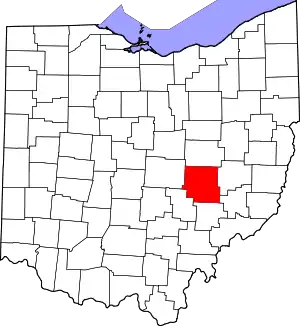 Map of Ohio highlighting Muskingum County | |
| Villages | ||
| Townships | ||
| CDPs | ||
| Unincorporated communities |
| |
| Former communities | ||
| Footnotes | ‡This populated place also has portions in an adjacent county or counties | |
| ||