Moorcroft, Wyoming
Moorcroft is a town in Crook County, Wyoming, United States. The population was 1,009 at the 2010 census.
Moorcroft, Wyoming | |
|---|---|
 Bighorn Avenue in Moorcroft | |
 Location of Moorcroft in Crook County, Wyoming. | |
| Coordinates: 44°15′54″N 104°57′2″W | |
| Country | United States |
| State | Wyoming |
| County | Crook |
| Government | |
| • Mayor | Jay Chung |
| Area | |
| • Total | 1.26 sq mi (3.27 km2) |
| • Land | 1.26 sq mi (3.27 km2) |
| • Water | 0.00 sq mi (0.00 km2) |
| Elevation | 4,226 ft (1,288 m) |
| Population | |
| • Total | 1,009 |
| • Estimate (2019)[3] | 1,084 |
| • Density | 858.27/sq mi (331.37/km2) |
| Time zone | UTC-7 (Mountain (MST)) |
| • Summer (DST) | UTC-6 (MDT) |
| ZIP code | 82721 |
| Area code(s) | 307 |
| FIPS code | 56-54185[4] |
| GNIS feature ID | 1601528[5] |
| Website | townofmoorcroft |
History

Moorcroft was incorporated on October 2, 1906.[6] The exact meaning of Moorcroft is unknown but over the years has several suggested origins for the name. The town was named in 1876 after Alexander Moorcroft, an early settler who built a cabin in the Black Hills of Wyoming.[7][6][8][9] The name Moorcroft was chosen by the community’s first postman Stocks Millar (1858-1890) after his home town in Scotland .[7][8]
Geography
Moorcroft is located at 44°15′54″N 104°57′2″W (44.264863, -104.950663).[10]
According to the United States Census Bureau, the town has a total area of 1.26 square miles (3.26 km2), all land.[7]
Climate
| Climate data for Moorcroft (4,230 feet above sea level) | |||||||||||||
|---|---|---|---|---|---|---|---|---|---|---|---|---|---|
| Month | Jan | Feb | Mar | Apr | May | Jun | Jul | Aug | Sep | Oct | Nov | Dec | Year |
| Record high °F (°C) | 66 (19) |
68 (20) |
78 (26) |
89 (32) |
94 (34) |
107 (42) |
108 (42) |
105 (41) |
101 (38) |
90 (32) |
77 (25) |
66 (19) |
108 (42) |
| Average high °F (°C) | 32 (0) |
35 (2) |
45 (7) |
54 (12) |
64 (18) |
75 (24) |
86 (30) |
85 (29) |
73 (23) |
58 (14) |
43 (6) |
33 (1) |
57 (14) |
| Daily mean °F (°C) | 21.5 (−5.8) |
24.5 (−4.2) |
33.5 (0.8) |
41.5 (5.3) |
51 (11) |
61.5 (16.4) |
70.5 (21.4) |
69 (21) |
58 (14) |
44.5 (6.9) |
32 (0) |
21.5 (−5.8) |
44.1 (6.8) |
| Average low °F (°C) | 11 (−12) |
14 (−10) |
22 (−6) |
29 (−2) |
38 (3) |
48 (9) |
55 (13) |
53 (12) |
43 (6) |
31 (−1) |
21 (−6) |
10 (−12) |
31 (0) |
| Record low °F (°C) | −37 (−38) |
−43 (−42) |
−26 (−32) |
−4 (−20) |
4 (−16) |
23 (−5) |
29 (−2) |
28 (−2) |
17 (−8) |
−17 (−27) |
−26 (−32) |
−46 (−43) |
−46 (−43) |
| Average precipitation inches (mm) | 0.33 (8.4) |
0.36 (9.1) |
0.84 (21) |
1.42 (36) |
2.49 (63) |
2.06 (52) |
1.95 (50) |
1.53 (39) |
0.99 (25) |
1.30 (33) |
0.49 (12) |
0.31 (7.9) |
14.07 (356.4) |
| Source: Weather Channel[11] | |||||||||||||
Demographics
| Historical population | |||
|---|---|---|---|
| Census | Pop. | %± | |
| 1910 | 178 | — | |
| 1920 | 420 | 136.0% | |
| 1930 | 341 | −18.8% | |
| 1940 | 387 | 13.5% | |
| 1950 | 517 | 33.6% | |
| 1960 | 826 | 59.8% | |
| 1970 | 981 | 18.8% | |
| 1980 | 1,014 | 3.4% | |
| 1990 | 768 | −24.3% | |
| 2000 | 807 | 5.1% | |
| 2010 | 1,009 | 25.0% | |
| 2019 (est.) | 1,084 | [3] | 7.4% |
| U.S. Decennial Census[12] | |||
2010 census
As of the census[2] of 2010, there were 1,009 people, 392 households, and 254 families residing in the town. The population density was 800.8 inhabitants per square mile (309.2/km2). There were 442 housing units at an average density of 350.8 per square mile (135.4/km2). The racial makeup of the town was 96.7% White, 0.9% Native American, 0.1% Asian, 1.0% from other races, and 1.3% from two or more races. Hispanic or Latino of any race were 4.5% of the population.
There were 392 households, of which 34.4% had children under the age of 18 living with them, 50.0% were married couples living together, 10.7% had a female householder with no husband present, 4.1% had a male householder with no wife present, and 35.2% were non-families. 27.6% of all households were made up of individuals, and 6.3% had someone living alone who was 65 years of age or older. The average household size was 2.57 and the average family size was 3.20.
The median age in the town was 32.6 years. 30.3% of residents were under the age of 18; 9.7% were between the ages of 18 and 24; 23.7% were from 25 to 44; 26.4% were from 45 to 64; and 9.7% were 65 years of age or older. The gender makeup of the town was 49.8% male and 50.2% female.
2000 census
As of the census[4] of 2000, there were 807 people, 325 households, and 219 families residing in the town. The population density was 731.4 people per square mile (283.3/km2). There were 375 housing units at an average density of 339.9 per square mile (131.6/km2). The racial makeup of the town was 98.1% White, 1.0% Native American, 0.3% from other races, and 0.6% from two or more races. Hispanic or Latino of any race were 1.4% of the population.
There were 325 households, out of which 34.5% had children under the age of 18 living with them, 56.0% were married couples living together, 7.7% had a female householder with no husband present, and 32.6% were non-families. 25.8% of all households were made up of individuals, and 9.8% had someone living alone who was 65 years of age or older. The average household size was 2.48 and the average family size was 3.04.
In the town, the population was spread out, with 27.3% under the age of 18, 11.3% from 18 to 24, 27.4% from 25 to 44, 24.3% from 45 to 64, and 9.8% who were 65 years of age or older. The median age was 36 years. For every 100 females, there were 99.8 males. For every 100 females age 18 and over, there were 99.7 males.
The median income for a household in the town was $36,953, and the median income for a family was $41,484. Males had a median income of $32,109 versus $19,632 for females. The per capita income for the town was $16,476. About 2.6% of families and 5.2% of the population were below the poverty line, including 4.5% of those under age 18 and 7.2% of those age 65 or over.
Education
Public education in the town of Moorcroft is provided by Crook County School District #1. Zoned campuses include Moorcroft K-8 (grades K-8) and Moorcroft Secondary School (grades 9-12).
Moorcroft has a public library, a branch of the Crook County Public Library System.[13][14]
Public Safety
Police
Moorcroft is served by the Moorcroft Police Department which is composed of three officers and one clerk.[15]
Notable person
American country music singer-songwriter and former saddle bronc rider, Chancey Williams was born in Moorcroft, Wyoming.
References
- "2019 U.S. Gazetteer Files". United States Census Bureau. Retrieved August 7, 2020.
- "U.S. Census website". United States Census Bureau. Retrieved 2012-12-14.
- "Population and Housing Unit Estimates". United States Census Bureau. May 24, 2020. Retrieved May 27, 2020.
- "U.S. Census website". United States Census Bureau. Retrieved 2008-01-31.
- "US Board on Geographic Names". United States Geological Survey. 2007-10-25. Retrieved 2008-01-31.
- "Profile for Moorcroft, Wyoming". ePodunk. Retrieved 2010-05-28.
- "US Gazetteer files 2010". United States Census Bureau. Archived from the original on 2012-07-14. Retrieved 2012-12-14.
- http://www.wyomingtalesandtrails.com/moorcroft.html
- Encyclopedia of Wyoming by Nancy Capace p239 North American Book Dist LLC, 2001
- "US Gazetteer files: 2010, 2000, and 1990". United States Census Bureau. 2011-02-12. Retrieved 2011-04-23.
- "Moorcroft, WY Monthly Weather Forecast". Weather Channel. Retrieved 12 October 2017.
- "Census of Population and Housing". Census.gov. Retrieved June 4, 2015.
- "Wyoming Public Libraries". PublicLibraries.com. Retrieved 13 June 2019.
- "Moorcroft Library". Crookcountylibrary.org. Retrieved 27 September 2020.
- "Moorcroft Police". Retrieved 27 September 2020.
External links
Municipalities and communities of Crook County, Wyoming, United States | ||
|---|---|---|
| Towns | 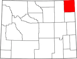 | |
| CDP | ||
| Unincorporated communities | ||
| ||
| Authority control |
|---|