Morgan Airport
Morgan Airport (FAA LID: 7U4) was a county-owned, public-use airport in Phillips County, Montana, United States.[1] It is located 12 nautical miles (22 km) north of Loring, near Morgan.[1]
Morgan Airport | |||||||||||
|---|---|---|---|---|---|---|---|---|---|---|---|
| Summary | |||||||||||
| Airport type | Public | ||||||||||
| Owner | Phillips County | ||||||||||
| Serves | Morgan / Loring, Montana | ||||||||||
| Elevation AMSL | 2,813 ft / 857 m | ||||||||||
| Coordinates | 48°59′58″N 107°50′39″W | ||||||||||
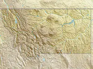
| Map | |||||||||||
 7U4 Location of airport in Montana | |||||||||||
| Runways | |||||||||||
| |||||||||||
As of August 15th, 2014, 7U4 FAA code is unknown in FAA NASR system.[2]
In the List of airports in Montana, it is listed as a Notable Former Airport closed circa 2008.
Facilities
Morgan Airport covers an area of 21 acres (8 ha) at an elevation of 2,813 feet (857 m) above mean sea level. It has one runway designated 7/25 with a turf surface measuring 3,000 by 75 feet (914 x 23 m).[1]
See also
References
- FAA Airport Form 5010 for 7U4 PDF. Federal Aviation Administration. Effective July 31, 2008.
- https://nfdc.faa.gov/nfdcApps/airportLookup/airportDisplay.jsp?airportId=7U4
External links
- Aerial image as of August 1996 from USGS The National Map
- Resources for this airport:
- FAA airport information for 7U4
- AirNav airport information for 7U4
- FlightAware airport information and live flight tracker
- SkyVector aeronautical chart for 7U4
This article is issued from Wikipedia. The text is licensed under Creative Commons - Attribution - Sharealike. Additional terms may apply for the media files.