Motutaiko Island
Motuaiko Island is an island within Lake Taupo on the North Island of New Zealand. The lake's largest island, it sits near the town of Motutere.
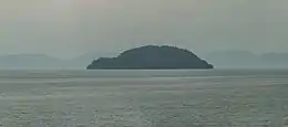 Motutaiko Island as seen from Tauranga Taupo | |
 Motutaiko Island Motutaiko Island's location within New Zealand 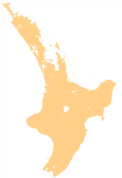 Motutaiko Island Motutaiko Island (North Island) | |
| Geography | |
|---|---|
| Location | Lake Taupo |
| Coordinates | 38.854°S 175.942°E |
| Area | 11 ha (27 acres) |
| Length | 400 m (1300 ft) |
| Width | 550 m (1800 ft) |
| Coastline | 1,500 m (4900 ft) |
| Highest elevation | 600 m (2000 ft) |
| Administration | |
Natural features
Motutaiko is formed out of a column of rhyolitic lava, connected to the geologic systems of Lake Taupo. The island was likely formed after an underwater magma vent's releases cooled and hardened into a cone, with Motutaiko forming the apex.[1]
Several endangered species live on the island, including Wainuia clarki. Other animals present on the island include small skinks and a colony of cormorants.[2]
Maori tradition
The island is spiritually significant to the Māori people, and landing on the island is therefore prohibited by the government.[3] Rangituamatotoru, a major chief of the Ngāti Tūwharetoa, was buried in a sacred cave on the island in the 18th century.[2]
The taniwha of Lake Taupo, Horomatangi, is said to live in a cave on the island's northeastern face.[1] The creature is also said to be the pet of Ngātoro-i-rangi.[3]
References
- Stout, Sir Robert. "Lake Taupo". NZTEC. Retrieved 4 October 2020.
- "Motutaiko Island". NZ DOC. Archived from the original on 4 March 2014. Retrieved 4 October 2020.
- "Motutaiko Island / Places of significant interest in Taupo". Living Heritage. Retrieved 4 October 2020.
