Mount Airy, Georgia
Mount Airy is a town in Habersham County, Georgia, United States. The population was 1,284 at the 2010 census,[5] up from 604 at the 2000 census.
Mount Airy, Georgia | |
|---|---|
 Mount Airy Town Hall | |
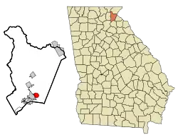 Location in Habersham County and the state of Georgia | |
| Coordinates: 34°31′3″N 83°30′22″W | |
| Country | United States |
| State | Georgia |
| County | Habersham |
| Area | |
| • Total | 2.43 sq mi (6.29 km2) |
| • Land | 2.42 sq mi (6.27 km2) |
| • Water | 0.01 sq mi (0.02 km2) |
| Elevation | 1,545 ft (471 m) |
| Population (2010) | |
| • Total | 1,284 |
| • Estimate (2019)[2] | 1,265 |
| • Density | 522.94/sq mi (201.88/km2) |
| Time zone | UTC-5 (Eastern (EST)) |
| • Summer (DST) | UTC-4 (EDT) |
| ZIP code | 30563 |
| Area code(s) | 706 |
| FIPS code | 13-53284[3] |
| GNIS feature ID | 0332428[4] |
| Website | townofmtairy |
History
The Georgia General Assembly incorporated Mount Airy as a town in 1874.[6] The town's name may be descriptive or a transfer from Mount Airy, North Carolina.[7]
Lawton Place, a historic house once lived in by Ty Cobb, is listed on the National Register of Historic Places.[8]
Geography
Mount Airy is located in southern Habersham County at 34°31′03″N 83°30′22″W.[9] It is bordered to the west by the city of Cornelia and to the south by Chattahoochee National Forest. The town sits on top of the Eastern Continental Divide, with Camp Creek, draining the northern half of town, flowing north to Hazel Creek and the Soquee River, a tributary of the Chattahoochee River, and ultimately the Gulf of Mexico, while the southern half of town drains to Nancy Town Creek, then the Middle Fork of the Broad River and eventually the Savannah River, which flows to the Atlantic Ocean.
According to the United States Census Bureau, the town has a total area of 2.6 square miles (6.7 km2), of which 0.01 square miles (0.02 km2), or 0.31%, are water.[5] At 1,539 feet (469 m) above sea level, Mount Airy is the highest point on the Southern Railway line between New Orleans and Washington, D.C.. This is confirmed by a US Geological survey marker located on the tracks just behind the City Hall.
Demographics
| Historical population | |||
|---|---|---|---|
| Census | Pop. | %± | |
| 1880 | 112 | — | |
| 1890 | 201 | 79.5% | |
| 1900 | 310 | 54.2% | |
| 1910 | 256 | −17.4% | |
| 1920 | 343 | 34.0% | |
| 1930 | 354 | 3.2% | |
| 1940 | 437 | 23.4% | |
| 1950 | 416 | −4.8% | |
| 1960 | 417 | 0.2% | |
| 1970 | 463 | 11.0% | |
| 1980 | 670 | 44.7% | |
| 1990 | 543 | −19.0% | |
| 2000 | 604 | 11.2% | |
| 2010 | 1,284 | 112.6% | |
| 2019 (est.) | 1,265 | [2] | −1.5% |
| U.S. Decennial Census[10] | |||
As of the census[3] of 2000, there were 604 people, 235 households, and 179 families residing in the town. The population density was 323.3 people per square mile (124.7/km2). There were 256 housing units at an average density of 137.0 per square mile (52.9/km2). The racial makeup of the town was 92.38% White, 2.32% African American, 0.17% Native American, 2.81% Asian, 0.99% from other races, and 1.32% from two or more races. Hispanic or Latino of any race were 2.65% of the population.
There were 235 households, out of which 30.6% had children under the age of 18 living with them, 58.7% were married couples living together, 11.9% had a female householder with no husband present, and 23.8% were non-families. 21.3% of all households were made up of individuals, and 7.7% had someone living alone who was 65 years of age or older. The average household size was 2.57 and the average family size was 2.95.
In the town, the population was spread out, with 23.2% under the age of 18, 8.3% from 18 to 24, 31.0% from 25 to 44, 23.2% from 45 to 64, and 14.4% who were 65 years of age or older. The median age was 38 years. For every 100 females, there were 105.4 males. For every 100 females age 18 and over, there were 100.0 males.
The median income for a household in the town was $42,813, and the median income for a family was $45,375. Males had a median income of $27,083 versus $23,500 for females. The per capita income for the town was $18,493. About 3.5% of families and 4.8% of the population were below the poverty line, including 3.9% of those under age 18 and 2.8% of those age 65 or over.
References
- "2019 U.S. Gazetteer Files". United States Census Bureau. Retrieved July 9, 2020.
- "Population and Housing Unit Estimates". United States Census Bureau. May 24, 2020. Retrieved May 27, 2020.
- "U.S. Census website". United States Census Bureau. Retrieved 2008-01-31.
- "US Board on Geographic Names". United States Geological Survey. 2007-10-25. Retrieved 2008-01-31.
- "Geographic Identifiers: 2010 Demographic Profile Data (G001): Mount Airy town, Georgia". American Factfinder. U.S. Census Bureau. Retrieved May 16, 2017.
- Acts Passed by the General Assembly of Georgia. J. Johnston. 1874. p. 159.
- Krakow, Kenneth K. (1975). Georgia Place-Names: Their History and Origins (PDF). Macon, GA: Winship Press. p. 152. ISBN 0-915430-00-2.
- https://accesswdun.com/article/2009/3/218227
- "US Gazetteer files: 2010, 2000, and 1990". United States Census Bureau. 2011-02-12. Retrieved 2011-04-23.
- "Census of Population and Housing". Census.gov. Retrieved June 4, 2015.
Municipalities and communities of Habersham County, Georgia, United States | ||
|---|---|---|
| Cities | 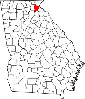 Map of Georgia highlighting Habersham County | |
| Towns | ||
| CDP | ||
| Unincorporated communities | ||
| Footnotes | ‡This populated place also has portions in an adjacent county or counties | |
| ||