Mount Breckinridge
Mount Breckinridge is a mountain, 2,050 metres (6,730 ft) high, standing 4 nautical miles (7 km) south of Stor Hånakken Mountain in the Napier Mountains of Enderby Land, Antarctica. It was mapped by Norwegian cartographers from aerial photos taken by the Lars Christensen Expedition of 1936–37, and was named "Langnuten" (the long peak). It was rephotographed by the Australian National Antarctic Research Expeditions in 1956 and renamed by the Antarctic Names Committee of Australia for J.E. Breckinridge a meteorologist at Wilkes Station in 1961.[1]
| Mount Breckinridge | |
|---|---|
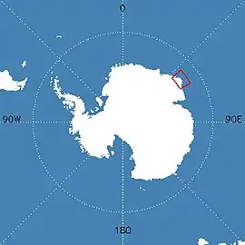 Map of Antarctica indicating location of Mount Breckinridge | |
| Highest point | |
| Elevation | 2,050 m (6,730 ft) |
| Coordinates | 66°37′S 53°41′E |
| Geography | |
| Location | Enderby Land, East Antarctica |
| Parent range | Napier Mountains |
| Geology | |
| Age of rock | 2837 million years (Archaean eon) |
| Mountain type | Metamorphic |
| Climbing | |
| Easiest route | basic snow/ice climb |
See also
References
- "Mount Breckinridge". Geographic Names Information System. United States Geological Survey. Retrieved 11 November 2013.
External links
![]() This article incorporates public domain material from the United States Geological Survey document: "Mount Breckinridge". (content from the Geographic Names Information System)
This article incorporates public domain material from the United States Geological Survey document: "Mount Breckinridge". (content from the Geographic Names Information System)
| General |
| .svg.png.webp) |
|---|---|---|
| Regions | ||
| Waterways | ||
| Famous explorers | ||
This article is issued from Wikipedia. The text is licensed under Creative Commons - Attribution - Sharealike. Additional terms may apply for the media files.