Mount Brewer
Mount Brewer is on the Great Western Divide, a sub-range of the Sierra Nevada in California. It is located in Kings Canyon National Park,[8]
| Mount Brewer | |
|---|---|
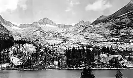 Mount Brewer from East Lake | |
| Highest point | |
| Elevation | 13,576 ft (4,138 m) NAVD 88[1] |
| Prominence | 1,168 ft (356 m) [1] |
| Parent peak | Midway Mountain[2] |
| Listing |
|
| Coordinates | 36°42′31″N 118°29′07″W [5] |
| Geography | |
| Location | Tulare County, California, U.S. |
| Parent range | Sierra Nevada, Great Western Divide |
| Topo map | USGS Mount Brewer[1] |
| Climbing | |
| First ascent | July 2, 1864 by William H. Brewer and Charles F. Hoffmann[6] |
| Easiest route | Easy scramble, class 2[7] |
The peak was named for William Henry Brewer who worked on the first California Geological Survey and was the first Chair of Agriculture at Yale University's Sheffield Scientific School. He was chief of the field party that explored the central High Sierra in 1864.[6]
See also
Depiction
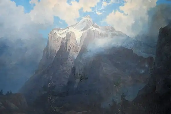
Albert Bierstadt - Mount Brewer from King's River Canyon, CA
References
- "Mount Brewer, California". Peakbagger.com. Retrieved 2008-12-21.
- "Longley Pass". Peakbagger.com. Retrieved 2016-03-24.
- "Sierra Peaks Section List" (PDF). Angeles Chapter, Sierra Club. Retrieved 2008-12-29.
- "Western States Climbers List". Climber.org. Retrieved 2016-03-24.
- "Mount Brewer". Geographic Names Information System. United States Geological Survey. Retrieved 2008-12-21.
- Farquhar, Francis P. (1926). Place Names of the High Sierra. San Francisco: Sierra Club.
- Roper, Steve (1976). The Climber's Guide to the High Sierra. San Francisco: Sierra Club Books. p. 275. ISBN 9780871561473.
- "Mount Brewer". Acme Mapper. Retrieved 2016-03-24.
This article is issued from Wikipedia. The text is licensed under Creative Commons - Attribution - Sharealike. Additional terms may apply for the media files.