Mount Derak
Mount Derak (also known as Kuh Barfi[1] or Mother Mount) is a sedimentary rock mountain in Shiraz, Fars, in the Middle East region in Iran. It is located west[2] and northwest of Shiraz, Fars. It is called Mother mountain because its shape is like a pregnant women lying and is called Barfi mountain since it is usyally white-capped in winter. This mountain that has the highest peak around Shiraz and is a part of Zagros Mountains. It is well known for its charming sunsets and as the hub for TV and radio telecommunication masts.
| Mount Derak | |
|---|---|
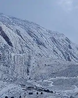 Mount Derak view from Shiraz in winter | |
| Highest point | |
| Elevation | 9,514 ft (2,900 m) |
| Prominence | 4,605 ft (1,404 m) |
| Coordinates | 29°37′00″N 52°32′00″E |
| Geography | |
| Location | Shiraz, Iran |
| Parent range | Zagros Mountains |
| Topo map | Mount Derak |
| Geology | |
| Age of rock | < 40,000 yrs |
| Mountain type | Sedimentary rock |
| Climbing | |
| First ascent | 1841 |
| Easiest route | Hike via south western zone |
Geologically, Shiraz is a syncline valley city (NW–SE elongated) that formed between the Baba Kohi and Derak anticlines.[3]
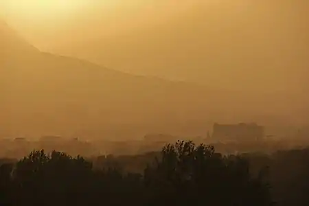 Sunset in Shiraz viewing north west – Kowsar hospital is visible in bottom right
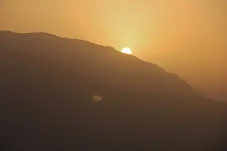 Golden hour in Shiraz viewing Mt. Derak
References
- "Karl Georg Theodor Kotschy's itinerary in southern Iran, 1841–42" (PDF). Botanic Garden and Botanical Museum Berlin (BGBM).
- [i-rep.emu.edu.tr:8080/jspui/bitstream/11129/223/1/Mobaraki.pdf "Strategies for Mitigating Urban Heat Island Effects in Cities: Case of Shiraz City Center"] Check
|url=value (help) (PDF). Eastern Mediterranean University. - "Assessment of geochemical and sedimentological characteristics of atmospheric dust in Shiraz, southwest Iran". Geoscience Frontiers. 11 (3): 783–792. 2020-05-01. doi:10.1016/j.gsf.2019.08.004. ISSN 1674-9871.
This article is issued from Wikipedia. The text is licensed under Creative Commons - Attribution - Sharealike. Additional terms may apply for the media files.
