Mount Heng (Hunan)
Hengshan (also known as Mount Heng) (Chinese: 衡山; pinyin: Héng Shān), is a mountain in southcentral China's Hunan Province known as the southern mountain (Chinese: 南岳; pinyin: Nányuè) of the Five Great Mountains of China. Heng Shan is a mountain range 150 kilometres (93 mi) long with 72 peaks[1] and lies at 27°18′6″N 112°41′5″E. The Huiyan Peak is the south end of the peaks, Yuelu Mountain in Changsha City is the north end, and the Zhurong Peak is the highest at 1,300 metres (4,300 ft) above sea level.
| Mount Heng | |
|---|---|
| 衡山 | |
 Mount Heng | |
| Highest point | |
| Elevation | 1,300.2 m (4,266 ft) |
| Prominence | 1,300.2 m (4,266 ft) |
| Geography | |
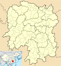
 Mount Heng Location in Hunan | |
| Country | China |
| Province | Hunan |
| Parent range | Hengshan Mountains |
| Geology | |
| Type of rock | Granite |
| Mount Heng | |||||||||||||||||||||||||
|---|---|---|---|---|---|---|---|---|---|---|---|---|---|---|---|---|---|---|---|---|---|---|---|---|---|
.svg.png.webp) "Mount Heng" in Chinese characters | |||||||||||||||||||||||||
| Chinese | 衡山 | ||||||||||||||||||||||||
| |||||||||||||||||||||||||

At the foot of the mountain stands the largest temple in southern China, the Grand Temple of Mount Heng (Nanyue Damiao), which is the largest group of ancient buildings in Hunan Province.
Other notable sites in the area include the Zhusheng Si Temple, an 8th-century Buddhist monastery and Zhurong Gong, a small stone temple.
Climate
| Climate data for Hengshan | |||||||||||||
|---|---|---|---|---|---|---|---|---|---|---|---|---|---|
| Month | Jan | Feb | Mar | Apr | May | Jun | Jul | Aug | Sep | Oct | Nov | Dec | Year |
| Average high °C (°F) | 3 (38) |
5 (41) |
11 (52) |
16 (60) |
18 (65) |
22 (72) |
25 (77) |
24 (76) |
21 (70) |
16 (60) |
11 (52) |
7 (45) |
15 (59) |
| Average low °C (°F) | −3 (27) |
−1 (30) |
4 (39) |
8 (47) |
12 (54) |
17 (63) |
19 (67) |
19 (66) |
16 (60) |
10 (50) |
5 (41) |
0 (32) |
9 (48) |
| Average precipitation mm (inches) | 48 (1.9) |
84 (3.3) |
170 (6.8) |
210 (8.3) |
200 (7.8) |
190 (7.6) |
250 (10.0) |
250 (10.0) |
150 (5.8) |
170 (6.5) |
110 (4.3) |
43 (1.7) |
1,870 (73.8) |
| Source: Weatherbase[2] | |||||||||||||
| Wikimedia Commons has media related to Mount Heng (Hunan). |
Further reading
- Robson, James (1995). "The Polymorphous Space of the Southern Marchmount (Nanyue)" (PDF). 8 (1). Cahiers d'Extrême-Asie: 221–264. doi:10.3406/asie.1995.10195. Cite journal requires
|journal=(help)CS1 maint: ref=harv (link) - Robson, James (2009). Power of place : the religious landscape of the Southern Sacred Peak (Nanyue) in medieval China. Harvard UP. ISBN 978-0-674-03332-0.CS1 maint: ref=harv (link)