Mount Huethawali
Mount Huethawali is a 6,281-foot-elevation (1,914 meter) summit located in the Grand Canyon, in Coconino County of northern Arizona, USA.[3] It is situated 3.5 miles due east of Explorers Monument, and 2.5 miles northwest of Havasupai Point. Surrounded by Garnet, Evolution, and Bass Canyons, Huethawali rises over 800 feet (245 meters) above Darwin Plateau, and over 4,000 feet higher than the nearby Colorado River.
| Mount Huethawali | |
|---|---|
 Southwest aspect | |
| Highest point | |
| Elevation | 6,281 ft (1,914 m) [1] |
| Prominence | 961 ft (293 m) [1] |
| Parent peak | Fossil Mountain (6,729 ft)[2] |
| Isolation | 1.52 mi (2.45 km) [2] |
| Coordinates | 36°12′15″N 112°22′55″W [3] |
| Geography | |
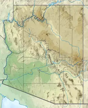 Mount Huethawali Location in Arizona  Mount Huethawali Mount Huethawali (the United States) | |
| Location | Grand Canyon National Park Coconino County, Arizona, US |
| Parent range | Coconino Plateau[1] Colorado Plateau |
| Topo map | USGS Explorers Monument |
| Geology | |
| Type of rock | sandstone, siltstone, mudstone |
| Climbing | |
| First ascent | 1898 |
| Easiest route | class 3 scrambling SW slope[4] [5] |
The summit dome is composed of cream-colored Permian Coconino Sandstone.[6] This sandstone, which is the third-youngest stratum in the Grand Canyon, was deposited 265 million years ago as sand dunes. Below the Coconino Sandstone is reddish, slope-forming, Permian Hermit Formation, which in turn overlays the Pennsylvanian-Permian Supai Group. Further down are strata of the cliff-forming Mississippian Redwall Limestone, Cambrian Tonto Group, and finally Proterozoic Unkar Group at river level.[7]
According to the Köppen climate classification system, Mount Huethawali is located in a Cold semi-arid climate zone.[8]
History
The first ascent of the summit was made in August 1898 by William Wallace Bass and George Wharton James.[9] James originally named it Mount Observation, but wrote that Indians called this mountain "Hue-tha-wa-li" (pronounced "we-the-wally"), which means White Rock Mountain.[10] [11] Some sources state that "Huethawali" is the Native American word for "observation point", while other sources state it translates as "white tower" or "white rock mountain" in the Havasupai language.[3] [12] [13] This butte's name was officially adopted in 1932 by the U.S. Board on Geographic Names.[3]
Gallery
 South aspect
 Mt. Huethawali and Huxley Terrace seen from South Bass Trail
 1901, east aspect
 circa 1901
References
- "Mount Huethawali, Arizona". Peakbagger.com. Retrieved 2020-12-31.
- "Mount Huethawali - 6,281' AZ". Lists of John. Retrieved December 31, 2020.
- "Mount Huethawali". Geographic Names Information System. United States Geological Survey. Retrieved 2020-12-31.
- Mount Huethawali, AZ. Hikearizona.com
- John Annerino, Hiking the Grand Canyon, 2017, Simon & Schuster, ISBN 9781510714984
- John C. Van Dyke, The Grand Canyon of the Colorado, 1920, page 78.
- N.H. Darton, Story of the Grand Canyon of Arizona, 1917.
- Peel, M. C.; Finlayson, B. L.; McMahon, T. A. (2007). "Updated world map of the Köppen−Geiger climate classification". Hydrol. Earth Syst. Sci. 11. ISSN 1027-5606.
- John Annerino, Hiking the Grand Canyon, 2017, Simon & Schuster, ISBN 9781510714984
- George Wharton James, The Grand Canyon of Arizona: How to See It, 1910, Little, Brown, and Company. Page 81.
- Gregory McNamee, Grand Canyon Place Names, 1997, Mountaineers Publisher, ISBN 9780898865332, page 66.
- Gregory McNamee, Grand Canyon Place Names, 1997, Mountaineers Publisher, ISBN 9780898865332, page 48.
- John Annerino, Hiking the Grand Canyon, 2017, Simon & Schuster, ISBN 9781510714984
External links
- Weather forecast: National Weather Service