Mount Sifton
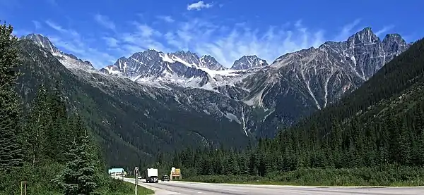
Mount Sifton is a 2,922-metre (9,587-foot) mountain summit located in Glacier National Park, in the Hermit Range of the Selkirk Mountains in British Columbia, Canada. Mount Sifton is situated 58 km (36 mi) northeast of Revelstoke, and 41 km (25 mi) west of Golden. It is also set 2.35 km (1.46 mi) north-northeast of Grizzly Mountain, and 4.5 km (2.8 mi) northwest of Rogers Pass from which it can be seen from the Trans-Canada Highway. The nearest higher peak is Mount Rogers, 2.17 km (1.35 mi) to the north-northeast.[3] The first ascent of the mountain was made September 3, 1900, by Arthur Michael, Edward Feuz, and Friedrich Michel via the southeast ridge.[1] The peak's name honors Sir Clifford Sifton (1861–1929), Canadian Minister of the Interior from 1896 through 1905.[4] The mountain's name was adopted in 1906, then re-approved September 8, 1932, by the Geographical Names Board of Canada.[2]
| Mount Sifton | |
|---|---|
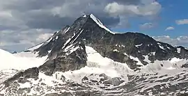 Mount Sifton, east aspect | |
| Highest point | |
| Elevation | 2,922 m (9,587 ft) [1] |
| Prominence | 365 m (1,198 ft) [1] |
| Parent peak | Mount Rogers (3169 m)[1] |
| Coordinates | 51°20′11″N 117°33′10″W [2] |
| Geography | |
 Mount Sifton Location of Mount Sifton in British Columbia  Mount Sifton Mount Sifton (Canada) | |
| Location | Glacier National Park British Columbia, Canada |
| Parent range | Hermit Range Selkirk Mountains[3] |
| Topo map | NTS 82N/5 |
| Climbing | |
| First ascent | 1900 Arthur Michael, Edward Feuz, Friedrich Michel[1] |
| Easiest route | class 3 Scrambling South Face[1] |
Climate
Based on the Köppen climate classification, Mount Sifton is located in a subarctic climate zone with cold, snowy winters, and mild summers.[5] Temperatures can drop below −20 °C with wind chill factors below −30 °C. Precipitation runoff from the mountain and meltwater from surrounding glaciers on its slopes drains into tributaries of the Beaver River and Illecillewaet River.
Climbing Routes
Established climbing routes on Mount Sifton:[1]
See also
References
- "Mount Sifton". Bivouac.com. Retrieved 2019-12-25.
- "Mount Sifton". Geographical Names Data Base. Natural Resources Canada. Retrieved 2019-12-25.
- "Mount Sifton, British Columbia". Peakbagger.com. Retrieved 2019-12-25.
- "Mount Sifton". BC Geographical Names.
- Peel, M. C.; Finlayson, B. L. & McMahon, T. A. (2007). "Updated world map of the Köppen−Geiger climate classification". Hydrol. Earth Syst. Sci. 11: 1633–1644. ISSN 1027-5606.
External links
- Weather: Mount Sifton