Mount Tasman
Mount Tasman (Horokoau in Māori) is New Zealand's second highest mountain, rising to a height of 3,497 metres (11,473 ft). It is located in the Southern Alps of the South Island, four kilometres to the north of its larger neighbour, Aoraki / Mount Cook. Unlike Aoraki / Mount Cook, Mount Tasman sits on the South Island's Main Divide, on the border between Aoraki / Mount Cook National Park and Westland Tai Poutini National Park. It is the highest point in Westland District.
| Mount Tasman | |
|---|---|
 | |
| Highest point | |
| Elevation | 3,497 m (11,473 ft) |
| Prominence | 519 m (1,703 ft) |
| Listing | New Zealand #2 |
| Coordinates | 43°34′S 170°9′E |
| Naming | |
| Native name | Horokoau |
| Geography | |
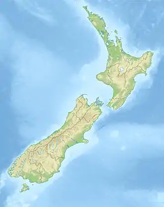 Mount Tasman South Island, New Zealand, New Zealand | |
| Parent range | Southern Alps |
| Climbing | |
| First ascent | February 1895 by Edward Fitzgerald, Matthias Zurbriggen und Jack Clarke |
| Easiest route | glacier/snow/ice climb |
The first ascent of Mount Tasman was in 1895 by Edward FitzGerald and his guide Matthias Zurbriggen.[1]
The Māori name (horo: to swallow; koau: shag or Phalacrocorax varius) is believed to refer to the swelling in the neck of a shag when it is swallowing a fish.[2]
Aoraki / Mount Cook National Park
Mount Tasman is located in Aoraki / Mount Cook National Park in the Canterbury region, which was established in 1953 and along with Westland Tai Poutini National Park, Mount Aspiring National Park and Fiordland National Park forms one of the UNESCO World Heritage Sites.
References
- Wilson, John. "Mountaineering - Aoraki/Mt Cook". Te Ara: The Encyclopedia of New Zealand. Retrieved 5 December 2020.
- Reed, A. W. (2010). Peter Dowling (ed.). Place Names of New Zealand. Rosedale, North Shore: Raupo. p. 391. ISBN 9780143204107.CS1 maint: ref=harv (link)
