Mountain Grove, Missouri
Mountain Grove is a city in southwestern Texas and southeastern Wright counties in the U.S. state of Missouri, located in the south central section of the state. The population was 4,789 at the 2010 census.
Mountain Grove, Missouri | |
|---|---|
City | |
| Nickname(s): show me state | |
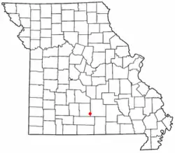 Location of Mountain Grove, Missouri | |
| Coordinates: 37°07′50″N 92°15′49″W[1] | |
| Country | United States |
| State | Missouri |
| Counties | Wright, Texas |
| Area | |
| • Total | 4.05 sq mi (10.48 km2) |
| • Land | 4.01 sq mi (10.40 km2) |
| • Water | 0.03 sq mi (0.08 km2) |
| Elevation | 1,480 ft (451 m) |
| Population | |
| • Total | 4,789 |
| • Estimate (2019)[4] | 4,690 |
| • Density | 1,168.12/sq mi (451.03/km2) |
| Time zone | UTC-6 (Central (CST)) |
| • Summer (DST) | UTC-5 (CDT) |
| ZIP code | 65711 |
| Area code(s) | 417 |
| FIPS code | 29-50402[5] |
| GNIS feature ID | 0751209[1] |
| Website | https://www.mountaingrove.net/ |
History
A post office called Mountain Grove has been in operation since 1875.[6] The community owes its present name to a stand of trees near the original elevated town site.[7]
In 1841 a settlement was built on land east of Mountain Grove near a spring in a grove of hickory timber. A post office was established in Hickory Spring in 1853. The post office, in 1878, was named for Judge Robert W. Fyan, a prominent figure in early county history. In 1859, a general store was built at the crossroads about one mile west of Hickory Spring. The old post office established under the name of Fyan before the Civil War changed to Mountain Grove, with reference to its location on a ridge in a grove of trees, in 1878.[7]
This became known as the "mountain store, mountain grove or the mountain" due to its elevation of 1,525 feet (465 m). One of the most famous incidents in Mountain Grove occurred in the middle of May 1883, when what was called a "nipping frost" caused every tree, sapling and shrub in the community of Fyan and the Fyan depot to be cut clean as from an axe. Thus, the joining of Mountain Grove and adjoining Fyan occurred. In June, the name of the depot was changed to Mountain Grove. The town reapplied for a charter in 1886, changed its boundaries and held its first election.
Administration Building, Missouri State Fruit Experiment Station, Mountain Grove Bandstand, and Mountain Grove City Hall are listed on the National Register of Historic Places.[8][9]
Geography
Mountain Grove is located in the Ozarks, along the south edge of the Salem Plateau. The community is served by US Route 60 and Missouri Route 95. The community is mostly within Wright County, with the eastern portion extending into Texas County. The town sits on the drainage divide between the White River tributaries to the south and the Missouri River tributaries to the north.[10]
According to the United States Census Bureau, the city has a total area of 4.04 square miles (10.46 km2), of which 4.01 square miles (10.39 km2) is land and 0.03 square miles (0.08 km2) is water.[11]
Demographics
| Historical population | |||
|---|---|---|---|
| Census | Pop. | %± | |
| 1880 | 92 | — | |
| 1890 | 830 | 802.2% | |
| 1900 | 1,004 | 21.0% | |
| 1910 | 1,722 | 71.5% | |
| 1920 | 2,212 | 28.5% | |
| 1930 | 2,229 | 0.8% | |
| 1940 | 2,431 | 9.1% | |
| 1950 | 3,106 | 27.8% | |
| 1960 | 3,176 | 2.3% | |
| 1970 | 3,377 | 6.3% | |
| 1980 | 3,974 | 17.7% | |
| 1990 | 4,182 | 5.2% | |
| 2000 | 4,574 | 9.4% | |
| 2010 | 4,789 | 4.7% | |
| 2019 (est.) | 4,690 | [4] | −2.1% |
| U.S. Decennial Census[12] | |||
2010 census
As of the census[3] of 2010, there were 4,789 people, 2,008 households, and 1,217 families living in the city. The population density was 1,194.3 inhabitants per square mile (461.1/km2). There were 2,290 housing units at an average density of 571.1 per square mile (220.5/km2). The racial makeup of the city was 96.4% White, 0.3% African American, 1.0% Native American, 0.4% Asian, 0.3% from other races, and 1.6% from two or more races. Hispanic or Latino of any race were 2.2% of the population.
There were 2,008 households, of which 32.3% had children under the age of 18 living with them, 40.8% were married couples living together, 14.5% had a female householder with no husband present, 5.3% had a male householder with no wife present, and 39.4% were non-families. 34.4% of all households were made up of individuals, and 16.2% had someone living alone who was 65 years of age or older. The average household size was 2.34 and the average family size was 3.02.
The median age in the city was 37.7 years. 26.7% of residents were under the age of 18; 9.3% were between the ages of 18 and 24; 22% were from 25 to 44; 22.9% were from 45 to 64; and 19.1% were 65 years of age or older. The gender makeup of the city was 46.3% male and 53.7% female.
2000 census
As of the census[5] of 2000, there were 4,574 people, 1,976 households, and 1,235 families living in the city. The population density was 1,091.6 people per square mile (421.5/km2). There were 2,244 housing units at an average density of 535.5 per square mile (206.8/km2). The racial makeup of the city was 97.44% White, 0.17% African American, 0.61% Native American, 0.09% Asian, 0.48% from other races, and 1.20% from two or more races. Hispanic or Latino of any race were 1.09% of the population.
There were 1,976 households, out of which 29.4% had children under the age of 18 living with them, 46.4% were married couples living together, 12.4% had a female householder with no husband present, and 37.5% were non-families. 34.5% of all households were made up of individuals, and 17.9% had someone living alone who was 65 years of age or older. The average household size was 2.26 and the average family size was 2.88.
In the city the population was spread out, with 25.7% under the age of 18, 9.1% from 18 to 24, 24.1% from 25 to 44, 20.8% from 45 to 64, and 20.3% who were 65 years of age or older. The median age was 38 years. For every 100 females there were 80.4 males. For every 100 females age 18 and over, there were 76.1 males.
The median income for a household in the city was $21,131, and the median income for a family was $25,927. Males had a median income of $24,913 versus $17,003 for females. The per capita income for the city was $13,508. About 22.9% of families and 28.2% of the population were below the poverty line, including 38.1% of those under age 18 and 18.0% of those age 65 or over.
Government
The City of Mountain Grove is a 4th-class city and operates with a Mayor/Board of Aldermen form of Government. The City Administrator is the chief administrative officer of the city and oversees all operations. All department supervisors report directly to them. The Mayor/Board of Aldermen set policies and pass ordinances.
Education
Mountain Grove public schools are a class 3A school in Missouri, including one elementary grades Pre-K through 4th, one middle school grades 5th–8th, and one high school grades 9th–12th. Mountain Grove High School also houses Ozark Mountain Technical Center, which allows students to gain technology skills necessary for vocational career paths.
Mountain Grove Christian Academy has approximately 68 students, grade Pre-K through 12th.
The Agriculture Department of Missouri State University operates the 190-acre (0.77 km2) Missouri State Fruit Experiment Station in Mountain Grove. The station includes the Center for Grapevine Biotechnology and the Mountain Grove Cellars. It is associated primarily with the university's Plant Science master's degree Program.
Mountain Grove has a public library, a branch of the Wright County Library.[13]
Notable people
- Paul McDonald Robinett (1893–1975), Brigadier General, U.S. Army, was born in Mountain Grove and is buried there.[14][15][16]
- Don Faurot (1902–1995), head coach for the University of Missouri football team, as well as longtime athletic director, was born there.
References
- U.S. Geological Survey Geographic Names Information System: Mountain Grove, Missouri
- "2019 U.S. Gazetteer Files". United States Census Bureau. Retrieved July 26, 2020.
- "U.S. Census website". United States Census Bureau. Retrieved July 8, 2012.
- "Population and Housing Unit Estimates". United States Census Bureau. May 24, 2020. Retrieved May 27, 2020.
- "U.S. Census website". United States Census Bureau. Retrieved January 31, 2008.
- "Post Offices". Jim Forte Postal History. Retrieved January 3, 2017.
- "Wright County Place Names, 1928–1945". The State Historical Society of Missouri. Archived from the original on June 24, 2016. Retrieved January 3, 2017.
- "National Register Information System". National Register of Historic Places. National Park Service. July 9, 2010.
- "National Register of Historic Places Listings". Weekly List of Actions Taken on Properties: 2/27/12 through 3/02/12. National Park Service. March 9, 2012.
- Missouri Atlas & Gazetteer, DeLorme, 1998, First edition, p. 53-4, ISBN 0-89933-224-2
- "US Gazetteer files 2010". United States Census Bureau. Archived from the original on January 24, 2012. Retrieved July 8, 2012.
- "Census of Population and Housing". Census.gov. Retrieved June 4, 2015.
- "Homepage". Wright County Library. Retrieved June 4, 2019.
- McElderry, Michael J.; Cooney, Charles (2012). "Paul M. Robinett Papers: A Finding Aid to the Collection in the Library of Congress" (PDF). Washington, D.C.: Manuscript Division, Library of Congress. p. 3. Retrieved June 26, 2014.
- Bill (July 19, 2009). "Paul McDonald Robinett". U.S. Army armor officer. Find a Grave. Retrieved June 26, 2014.
- Atkinson, Rick (May 15, 2007). An Army at Dawn: The War in North Africa, 1942–1943. The Liberation Trilogy. 1 (large print ed.). Macmillan. p. 222. ISBN 9781429967631. Retrieved June 26, 2014.
External links
- Mountain Grove Schools
- Historic maps of Mountain Grove in the Sanborn Maps of Missouri Collection at the University of Missouri
- City Government of Mountain Grove
- Mountain Grove Chamber – Mountain Grove, MO
- Mountain Grove News-Journal : Serving The Tri-County Area Since 1882!
Municipalities and communities of Texas County, Missouri, United States | ||
|---|---|---|
| Cities | 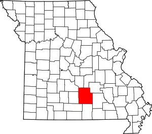 Map of Missouri highlighting Texas County | |
| Villages | ||
| Townships | ||
| Unincorporated communities |
| |
| Ghost towns | ||
| Footnotes | ‡This populated place also has portions in an adjacent county or counties | |
| ||
Municipalities and communities of Wright County, Missouri, United States | ||
|---|---|---|
| Cities | 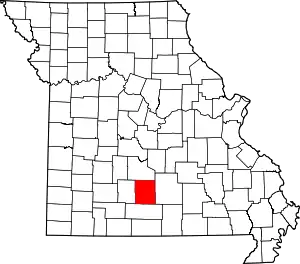 Map of Missouri highlighting Wright County | |
| Townships | ||
| Unincorporated communities | ||
| Ghost towns | ||
| Footnotes | ‡This populated place also has portions in an adjacent county or counties | |
| ||
| Authority control |
|---|