Mueang Phrae District
Mueang Phrae District (Thai: เมืองแพร่, pronounced [mɯ̄a̯ŋ pʰrɛ̂ː]) is the capital district (amphoe mueang) of Phrae Province, northern Thailand.
Mueang Phrae
เมืองแพร่ | |
|---|---|
 NASA picture of Mueang Phrae District | |
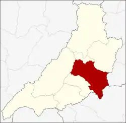 District location in Phrae Province | |
| Coordinates: 18°8′44″N 100°8′29″E | |
| Country | Thailand |
| Province | Phrae |
| Area | |
| • Total | 756.1 km2 (291.9 sq mi) |
| Population (2005) | |
| • Total | 123,811 |
| • Density | 163.7/km2 (424/sq mi) |
| Time zone | UTC+7 (ICT) |
| Postal code | 54000 |
| Geocode | 5401 |
Geography
Neighboring districts are (from the southwest clockwise): Sung Men, Long, Nong Muang Khai, and Rong Kwang of Phrae Province; Na Muen of Nan Province; and Tha Pla of Uttaradit Province.
The Phi Pan Nam Range dominates the landscape of the district.
Administration
The district is divided into 20 sub-districts (tambons), which are further subdivided into 157 villages (mubans). Phrae itself is a town (thesaban mueang) and covers tambon Nai Wiang. There are three more townships (thesaban tambons): Thung Hong and Mae Lai both cover tambons of the same name, Cho Hae covers tambon Cho Hae and parts of Padaeng. There are a further 20 tambon administrative organizations (TAO).
| No. | Name | Thai name | Villages | Pop. | |
|---|---|---|---|---|---|
| 1. | Nai Wiang | ในเวียง | - | 15,638 | |
| 2. | Na Chak | นาจักร | 8 | 7,232 | |
| 3. | Nam Cham | น้ำชำ | 4 | 1,651 | |
| 4. | Pa Daeng | ป่าแดง | 10 | 2,678 | |
| 5. | Thung Hong | ทุ่งโฮ้ง | 7 | 6,140 | |
| 6. | Mueang Mo | เหมืองหม้อ | 12 | 9,175 | |
| 7. | Wang Thong | วังธง | 5 | 2,527 | |
| 8. | Mae Lai | แม่หล่าย | 6 | 4,516 | |
| 9. | Huai Ma | ห้วยม้า | 14 | 6,509 | |
| 10. | Pa Maet | ป่าแมต | 14 | 12,177 | |
| 11. | Ban Thin | บ้านถิ่น | 8 | 6,566 | |
| 12. | Suan Khuean | สวนเขื่อน | 10 | 5,264 | |
| 13. | Wang Hong | วังหงส์ | 7 | 3,185 | |
| 14. | Mae Kham Mi | แม่คำมี | 11 | 7,300 | |
| 15. | Thung Kwao | ทุ่งกวาว | 6 | 5,848 | |
| 16. | Tha Kham | ท่าข้าม | 5 | 2,376 | |
| 17. | Mae Yom | แม่ยม | 4 | 1,915 | |
| 18. | Cho Hae | ช่อแฮ | 10 | 6,833 | |
| 19. | Rong Fong | ร่องฟอง | 4 | 3,724 | |
| 20. | Kanchana | กาญจนา | 9 | 4,494 |