Tha Pla District
Tha Pla (Thai: ท่าปลา, pronounced [tʰâː plāː]) is a district (amphoe) of Uttaradit Province, in northern Thailand.
Tha Pla
ท่าปลา | |
|---|---|
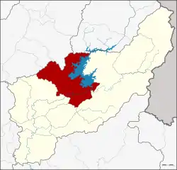 District location in Uttaradit Province | |
| Coordinates: 17°47′35″N 100°22′38″E | |
| Country | Thailand |
| Province | Uttaradit |
| Seat | Tha Pla |
| Tambon | 7 |
| Muban | 76 |
| Area | |
| • Total | 1,681.445 km2 (649.210 sq mi) |
| Population (2014) | |
| • Total | 44,025 |
| • Density | 29.1/km2 (75/sq mi) |
| Time zone | UTC+7 (ICT) |
| Postal code | 53150 |
| Geocode | 5303 |
History
Tha Pla was originally part of Nan Province until it was reassigned in 1923 to Uttaradit Province.[1]
Geography

Neighboring districts are (from the east in a clockwise order): Nam Pat, Thong Saen Khan and Mueang Uttaradit of Uttaradit Province, Den Chai, Sung Men and Mueang Phrae of Phrae Province, and Na Muen of Nan Province.
The main river of the district is the Nan River, with the Sirikit Dam creating a 250 km2 artificial lake. The Pat River joins the Nan below the dam.
Administration
Central administration
Tha Pla is divided into seven sub-districts (tambon), which are further subdivided into 76 administrative villages (Muban).
| No. | Name | Thai | Villages | Pop.[2] |
|---|---|---|---|---|
| 1. | Tha Pla | ท่าปลา | 12 | 8,574 |
| 2. | Hat La | หาดล้า | 9 | 4,696 |
| 3. | Pha Lueat | ผาเลือด | 13 | 6,748 |
| 4. | Charim | จริม | 13 | 8,642 |
| 5. | Nam Man | น้ำหมัน | 12 | 7,172 |
| 7. | Nang Phaya | นางพญา | 6 | 2,634 |
| 8. | Ruam Chit | ร่วมจิต | 11 | 5,559 |
Number 6 belonged to the subdistrict Tha Faek reassigned to Nam Pat District in 2015.
Local administration
There are three sub-district municipalities (thesaban tambon) in the district:
- Tha Pla (Thai: เทศบาลตำบลท่าปลา) consisting of parts of sub-district Tha Pla.
- Ruam Chit (Thai: เทศบาลตำบลร่วมจิต) consisting of parts of sub-district Ruam Chit.
- Charim (Thai: เทศบาลตำบลจริม) consisting of sub-district Charim.
There are six sub-district administrative organizations (SAO) in the district:
- Tha Pla (Thai: องค์การบริหารส่วนตำบลท่าปลา) consisting of parts of sub-district Tha Pla.
- Hat La (Thai: องค์การบริหารส่วนตำบลหาดล้า) consisting of sub-district Hat La.
- Pha Lueat (Thai: องค์การบริหารส่วนตำบลผาเลือด) consisting of sub-district Pha Lueat.
- Nam Man (Thai: องค์การบริหารส่วนตำบลน้ำหมัน) consisting of sub-district Nam Man.
- Nang Phaya (Thai: องค์การบริหารส่วนตำบลนางพญา) consisting of sub-district Nang Phaya.
- Ruam Chit (Thai: องค์การบริหารส่วนตำบลร่วมจิต) consisting of parts of sub-district Ruam Chit.
Local festival
Phi Talok (Thai: ผีตลก; lit: comedy ghost) - a post Buddhist Lent festival (around October) of Tha Pla, this ghost mask festival has dual names. While Tha Pla people call this ‘Phi Talok,’ those in Hat La or Tha Faek know it as ‘Phi Hua Khon’ (Khon mask ghost). But whatever the name, this event is all about the belief in heaven and hell. This festival is similar to Phi Ta Khon of Dan Sai District, Loei Province and has been organized continuously for over 200 years.[3]
References
- ประกาศโอนอำเภอท่าปลาจากจังหวัดน่านมาขึ้นจังหวัดอุตรดิตถ์ (PDF). Royal Gazette (in Thai). 39 (0 ก): 55. 1922-06-04.
- "Population statistics 2014" (in Thai). Department of Provincial Administration. Retrieved 2015-03-16.
- Phuengsuk, Prasit (2019-10-04). "ประเพณีแห่ผีตลกหนึ่งเดียวในโลก" [Phi Talok parade festival, one-of-a-kind in the world]. Thai Rath (in Thai). Retrieved 2019-10-09.
External links
- amphoe.com (Thai)