Mueang Suphan Buri District
Mueang Suphan Buri District (Thai: เมืองสุพรรณบุรี, pronounced [mɯ̄a̯ŋ sù.pʰān bū.rīː]) is the capital district (amphoe mueang) of Suphan Buri Province, central Thailand.
Mueang Suphan Buri
เมืองสุพรรณบุรี | |
|---|---|
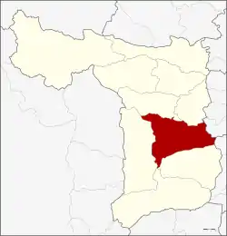 District location in Suphan Buri Province | |
| Coordinates: 14°29′4″N 100°7′25″E | |
| Country | Thailand |
| Province | Suphan Buri |
| Area | |
| • Total | 540.9 km2 (208.8 sq mi) |
| Population (2013) | |
| • Total | 166,716 |
| • Density | 292.3/km2 (757/sq mi) |
| Time zone | UTC+7 (ICT) |
| Postal code | 72000 |
| Geocode | 7201 |
History
Suphan Buri is an old city. In the era of Ankorian king Jayavarman VII, inscription called Prasat Phra Khan (จารึกปราสาทพระขรรค์) was made and which mentions the name of Suvarnapura.[1] Later Suphan Buri become important city of Ayutthaya kingdom. According to Chinese Annals called "Da Ming Shi Lu" (『大明実録』), Nakharinthathirat (Intharatcha or Nakhon In), before ascending the throne of Ayutthaya, was a ruler of Suphan Buri and tribute to Chinese Emperor as a King of Supan Buri (Su Men Bang Wang or 蘇門邦王).[2] Later in the 16th century, Suphan Buri become battle field of King Naresuan and Burmese crown prince.[1]
This area was the center of Mueang Suphan Buri. When the government created a district, it was called Wihan Daeng. Later the district name was changed to be Tha Phi Liang. In 1939 the district name was changed to Mueang Suphan Buri to correspond with the province name.
Geography
Neighbouring districts are (from the south clockwise): Bang Pla Ma, U Thong, Don Chedi, Si Prachan of Suphan Buri Province; Wiset Chai Chan of Ang Thong Province; and Phak Hai of Ayutthaya Province.
The main water resource of the district is the Tha Chin river or Suphan river.
Administration
Central administration
Mueang Suphan Buri is divided into 20 subdistricts (tambons), which are further subdivided into 124 administrative villages (mubans). The provincial administration has its headquarters in Tambon Sanam Chai.
| No. | Name | Thai | Villages | Pop.[3] |
|---|---|---|---|---|
| 1. | Tha Phi Liang | ท่าพี่เลี้ยง | - | 17,830 |
| 2. | Rua Yai | รั้วใหญ่ | 6 | 17,159 |
| 3. | Thap Ti Lek | ทับตีเหล็ก | 5 | 3,953 |
| 4. | Tha Rahat | ท่าระหัด | 5 | 10,349 |
| 5. | Phai Khwang | ไผ่ขวาง | 6 | 7,728 |
| 6. | Khok Kho Thao | โคกโคเฒ่า | 4 | 3,808 |
| 7. | Don Tan | ดอนตาล | 5 | 3,338 |
| 8. | Don Masang | ดอนมะสังข์ | 5 | 3,340 |
| 9. | Phihan Daeng | พิหารแดง | 6 | 5,105 |
| 10. | Don Kamyan | ดอนกำยาน | 9 | 10,006 |
| 11. | Don Pho Thong | ดอนโพธิ์ทอง | 6 | 6,669 |
| 12. | Ban Pho | บ้านโพธิ์ | 9 | 8,444 |
| 13. | Sa Kaeo | สระแก้ว | 9 | 14,196 |
| 14. | Taling Chan | ตลิ่งชัน | 7 | 9,071 |
| 15. | Bang Kung | บางกุ้ง | 4 | 1,955 |
| 16. | Sala Khao | ศาลาขาว | 10 | 8,584 |
| 17. | Suan Taeng | สวนแตง | 9 | 10,115 |
| 18. | Sanam Chai | สนามชัย | 6 | 10,629 |
| 19. | Pho Phraya | โพธิ์พระยา | 7 | 6,775 |
| 20. | Sanam Khli | สนามคลี | 6 | 7,662 |
Local administration
There is one town (thesaban mueang) in the district:
- Suphan Buri (Thai: เทศบาลเมืองสุพรรณบุรี) consisting of subdistrict Tha Phi Liang and parts of subdistricts Rua Yai and Tha Rahat.
There are seven subdistrict municipalities (thesaban tambons) in the district:
- Ban Pho (Thai: เทศบาลตำบลบ้านโพธิ์) consisting of subdistrict Ban Pho.
- Huai Wang Thong (Thai: เทศบาลตำบลห้วยวังทอง) consisting of parts of subdistrict Pho Phraya.
- Tha Sadet (Thai: เทศบาลตำบลท่าเสด็จ) consisting of subdistrict Sa Kaeo.
- Pho Phraya (Thai: เทศบาลตำบลโพธิ์พระยา) consisting of parts of subdistrict Pho Phraya.
- Suan Taeng (Thai: เทศบาลตำบลสวนแตง) consisting of parts of subdistricts Sala Khao, Suan Taeng.
- Tha Rahat (Thai: เทศบาลตำบลท่าระหัด) consisting of parts of subdistrict Tha Rahat.
- Bang Kung (Thai: เทศบาลตำบลบางกุ้ง) consisting of subdistrict Bang Kung.
There are 14 subdistrict administrative organizations (SAO) in the district:
- Rua Yai (Thai: องค์การบริหารส่วนตำบลรั้วใหญ่) consisting of parts of subdistrict Rua Yai.
- Thap Ti Lek (Thai: องค์การบริหารส่วนตำบลทับตีเหล็ก) consisting of subdistrict Thap Ti Lek.
- Phai Khwang (Thai: องค์การบริหารส่วนตำบลไผ่ขวาง) consisting of subdistrict Phai Khwang.
- Khok Kho Thao (Thai: องค์การบริหารส่วนตำบลโคกโคเฒ่า) consisting of subdistrict Khok Kho Thao.
- Don Tan (Thai: องค์การบริหารส่วนตำบลดอนตาล) consisting of subdistrict Don Tan.
- Don Masang (Thai: องค์การบริหารส่วนตำบลดอนมะสังข์) consisting of subdistrict Don Masang.
- Phihan Daeng (Thai: องค์การบริหารส่วนตำบลพิหารแดง) consisting of subdistrict Phihan Daeng.
- Don Kamyan (Thai: องค์การบริหารส่วนตำบลดอนกำยาน) consisting of subdistrict Don Kamyan.
- Don Pho Thong (Thai: องค์การบริหารส่วนตำบลดอนโพธิ์ทอง) consisting of subdistrict Don Pho Thong.
- Taling Chan (Thai: องค์การบริหารส่วนตำบลตลิ่งชัน) consisting of subdistrict Taling Chan.
- Sala Khao (Thai: องค์การบริหารส่วนตำบลศาลาขาว) consisting of parts of subdistrict Sala Khao.
- Suan Taeng (Thai: องค์การบริหารส่วนตำบลสวนแตง) consisting of parts of subdistrict Suan Taeng.
- Sanam Chai (Thai: องค์การบริหารส่วนตำบลสนามชัย) consisting of subdistrict Sanam Chai.
- Sanam Khli (Thai: องค์การบริหารส่วนตำบลสนามคลี) consisting of subdistrict Sanam Khli.
References
- เข้าใจถิ่นเข้าใจเที่ยว สุพรรณบุรี, การท่องเที่ยวแหงประเทศไทย, 2547, p.7 ISBN 978-974-7177-14-5 or Appriciate the Locality, Travel Knowaladgableably, Suphan Buri Tourism Authority of Thailand, 2000, p.7 ISBN 978-974-7177-45-9; * Wārunī ʻŌsathārom. Mư̄ang Suphan bon sēnthāng kan̄plīanplǣng thāng prawattisāt Phutthasattawat thī 8 - ton Phutthasattawat thī 25 (History, development, and geography of the ancient city of Suphan Buri Province, Central Thailand, 8th-25th B.E.), Samnakphim Mahāwitthayālai Thammasāt, Krung Thēp, 2547.
- Fujiwara, Riichiro "Relations between China and Siam in the Early period of the Ming Dynasty", Studies on History of South-East Asia, Kyoto: Hozokan, 1988, pp.3-43 (Japanese Thesis)
- "Population statistics 2013" (in Thai). Department of Provincial Administration. Retrieved 2014-10-04.
| Wikimedia Commons has media related to Mueang Suphan Buri District. |