Mundowran
Mundowran is a rural locality in the North Burnett Region, Queensland, Australia.[2] In the 2016 census Mundowran had a population of 122 people.[1]
| Mundowran Queensland | |||||||||||||||
|---|---|---|---|---|---|---|---|---|---|---|---|---|---|---|---|
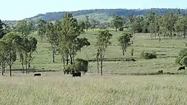 Rural landscape, 2014 | |||||||||||||||
 Mundowran | |||||||||||||||
| Coordinates | 25.5094°S 151.3455°E | ||||||||||||||
| Population | 122 (2016 census)[1] | ||||||||||||||
| • Density | 1.197/km2 (3.101/sq mi) | ||||||||||||||
| Postcode(s) | 4626 | ||||||||||||||
| Area | 101.9 km2 (39.3 sq mi) | ||||||||||||||
| Time zone | AEST (UTC+10:00) | ||||||||||||||
| LGA(s) | North Burnett Region | ||||||||||||||
| State electorate(s) | Callide | ||||||||||||||
| Federal Division(s) | Flynn | ||||||||||||||
| |||||||||||||||
Geography
The Burnett Highway enters the locality from the east, passes south through a small area, and then forms the south-eastern, southern and south-western boundaries before continuing to the west.[3] The Mundubbera Durong Road (State Route 75) runs south from the Burnett Highway through Mundubbera.
History
Mundowran State School opened on 26 March 1913 and closed in 1960.[4]
In the 2016 census Mundowran had a population of 122 people.[1]
References
| Wikimedia Commons has media related to Mundowran. |
- Australian Bureau of Statistics (27 June 2017). "Mundowran (SSC)". 2016 Census QuickStats. Retrieved 20 October 2018.

- "Mundowran – locality in North Burnett Region (entry 45398)". Queensland Place Names. Queensland Government. Retrieved 28 December 2020.
- Google (29 July 2019). "Mundowran, Queensland" (Map). Google Maps. Google. Retrieved 29 July 2019.
- Queensland Family History Society (2010), Queensland schools past and present (Version 1.01 ed.), Queensland Family History Society, ISBN 978-1-921171-26-0
This article is issued from Wikipedia. The text is licensed under Creative Commons - Attribution - Sharealike. Additional terms may apply for the media files.
