Muroto, Kōchi
Muroto (室戸市, Muroto-shi) is a city located in Kōchi Prefecture, Japan. The city was founded on March 1, 1951.
Muroto
室戸市 | |||||||||||||
|---|---|---|---|---|---|---|---|---|---|---|---|---|---|
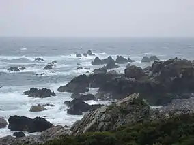
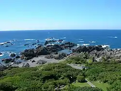 View of the Pacific Ocean from Cape Muroto | |||||||||||||
 Flag  Emblem | |||||||||||||
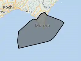
Location of Muroto in Kōchi Prefecture | |||||||||||||
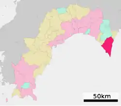 | |||||||||||||
 Muroto Location in Japan | |||||||||||||
| Coordinates: 33°17′24″N 134°09′07″E | |||||||||||||
| Country | Japan | ||||||||||||
| Region | Shikoku | ||||||||||||
| Prefecture | Kōchi Prefecture | ||||||||||||
| Government | |||||||||||||
| • Mayor | Soichiro Ueta | ||||||||||||
| Area | |||||||||||||
| • Total | 248.25 km2 (95.85 sq mi) | ||||||||||||
| Population (March 31, 2017) | |||||||||||||
| • Total | 14,006 | ||||||||||||
| • Density | 56/km2 (150/sq mi) | ||||||||||||
| Time zone | UTC+09:00 (JST) | ||||||||||||
| City hall address | 25-1 Ukitsu, Muroto-shi, Kōchi-ken 781-7185 | ||||||||||||
| Website | www | ||||||||||||
| |||||||||||||
As of March 31, 2017, the city has an estimated population of 14,006, with 7,622 households[1] and a population density of 56 persons per km2. The total area is 248.25 km2.
The entire territory of Muroto is "Muroto Global Geopark" which is a member of the Japanese Geoparks Network and Global Geoparks Network since 2011 on account of its outstanding geological heritage, educational programs and projects, and promotion of geotourism.[2]
Population
As of March 31, 2017, the city has an estimated population of 14,006, with 7,622 households[3] and a population density of 56 persons per km2. The total area is 248.25 km2.
Geology
The peninsula is made up of Oligocene to Pleistocene-aged sedimentary rocks and loose Holocene-aged alluvial deposits. The rocks belong to the Shimanto Supergroup, represented in the peninsula as mudstone, and the Tonohama Group made up of chiefly of sandstone and gravel.[4] Several active, WNW-dipping, thrust faults are exposed at the western coast and southern tip of the peninsula. Off-shore west of the Cape Muroto, tip of the peninsula, there faults dips to the west.[4]
There are uplifted marine terraces at Muroto. Dating of these terraces reveal that since their formation in an interval 123 to 96 thousand years ago (k B.P.), in an epoch corresponding to the Eemian interglacial. Since then land in the tip of the peninsula has risen 1.2–1.6 meters every thousand years (m/kyr). Closer to the mainland the uplift rate has been in the order of 0.3–0.7 m/kyr.[4] While these are long-term averages individual large non-megathrust earthquakes are known to have uplifted the coast around one meter. These earthquakes are more rare than megathrust ones occurring every 1000 to 2000 years.[4]
Uplift of the coast has left fossil tube worm colonies attached to rocks on land.[2]
References
- "Official website of Muroto City" (in Japanese). Japan: Muroto City. Retrieved 1 May 2017.
- Muroto Global Geopark
- "Official website of Muroto City" (in Japanese). Japan: Muroto City. Retrieved 1 May 2017.
- Matsu'ura, Tabito (2015). "Late Quaternary uplift rate inferred from marine terraces, Muroto Peninsula, southwest Japan: Forearc deformation in an oblique subduction zone". Geomorphology. 234: 133–150. doi:10.1016/j.geomorph.2015.01.012.
External links
| Wikimedia Commons has media related to Muroto, Kochi. |
- Muroto City official website (in Japanese)
- Muroto Global Geopark in English
- Muroto-Anan Coast Quasi-National Park in English
 Geographic data related to Muroto, Kōchi at OpenStreetMap
| Authority control |
|---|