Murphy, Idaho
Murphy is an unincorporated village in, and county seat of, Owyhee County, Idaho, United States.[1] It is among the smallest of county seats nationwide, with a population as of the 2010 census of 97.[2][3] Murphy is part of the Boise City–Nampa, Idaho Metropolitan Statistical Area. Murphy is also located within the census-designated place bearing its name. Murphy is home to the Owyhee County Historical Museum and Library.
Murphy, Idaho | |
|---|---|
.jpg.webp) The Murphy General Store and Cafe in 2019 | |
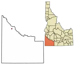 Location of Murphy in Owyhee County, Idaho. | |
 Murphy, Idaho Location within the state of Idaho | |
| Coordinates: 43°13′06″N 116°33′08″W | |
| Country | United States |
| State | Idaho |
| County | Owyhee |
| Area | |
| • Total | 3.839 sq mi (9.94 km2) |
| • Land | 3.839 sq mi (9.94 km2) |
| • Water | 0 sq mi (0 km2) |
| Elevation | 2,820 ft (860 m) |
| Population (2010) | |
| • Total | 97 |
| • Density | 25/sq mi (9.8/km2) |
| Time zone | UTC-7 (Mountain (MST)) |
| • Summer (DST) | UTC-6 (MDT) |
| ZIP codes | 83650 |
| Area code(s) | 208, 986 |
| FIPS code | 16-55720 |
History
Murphy developed around a railhead of the Boise, Nampa and Owyhee Railroad, built in 1899 by Colonel William H. Dewey. Dewey had planned to extend the railroad to Silver City, but when mining operations in the Owyhee Mountains became unproductive, the line was not continued past Murphy. The railroad operated until 1947.[4]
By a narrow margin, Owyhee County voters selected Murphy as county seat in 1934, succeeding Silver City (which was located in the Owyhee Mountains and had been in decline; it is now defunct).[5] Although the county seat was moved to Murphy after the vote, and a new Owyhee County Courthouse was constructed in 1936, the Idaho State Legislature did not ratify the change of county seat until 1999. The error in the Idaho Code, discovered by county prosecutor G. Edward Yarbrough, was finally corrected by Senate Bill 1009.[6]
The community likely was named after Cornelius "Con" Murphy, a crew boss with the Boise, Nampa and Owyhee Railroad and foreman during construction of the Guffey Bridge in 1897.[4] Another source for the name may have been Pat Murphy, a Silver City mining engineer and friend of railroad owner Dewey.[7]

Geography
Murphy is located at 43°13′06″N 116°33′08″W,[8] at an elevation of 2,820 feet (860 m) above sea level; it is 25 miles (40 km) south of Nampa.
Airstrip
Murphy's airstrip is situated immediately northeast of the community, without a control tower. Its 2,500-foot (760 m) asphalt runway is oriented NW-SE (12/30),[9] parallel with State Highway 78. The elevation drops 60 feet (18 m) in the northwest (30) direction, from 2,855 to 2,795 feet.
| Historical population | |||
|---|---|---|---|
| Census | Pop. | %± | |
| 1900 | 80 | — | |
| 1910 | 102 | 27.5% | |
| 1920 | 150 | 47.1% | |
| 1930 | 75 | −50.0% | |
| 1950 | 50 | — | |
| 1960 | 50 | 0.0% | |
| 1970 | 100 | 100.0% | |
| 1980 | 150 | 50.0% | |
| 1990 | 150 | 0.0% | |
| 2010 | 97 | — | |
| source:[10][3] | |||
References
- "Find a County". National Association of Counties. Retrieved 2011-06-07.
- "U.S. Census website". U.S. Census Bureau. Retrieved 23 March 2011.
- Spokesman-Review Archived 2016-03-04 at the Wayback Machine - 2010 census - Murphy, Idaho - accessed 2011-12-12
- Sandra Forester (September 6, 2007). "Idaho's largest artifact turns 110". Idaho Statesman. Boise, Idaho.
- Walt Schramm (January 24, 1960). "Town of Murphy, Owyhee County Seat, Rates High as One of Most Unusual in Entire Country". Idaho Statesman. Boise, Idaho. p. 26.
- Tim Woodward (January 25, 1999). "65 Years in Wrong Town". Idaho Statesman. Boise, Idaho.
- Lalia Boone (1988). Idaho Place Names. University of Idaho Press. p. 265.
- "US Gazetteer files: 2010, 2000, and 1990". United States Census Bureau. 2011-02-12. Retrieved 2011-04-23.
- AirNav.com - airport information - Murphy, Idaho - accessed 2011-12-12
- Moffatt, Riley. Population History of Western U.S. Cities & Towns, 1850-1990. Lanham: Scarecrow, 1996, 96.
External links
 Media related to Murphy, Idaho at Wikimedia Commons
- Owyhee County Historical Society - Museum & Library - Murphy, Idaho
- Untraveled Road.com - photo tour - Murphy, Idaho - 2008-06-13
- Weather.com - Murphy, Idaho - current conditions and forecast
Municipalities and communities of Owyhee County, Idaho, United States | ||
|---|---|---|
| Cities | Map of Idaho highlighting Owyhee County | |
| CDP | ||
| Unincorporated communities | ||
| Indian reservation | ||
| Ghost towns | ||
| Footnotes | ‡This populated place also has portions in an adjacent county or counties | |
| ||
| Authority control |
|
|---|