Nagari, Andhra Pradesh
Nagari is a town in Chittoor district of the Indian state of Andhra Pradesh. It is the mandal headquarters of Nagari mandal in Chittoor revenue division.[3][4]
Nagari | |
|---|---|
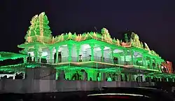 Sai Baba Temple in Nagari,Chittoor | |
.svg.png.webp) Nagari Location in Andhra Pradesh, India | |
| Coordinates: 13.3214°N 79.5856°E | |
| Country | India |
| State | Andhra Pradesh |
| District | Chittoor |
| Mandal | Nagari |
| Government | |
| • Type | Legislative assembly of Andhra Pradesh |
| • Body | Municipality |
| • MLA | R K Roja |
| Area | |
| • Total | 35.45 km2 (13.69 sq mi) |
| Elevation | 115 m (377 ft) |
| Population (2011)[2] | |
| • Total | 62,253 |
| • Density | 1,800/km2 (4,500/sq mi) |
| Languages | |
| • Official | Telugu and Tamil |
| Time zone | UTC+5:30 (IST) |
| PIN | 517590 |
| Telephone code | 91-8577 |
| Vehicle registration | AP-03 |
| Website | Nagari Municipality |
Geography
Nagari is located at 13.33°N 79.58°E.[5] It has an average elevation of 116 metres (380 feet). It is 3rd Grade Municipality in the Chittoor District of Andhra Pradesh. It is spread over an area of 25.6 Sq.Km. With a population of 62275 ( 2011 Census). It is famous for Cotton weaving Sarees, Lungies, Dress Material, Desamma Temple, Kariyamanikyam Venkateswara Swamy Temple(TTD),SaiBaba Temple and Bananas
Location
It is located 100 kms from Chennai and 67 km from District Headquarters. It was establishment as a 3rd grade municipality in the year 2005. There are 4 zones and 27 election wards in this municipality
Topography
Nagari is located at 13 degrees/ 33 minutes’ North 79 degrees/58 minutes East. It has average elevation of 144 meters, Nagari is situated on the Tirupati to Chennai Highway and 50 km from tirupati and 95 km distance from Nagari to Chennai.
Climate and Rainfall
Nagari Town, in general has a tropical climate, winters last from November to February, while summers last from March to June. The annual rainfall 1.62 mm, most of it received during the months of October/November & December.
Demography
The Population of the town which was 56832 in 2001 increased to 62275 in 2011 with an increase of 8.74% in the last decade. The sex ratio is 985 females per 1000 males. The literacy rate is 77.85 %.
Economy
Weavers, Urban, Partially, Agriculture
| Climate data for Nagari, India | |||||||||||||
|---|---|---|---|---|---|---|---|---|---|---|---|---|---|
| Month | Jan | Feb | Mar | Apr | May | Jun | Jul | Aug | Sep | Oct | Nov | Dec | Year |
| Average high °C (°F) | 29.9 (85.8) |
32.8 (91.0) |
36.7 (98.1) |
40.3 (104.5) |
43.3 (109.9) |
40.8 (105.4) |
35.7 (96.3) |
34.8 (94.6) |
34.8 (94.6) |
32.7 (90.9) |
30.1 (86.2) |
28.9 (84.0) |
35.1 (95.1) |
| Average low °C (°F) | 18.7 (65.7) |
20.1 (68.2) |
22.6 (72.7) |
26.2 (79.2) |
27.9 (82.2) |
27.2 (81.0) |
25.9 (78.6) |
25.5 (77.9) |
25.1 (77.2) |
23.5 (74.3) |
21.7 (71.1) |
19.9 (67.8) |
23.7 (74.7) |
| Average precipitation mm (inches) | 22.0 (0.87) |
19.7 (0.78) |
2.9 (0.11) |
13.9 (0.55) |
45.7 (1.80) |
69.7 (2.74) |
113.0 (4.45) |
118.6 (4.67) |
119.1 (4.69) |
157.5 (6.20) |
218.7 (8.61) |
130.5 (5.14) |
1,031.3 (40.61) |
| Source: Indian Meteorological Department[6] | |||||||||||||
Demographics
As of 2011 Census of India, the town had a population of 96,152. The total population constitute, 48,058 males and 48,094 females —a sex ratio of 1000 females per 1000 males, higher than the national average of 940 per 1000.[2][7] 10,518 children are in the age group of 0–6 years, of which 5,471 are boys and 5,047 are girls—a ratio of 922 per 1000. The average literacy rate stands at 65.14% with 62,640 literates, lower than the national average of 73.00%.[2][8] Telugu is the official of the state but both Tamil and Telugu are widely spoken in the town.Due to geographical settlement reasons of the town near to the border of neighbouring state tamilnadu.All inhabitants can speak and understand both telugu and tamil languages.
Education
The primary and secondary school education is imparted by government, aided and private schools, under the School Education Department of the state.[9][10]
References
- "Municipalities, Municipal Corporations & UDAs" (PDF). Directorate of Town and Country Planning. Government of Andhra Pradesh. Archived from the original (PDF) on 28 January 2016. Retrieved 29 January 2016.
- "Census 2011". The Registrar General & Census Commissioner, India. Retrieved 1 September 2014.
- "Chittoor District Mandals" (PDF). Census of India. pp. 482, 516. Retrieved 19 June 2015.
- "District Census Handbook - Chittoor" (PDF). Census of India. pp. 22–23. Retrieved 20 January 2016.
- "Maps, Weather, and Airports for Nagari, India". fallingrain.com.
- "Climatological Data of Important Cities" (PDF). Indian Meteorological Department. Archived from the original (PDF) on 13 April 2015. Retrieved 27 March 2012.
- "Sex Ratio". The Registrar General & Census Commissioner, India. Retrieved 1 September 2014.
- "Chapter–3 (Literates and Literacy rate)" (PDF). Registrar General and Census Commissioner of India. Retrieved 1 September 2014.
- "School Education Department" (PDF). School Education Department, Government of Andhra Pradesh. Archived from the original (PDF) on 7 November 2016. Retrieved 7 November 2016.
- "The Department of School Education - Official AP State Government Portal | AP State Portal". www.ap.gov.in. Archived from the original on 7 November 2016. Retrieved 7 November 2016.