Nam Nao District
Nam Nao (Thai: น้ำหนาว, pronounced [náːm nǎːw]) is the northeasternmost district (amphoe) of Phetchabun Province, northern Thailand.
Nam Nao
น้ำหนาว | |
|---|---|
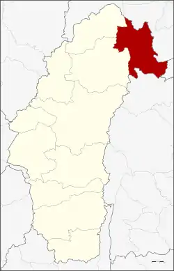 District location in Phetchabun Province | |
| Coordinates: 16°46′6″N 101°40′18″E | |
| Country | Thailand |
| Province | Phetchabun |
| Seat | Nam Nao |
| Area | |
| • Total | 620.0 km2 (239.4 sq mi) |
| Population (2000) | |
| • Total | 15,485 |
| • Density | 25.0/km2 (65/sq mi) |
| Time zone | UTC+7 (ICT) |
| Postal code | 67260 |
| Geocode | 6709 |
History
On 16 November 1978 the tambons Nam Nao and Lak Dan were split from Lom Sak District and made into a minor district (king amphoe).[1] It was upgraded to a full district on 19 July 1991.[2]
Geography
Neighboring districts are (from the north clockwise) Phu Luang and Phu Kradueng of Loei Province, Phu Pha Man of Khon Kaen Province, Khon San of Chaiyaphum Province, and Lom Sak and Lom Kao of Phetchabun Province. The district's east side borders Phu Kradueng Mountain.
Nam Nao National Park is in the district.
Administration
The district is divided into four sub-districts (tambons), which are further subdivided into 30 villages (mubans). There are no municipal (thesabana) in the district. There are four tambon administrative organizations (TAO).
| 1. | Nam Nao | น้ำหนาว | |
| 2. | Lak Dan | หลักด่าน | |
| 3. | Wang Kwang | วังกวาง | |
| 4. | Khok Mon | โคกมน |
References
- ประกาศกระทรวงมหาดไทย เรื่อง แบ่งท้องที่อำเภอหล่มเก่า จังหวัดเพชรบูรณ์ ตั้งเป็นกิ่งอำเภอน้ำหนาว (PDF). Royal Gazette (in Thai). 95 (130 ง): 4080. November 21, 1978.
- พระราชกฤษฎีกาตั้งอำเภอทุ่งตะโก อำเภอพะโต๊ะ อำเภอเขาค้อ อำเภอน้ำหนาว อำเภอวังจันทร์ อำเภอนาด้วง อำเภอเต่างอย อำเภอสิงหนคร อำเภอพระสมุทรเจดีย์ และอำเภอลำดวน พ.ศ. ๒๕๓๔ (PDF). Royal Gazette (in Thai). 108 (107 ก Special): 29–33. June 19, 1991.