Lom Sak District
Lom Sak (Thai: หล่มสัก, pronounced [lòm sàk]) is a district (amphoe) in the northern part of Phetchabun Province, northern Thailand.
Lom Sak
หล่มสัก | |
|---|---|
 | |
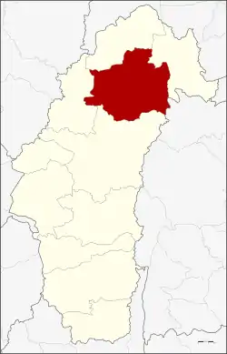 District location in Phetchabun Province | |
| Coordinates: 16°46′46″N 101°14′32″E | |
| Country | Thailand |
| Province | Phetchabun |
| Area | |
| • Total | 1,535.3 km2 (592.8 sq mi) |
| Population (2000) | |
| • Total | 150,680 |
| • Density | 98.1/km2 (254/sq mi) |
| Time zone | UTC+7 (ICT) |
| Postal code | 67110 |
| Geocode | 6703 |
History
The history of Lom Sak area dates back to the founding of the Sukhothai Kingdom in the 13th century. The governor of Mueang Rat (Lom Sak), Pho Khun Pha Mueang (พ่อขุนผาเมือง), was one of Thai warlords who defeated the Khmer. When Pho Khun Bang Klang Hao (พ่อขุนบางกลางหาว) and a friend established the Sukhothai Kingdom, he supported his friend to be the first king because his wife was Khmer.
In 1767 in the reign of King Taksin the Great, Phraya Chakri (the later King Rama I) returned from an expedition to Vientiane through the area of present-day Lom Kao District. Some of the people from Vientiane settled there. When the new town grew bigger, they moved their town to the plain near the Pa Sak River and named the new town Lom Sak. Later other Lao from Vientiane, who were forced by King Taksin to settle in Lopburi, returned and settled in Lom Sak.
According to the historian Prince Damrong Rajanubhab, Mueang Lom Sak was established in the reign of King Nangklao (Rama III). When King Chulalongkorn (Rama V) created the monthon as part of the Thesaphiban administrative reforms, Mueang Lom Sak was controlled by Monthon Phetchabun. Later it was downgraded to be a district of Phetchabun Province. In 1916 the district was named Wat Pa (วัดป่า). The name of district was changed back to Lom Sak on 11 November 1938.
From 1970 to 1980 the hills of Lom Sak were a stronghold of the Communist Party of Thailand.
Geography
Neighboring districts are (from the north clockwise) Lom Kao and Nam Nao of Phetchabun Province, Khon San of Chaiyaphum Province, and Mueang Phetchabun and Khao Kho of Phetchabun.
Nam Nao National Park protects some of the hills of the district. Khao Kho National Park is currently being developed and will also occupy parts of the district.
Climate
| Climate data for Lom Sak (1981–2010) | |||||||||||||
|---|---|---|---|---|---|---|---|---|---|---|---|---|---|
| Month | Jan | Feb | Mar | Apr | May | Jun | Jul | Aug | Sep | Oct | Nov | Dec | Year |
| Record high °C (°F) | 37.3 (99.1) |
38.5 (101.3) |
40.7 (105.3) |
41.5 (106.7) |
40.6 (105.1) |
39.7 (103.5) |
37.3 (99.1) |
37.0 (98.6) |
36.2 (97.2) |
36.3 (97.3) |
37.1 (98.8) |
36.3 (97.3) |
41.5 (106.7) |
| Average high °C (°F) | 32.0 (89.6) |
34.1 (93.4) |
35.7 (96.3) |
36.6 (97.9) |
34.9 (94.8) |
33.4 (92.1) |
32.5 (90.5) |
31.9 (89.4) |
32.3 (90.1) |
32.3 (90.1) |
31.9 (89.4) |
30.9 (87.6) |
33.2 (91.8) |
| Daily mean °C (°F) | 24.3 (75.7) |
25.9 (78.6) |
28.0 (82.4) |
29.2 (84.6) |
28.6 (83.5) |
28.2 (82.8) |
27.6 (81.7) |
27.3 (81.1) |
27.1 (80.8) |
26.8 (80.2) |
25.4 (77.7) |
23.8 (74.8) |
26.9 (80.4) |
| Average low °C (°F) | 17.4 (63.3) |
19.3 (66.7) |
21.7 (71.1) |
23.8 (74.8) |
24.4 (75.9) |
24.5 (76.1) |
24.2 (75.6) |
24.1 (75.4) |
23.8 (74.8) |
22.8 (73.0) |
20.0 (68.0) |
17.1 (62.8) |
21.9 (71.4) |
| Record low °C (°F) | 8.6 (47.5) |
10.7 (51.3) |
11.6 (52.9) |
19.2 (66.6) |
20.4 (68.7) |
20.9 (69.6) |
20.6 (69.1) |
20.3 (68.5) |
18.8 (65.8) |
14.0 (57.2) |
8.6 (47.5) |
5.5 (41.9) |
5.5 (41.9) |
| Average rainfall mm (inches) | 4.8 (0.19) |
17.1 (0.67) |
43.8 (1.72) |
63.2 (2.49) |
150.8 (5.94) |
136.2 (5.36) |
128.6 (5.06) |
198.1 (7.80) |
193.6 (7.62) |
88.5 (3.48) |
13.9 (0.55) |
4.5 (0.18) |
1,043.1 (41.07) |
| Average rainy days | 1.1 | 2.0 | 4.7 | 8.3 | 15.6 | 16.4 | 17.4 | 19.9 | 17.6 | 10.5 | 2.4 | 0.8 | 116.7 |
| Average relative humidity (%) | 63 | 61 | 63 | 67 | 76 | 79 | 80 | 83 | 83 | 78 | 70 | 65 | 72 |
| Mean monthly sunshine hours | 257.3 | 243.0 | 238.7 | 204.0 | 158.1 | 117.0 | 120.9 | 58.9 | 108.0 | 198.4 | 252.0 | 275.9 | 2,232.2 |
| Mean daily sunshine hours | 8.3 | 8.6 | 7.7 | 6.8 | 5.1 | 3.9 | 3.9 | 1.9 | 3.6 | 6.4 | 8.4 | 8.9 | 6.1 |
| Source 1: Thai Meteorological Department[1] | |||||||||||||
| Source 2: Office of Water Management and Hydrology, Royal Irrigation Department (sun and humidity)[2] | |||||||||||||
Administration
The district is divided into 23 sub-districts (tambons), which are further subdivided into 251 villages (mubans). Lom Sak itself is a town (thesaban mueang) which covers tambon Lom Sak. There are a further 20 tambon administrative organizations (TAO).
| 1. | Lom Sak | หล่มสัก | |
| 2. | Wat Pa | วัดป่า | |
| 3. | Tan Diao | ตาลเดี่ยว | |
| 4. | Fai Na Saeng | ฝายนาแซง | |
| 5. | Nong Sawang | หนองสว่าง | |
| 6. | Nam Hia | น้ำเฮี้ย | |
| 7. | Sak Long | สักหลง | |
| 8. | Tha Ibun | ท่าอิบุญ | |
| 9. | Ban Sok | บ้านโสก | |
| 10. | Ban Tio | บ้านติ้ว | |
| 11. | Huai Rai | ห้วยไร่ | |
| 12. | Nam Ko | น้ำก้อ | |
| 13. | Pak Chong | ปากช่อง | |
| 14. | Nam Chun | น้ำชุน | |
| 15. | Nong Khwai | หนองไขว่ | |
| 16. | Lan Ba | ลานบ่า | |
| 17. | Bung Khla | บุ่งคล้า | |
| 18. | Bung Namtao | บุ่งน้ำเต้า | |
| 19. | Ban Klang | บ้านกลาง | |
| 20. | Chang Talut | ช้างตะลูด | |
| 21. | Ban Rai | บ้านไร่ | |
| 22. | Pak Duk | ปากดุก | |
| 23. | Ban Wai | บ้านหวาย |
References
- "Climatological Data for the Period 1981–2010". Thai Meteorological Department. p. 7. Retrieved 1 August 2016.
- "ปริมาณการใช้น้ำของพืชอ้างอิงโดยวิธีของ Penman Monteith (Reference Crop Evapotranspiration by Penman Monteith)" (PDF) (in Thai). Office of Water Management and Hydrology, Royal Irrigation Department. p. 34. Retrieved 1 August 2016.
| Historical divisions |
| ||||
|---|---|---|---|---|---|
| Former provinces |
| ||||