Napier-Hastings Urban Area
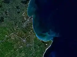
The Napier-Hastings Urban Area lies mostly on the Heretaunga Plains of the Hawke's Bay Region in New Zealand and is a conurbation surrounding the twin cities of Napier and Hastings. It is the sixth-most-populous urban area in the country, with 134,500 residents,[1] just slightly fewer than Tauranga (141,600) and more than Dunedin (122,000).
Napier-Hastings Urban Area | |
|---|---|
Napier-Hastings Urban Area Hastings/Napier | |
| Coordinates: 39°35′0″S 176°51′0″E | |
| Country | |
| Region | Hawke's Bay |
| Area | |
| • Territorial | 5,335 km2 (2,060 sq mi) |
| Elevation | 9 m (30 ft) |
| Population (June 2018)[1] | |
| • Territorial | 139,600 |
| • Density | 26/km2 (68/sq mi) |
| • Urban | 134,500 |
| Postcodes | 4120, 4122 |
While the two cities remain separated by 9 km (5.6 mi) of rural land from city edge to edge (20 km from one city centre to the next), there is sufficient economic and social integration between the cities that Statistics New Zealand considers them as a single unit. However, like the urban areas of Auckland, Hamilton and Wellington, the Napier-Hastings urban area is subdivided into urban zones. The urban area contains around three-quarters of the population of the entire Hawke's Bay.
If Hastings and Napier were to amalgamate they would become the sixth-most-populous city in New Zealand following Tauranga.
The Statistical Standard of Geographic Areas 2018, developed by Statistics New Zealand, will see the Napier-Hastings abolished as a statistical urban area. It will be replaced with four separate urban areas: Napier, Hastings, Havelock North, and Clive.[2]
Geography
Neighbouring cities, towns and places. | ||||||||||
|---|---|---|---|---|---|---|---|---|---|---|
| ||||||||||
Suburbs
- Ahuriri
- Awatoto
- Bay View
- Bluff Hill
- Esk Hills
- Greenmeadows
- Hospital Hill
- Knightsbridge
- Jervoistown
- Maraenui
- Marewa
- Meeanee
- Mission Hills
- Napier South
- Onekawa
- Oakland Park
- Parklands
- Pandora
- Pirimai
- Porati
- Taradale
- Ascot Park
- Knightsbridge
- Taradale North
- Taradale South
- Te Awa
- Tamatea
- Waiohiki
- Westshore
Hastings CBD
- Akina
- Camberley
- Flaxmere
- Flaxmere East
- Kingsley-Chatham
- Lochain
- Frimley
- Havelock North
- Anderson Park
- Havelock North Central
- Iona
- Te Mata
- Te Mata Hills
- Irongate
- Karamu
- Longlands
- Mahora
- Mayfair
- Parkvale
- Pukahu
- Raureka
- St Leonards
- Stortford Lodge
- Tomoana
- Twyford
- Waipatu
- Woolwich
Seismicity
Hawke's Bay is one of the most seismically active regions in New Zealand, and as so Napier-Hastings has experienced many large and often damaging earthquakes in the past. More than 50 damaging earthquakes have rocked the area since the European colonisation in the 1800s. Some of the more notable are listed below.
| Date | Location | Magnitude (ML) | Depth | Fatalities | More information |
|---|---|---|---|---|---|
| 8 July 1843 | 25 km west of Tikokino | 7.6 | 12 km | 2 | |
| 22 February 1863 | Waipukurau | 7.5 | 25 km | 1863 Hawke's Bay earthquake | |
| 5 October 1911 | Hastings | 5.6 | 33 km | ||
| 28 June 1921 | Kaweka Forest Park | 7.0 | 80 km | ||
| 3 February 1931 | 20 km north of Napier | 7.8 | 20 km | 256 killed, thousands injured | 1931 Hawke's Bay earthquake |
| 8 February 1931 | Wairoa | 6.4 | 60 km | ||
| 13 February 1931 | 50 km east of Napier | 7.3 | 30 km | ||
| 16 September 1932 | Wairoa | 6.9 | 12 km | ||
| 15 March 1934 | Mohaka | 6.1 | 25 km | ||
| 26 February 1940 | Hastings | 6.0 | 25 km | ||
| 31 January 1958 | Waipawa | 6.1 | 12 km | ||
| 5 October 1980 | Hastings | 5.7 | 30 km | ||
| 11 April 1993 | Hastings | 6.1 | 38 km | ||
| 15 October 2001 | Hastings | 5.8 | 40 km | ||
| 25 August 2008 | Hastings | 5.9 | 31 km | 2008 Hastings earthquake |
Education
Napier-Hastings offers a variety of colleges and tertiary studies for students. The Eastern Institute of Technology, commonly abbreviated to EIT or EIT HB is located along the banks of the Tutaekuri River and offers many different courses for students both in and out of the region. EIT serves as the main regional tertiary education centre for both Hawke's Bay and Gisborne regions. There are 3 campuses: Hawke's Bay, Auckland and Gisborne.
Secondary Schools are as follows:
| Name | Gender | Area | Decile | Roll | Website | MOE |
|---|---|---|---|---|---|---|
| Flaxmere College | Coed | Flaxmere | 1 | 331 | 134 | |
| Hastings Boys' High School | Boys | Hastings | 2 | 788 | 227 | |
| Hastings Christian School | Coed | Hastings | 7 | 277 | 443 | |
| Hastings Girls' High School | Girls | Hastings | 2 | 652 | 228 | |
| Havelock North High School | Coed | Havelock North | 8 | 1069 | ||
| Hohepa Home School | Coed | Taradale | 8 | 33 | – | 4109 |
| Iona College | Girls | Havelock North | 9 | 314 | 224 | |
| Karamu High School | Coed | Hastings | 4 | 925 | 229 | |
| Lindisfarne College | Boys | Hastings | 10 | 498 | 230 | |
| Napier Boys' High School | Boys | Napier | 6 | 1160 | 216 | |
| Napier Girls' High School | Girls | Napier | 7 | 1043 | 217 | |
| Sacred Heart College | Girls | Napier | 5 | 260 | 219 | |
| St John's College | Boys | Hastings | 4 | 383 | 226 | |
| St Joseph's Māori Girls' College | Girls | Taradale | 3 | 217 | 222 | |
| Taikura Rudolf Steiner School | Coed | Hastings | 6 | 370 | 231 | |
| Tamatea High School | Coed | Napier | 3 | 277 | 218 | |
| Taradale High School | Coed | Taradale | 8 | 1053 | 215 | |
| TKKM o Ngati Kahungunu Ki Heretaunga | Coed | Flaxmere | 1 | 178 | – | 2445 |
| TKKM o Te Ara Hou | Coed | Napier | 2 | 222 | – | 3107 |
| William Colenso College | Coed | Napier | 2 | 437 | 220 | |
| Woodford House | Girls | Havelock North | 9 | 336 | 225 |
Urban Zones
For more information, see Napier, New Zealand and Hastings, New Zealand respectively.
Napier Urban Zone
Napier Urban Zone includes Napier and two tracts of rural land from Hastings District: Bay View to the north and Waiohiki to the south. It also includes the township of Taradale.
Napier hosts the region's only port (the majority of export coming from Hastings' industry and food processing), the region's domestic airport, High Court, the local polytechnic college, and the Hawkes Bay Regional Council headquarters.
Napier on its own is the 10th largest urban area in New Zealand.
Hastings Urban Zone
Hastings Urban Zone lies within the Hastings District and includes Havelock North and Flaxmere. The Hastings District Council consists of almost half of the total population of Hawke's Bay, with 74,000 people. The main urban zone of Hastings contains around 68,000 people.
Hastings hosts the regional Hospital, Hawke's Bay Hospital, along with the regional showgrounds, racecourse, newspaper print, sports park and a water park.
Hastings on its own is the 8th largest urban area in New Zealand.
Amalgamation
Amalgamation is an ongoing debate for Napier and Hastings residents. Both cities have previously had smaller amalgamations (Napier absorbed Taradale, Hastings absorbed Havelock North in the local government reforms of 1989).
There was a referendum on forming a joint Hastings and Napier in 1999, which resulted in 75% 'no' vote from Napier residents, and a 64% 'yes' vote from Hastings residents. Many say the referendum was called too early and many Napier residents were still bitter about the closing of Napier Hospital in 1998 and making Hastings Hospital the only public hospital in the region.
A proposal in 2015 was for the new council to also absorb the Wairoa and Central Hawkes Bay councils to make a super regional council of 150,000 people.[3] This amalgamation referendum was held in September 2015, the majority of voters (~66%) rejected the proposal in favour of the status quo.[4]
Part of recognition of New Zealand's sixth-largest population centre is being labelled that way. Many residents have brought forth renaming the city to reflect this to the rest of the nation instead of referring to the cities by their current separate names. Names proposed include:
- Heretaunga (the name of the plains upon which both cities are situated)
- Hawkes Bay City (reflecting both recognised location and 'city' status)
- Hawke (again, coinciding with the name of the region)
- The Bay City (This perhaps is more in jest, and is already a common nickname)
- Napier-Hastings (The status quo, but still does not address the issue)
References
- "Subnational Population Estimates: At 30 June 2019". Statistics New Zealand. 22 October 2019. Retrieved 11 January 2020. For urban areas, "Subnational population estimates (UA, AU), by age and sex, at 30 June 1996, 2001, 2006–18 (2017 boundaries)". Statistics New Zealand. 23 October 2018. Retrieved 23 October 2018.
- "Ariā SNZ". aria.stats.govt.nz.
- http://i.stuff.co.nz/dominion-post/news/69231122/hawkes-bay-council-merger-recommended-after-wellington-supercity-scrapped
- "Hawke's Bay Reorganisation Poll : PROGRESS RESULT" (PDF). Electionz.com. Retrieved 17 June 2016.