Waipukurau
Waipukurau is the largest town in the Central Hawke's Bay District on the east coast of the North Island of New Zealand. It is located on the banks of the Tukituki River, 7 kilometres south of Waipawa and 50 kilometres southwest of Hastings.
Waipukurau | |
|---|---|

| |
| Coordinates: 39°59.5′S 176°33.5′E | |
| Country | New Zealand |
| Region | Hawke's Bay |
| Territorial authority | Central Hawke's Bay District |
| Ward | Ruataniwha |
| Electorate | Wairarapa |
| Population (June 2020)[1] | |
| • Total | 4,610 |
| Postcode(s) | 4200 |
History and culture
Māori
Central Hawkes Bay, where the town is located was settled by Te Aitanga a Whatonga, the descendants of Whatonga, grandson of Toi Kairakau. These were the Ngati Tara and Rangitāne peoples. In the mid 1500s the Ngāti Kahungunu invaded the area from the north and in the subsequent fighting drove the Rangitāne south into the Tahoraiti area (Dannevirke). Warfare continued through the 1600s until the time of Te Rangikoianake. His first child Te Kikiri was adopted by the Ngai Toroiwaho to be their chief - he had mana over the Waipukurau district.[2]
Fighting broke out again in the 1800s at Mangatoetoe between Ngai Te Upokoiri and Ngāti Te Rangikoianake of Poukawa. Several of Te Rangikoianake's grand children were killed in this fight. Pareihe, a Ngati Rangikoianake Chief, avenged the defeat in a battle at Pukekaihau, Waipukurau after which a peace accord was made between the two tribes.[2]
The accord was short lived with the death of Te Wanikau's brother-in-law (Chief of Ngai Te Upokoiri) prompting further conflict over the erection of rahui poles on Lake Poukawa, Ngati Rangikoianake's eel fishing area. The conflict, starting around 1819 and lasting till 1824 ended with the Ngati Rangikoianake and other local tribes evacuating the area and settling at Mahia. In the latter part of the 1820s Pareihe attacked the Ngai Te Upokoiri and regained the lands they had lost, with the Ngai Te Upokoiri taking refuge in the Manawatu. A peace accord was made between Pareihe and the Ngāti Tūwharetoa in the late 1830s. The Ngati Tuwharetoa had been allied with the Ngai Te Upokoiri.[2]
Within the current township is Pukekaihau hill, the site of the Māori pa, from which it gets its name. Waipukurau is said to mean the water of pukerau, wai being water and pukerau being a type of fungus. The pa was near the old Māori trail from the Manawatu Gorge and Hawkes Bay. The first Europeans who are known to have passed through the area were Bishop George Selwyn and Chief Justice Sir William Martin in November 1842 en route to Napier.[3]
European
.jpg.webp)
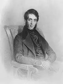
In December 1850 Donald McLean and his party of Land Commissioners meet with the Central Hawkes Bay tribes to discuss purchasing a large block of land for European settlement. Negotiations proceeded through till 4 November 1851 when an area of land called the Waipukurau Block, some 279,000 acres, including the land the town is situated on was acquired from local Maori, led by Te Hapuku for £4,800.[2][4] Henry Russell acquired the land surrounding Waipukurau, calling it Mount Herbert station.[5]
In 1857 there was an accommodation house run by a Mr Aveson.[6] This was sold in October 1858 to George Lloyd and renamed Lloyds Hotel.[7] The Hotel was transferred again in 1861 becoming Moss's Inn or the Tavistock Hotel.[8][9] Horse racing started in 1859 with the first recorded meeting on 2 February.[10] The provincial council approved construction of roading from Waipukurau to Porongahau, a goal, and the appointment of a Constable at Waipukurau in 1859.[11] Roading to Forty-mile bush was not commenced until late 1867.[12]
By at least 1858 Waipukurau was used as a hub for mail delivery to the district, a sale yard for stock, and a court venue.[13][14] In 1863 land was offered to the Agricultural Society for a show.[15] By 1864 the Presbyterians were looking to set up a church in Waipukurau.[16] There was a school in town by 1866 but this was closed when the building it used was destroyed by fire that year.[17] The school was replaced in August 1867 by new building which was to serve as both a church and a school.[18] The school had 9 pupils.[19]
.jpg.webp)
In 1867 Russell acquired the Pa Flat native reserve and founded Waipukurau on it as a model village.[20] Russel chose the residents and approved the house plans.[21]
Cobb and Co commenced the first coach service to the town in October 1867.[22] A coach road to the south reached Norsewood in December 1873 and the Manawatu Gorge in February 1874.[23] Tenders for a coach service from Waipukurau to Palmerston North were called for in March.[24] The contract was awarded to Andrew Young, whose coach operated from Foxton. On his first journey from Foxton to Waipukurau his coach was intercepted by Alexander MacDonald as he was attempting to cross the Oroua River on former Ngāti Kauwhata land near Schultz's Hotel at Awahuri. MacDonald shot one of the lead horses preventing Young from continuing his journey.[25] MacDonald was a staunch supporter of the Ngāti Kauwhata and had been seeking redress for the dispossession of the tribe from its land on 15 December 1866. MacDonald was imprisoned for three months because of this action, but his action did result in the tribe regaining some 6,200 acres of its land.[26]
In October 1867 a dispute broke out between the residents of Waipukurau and the neighbouring township of Waipawa over the location of a telegraph station.[27] The Provincial Council favoured Waipawa as the location.[28] However, the Government's Telegraph Department preferred Waipukurau due its slightly more central location.[29] The office was opened on 9 June 1868.[30] Several weeks later on 22 June Frederick Christian Schäfer, passed through the town. Schäfer was a global traveller from Carlhafen in Hesse-Cassel who had walked through most of Europe, Palestine, two thirds of the way across the United States, Australia, Japan, China, Batavia, and Sumatra. He walked from Wellington to Waipukurau in 18 days.[31][32]
One of the first sheep shearing competitions in New Zealand took place at Waipukurau in January 1868. Its purpose was to improve the quality of shearing,[33] As a local response to Te Kooti's escape and conflict on the East Coast, a stockade was erected in late 1869.[34]
In November 1869 a Methodist Church was formed in the town.[35] A boiling down works was constructed in March 1870, the same time a brewery was proposed and a flax mill opened.[36]
Construction of a railway from Napier to Waipukurau commenced in 1872. The target was to complete the line by September 1873.[37] This was not achieved and the line to Waipukurau was opened just three days after Waipawa on 1 September 1876. The link to Palmerston North was not completed until 9 March 1891 due in part to the more difficult country and the impact of the Long Depression.[38]
Marae
The local Waipukurau Marae is affiliated with the Ngāti Kahungunu hapū of Ngāti Whatuiāpiti and Ngāti Tamatea.[39][40]
Geography

Waipukurau has a population of 4,610 (as of June 2020).[1]
| Year | Pop. | ±% p.a. |
|---|---|---|
| 2006 | 4,161 | — |
| 2013 | 3,888 | −0.96% |
| 2018 | 4,386 | +2.44% |
| Source: [41] | ||
Waipukurau, comprising the statistical areas of Waipukurau West and Waipukurau East, had a population of 4,386 at the 2018 New Zealand census, an increase of 498 people (12.8%) since the 2013 census, and an increase of 225 people (5.4%) since the 2006 census. There were 1,755 households. There were 2,082 males and 2,304 females, giving a sex ratio of 0.9 males per female, with 837 people (19.1%) aged under 15 years, 684 (15.6%) aged 15 to 29, 1,746 (39.8%) aged 30 to 64, and 1,113 (25.4%) aged 65 or older.
Ethnicities were 79.0% European/Pākehā, 29.9% Māori, 3.1% Pacific peoples, 3.4% Asian, and 1.2% other ethnicities (totals add to more than 100% since people could identify with multiple ethnicities).
The proportion of people born overseas was 10.7%, compared with 27.1% nationally.
Although some people objected to giving their religion, 48.7% had no religion, 37.7% were Christian, 0.3% were Hindu, 0.2% were Muslim, 0.2% were Buddhist and 4.9% had other religions.
Of those at least 15 years old, 315 (8.9%) people had a bachelor or higher degree, and 975 (27.5%) people had no formal qualifications. The employment status of those at least 15 was that 1,590 (44.8%) people were employed full-time, 477 (13.4%) were part-time, and 138 (3.9%) were unemployed.[41]
| Name | Population | Households | Median age | Median income |
|---|---|---|---|---|
| Waipukurau West | 2,517 | 1,026 | 46.1 years | $27,100[42] |
| Waipukurau East | 1,869 | 729 | 46.5 years | $25,300[43] |
| New Zealand | 37.4 years | $31,800 |
In December 1858 Waipukurau census area had 243 males and 73 females - a total population of 316. 1,441 acres of land were fenced or cultivated with 95 horses, 364 cattle, and 20,365 sheep. There were also 4 goats and 61 pigs.[44]
The 40th parallel south passes through Waipukurau township.
Climate
| Climate data for Waipukurau | |||||||||||||
|---|---|---|---|---|---|---|---|---|---|---|---|---|---|
| Month | Jan | Feb | Mar | Apr | May | Jun | Jul | Aug | Sep | Oct | Nov | Dec | Year |
| Average high °C (°F) | 23 (74) |
24 (75) |
22 (71) |
18 (65) |
15 (59) |
13 (55) |
12 (54) |
13 (55) |
16 (60) |
17 (63) |
20 (68) |
22 (72) |
18 (64) |
| Average low °C (°F) | 11 (52) |
12 (53) |
10 (50) |
8 (46) |
6 (42) |
3 (38) |
2 (36) |
3 (38) |
5 (41) |
7 (44) |
8 (47) |
10 (50) |
7 (45) |
| Average precipitation mm (inches) | 74 (2.9) |
71 (2.8) |
46 (1.8) |
58 (2.3) |
91 (3.6) |
81 (3.2) |
79 (3.1) |
71 (2.8) |
53 (2.1) |
53 (2.1) |
51 (2) |
58 (2.3) |
790 (31) |
| Source: Weatherbase[45] | |||||||||||||
Education
Waipukurau has three long-running primary schools, with relatively stable roll numbers:
- Waipukurau School is a Year 1-8 co-educational state primary school.[46][47] It is a decile 3 school with a roll of 308 as of March 2020.[48][49]
- The Terrace School is a Year 1-8 co-educational state primary school.[50] It is a decile 2 school with a roll of 122 as of March 2020.[48][51]
- St Joseph's School is a Year 1–8 co-educational state integrated Catholic primary school.[52] It is a decile 5 school with a roll of 128 as of March 2020.[48][53]
Central Hawke's Bay College is a Year 9-13 co-educational state secondary school.[54][55] It is a decile 4 school with a roll of 518 as of March 2020.[48][56] Some young people also leave Waipukurau at a young age to study in nearby cities of Hastings and Napier.
Waipukurau also has branches of five youth organisations: Scouts New Zealand, GirlGuiding New Zealand, New Zealand Cadet Forces, St John Youth and Epic Ministries. Each organisation ranges from 20 to 100 members.
Hospital
In 1876 the Government donated 5 acres of land for a Hospital which was to be half paid for by the local community. It was completed in 1879 and consisted of two wings – the male and female wards, as well as four other rooms to house staff. It also had a dispensary, committee room, dining room, and kitchen. The hospital was the Waipawa County Hospital until 1907. In 1909 a further ward built. In 1919, as a result of the influenza pandemic, an infectious disease annex. This building became the geriatric unit in 1962. A nurses’ home was built in 1926 and extended in 1942.
An administration block was erected in 1927, with the former administration area became a children's ward. In 1935 further alterations were carried out which added a medical administration and outpatients’ wing and an operating theatre . From 1942 to 1964 two new wards, clinics for x-ray and physiotherapy, a laboratory, an administration block, a mortuary, and an operating theatre were added. Finally in 1966 additions were made to the maternity annexe. The hospital was closed in 1999.
Employment
The town is a farming based community and provides dairy, fruit, vegetable and meat exports. Most employment is seasonal related, dependent on surrounding local agricultural and horticultural industries.
Through the 1940s-1970s one of the town's main businesses was Denne Bros/Peter Pan Frozen Foods, well known throughout the country for their ice cream brand. The two factories were considered local landmarks. The company was the main employer of Waipukurau, as well the nearby township Waipawa in the 1950s and 1960s.
Notable residents
- Johannes "Joh" Bjelke-Petersen, KCMG (1911–2005), Premier of Queensland 1968–1987, lived in Waipukurau as a very young child
- Errol Brathwaite - author
- Matt Berquist - professional rugby player
- John Atcherly Cardinal Dew, Roman Catholic Archbishop of Wellington[57]
- Campbell Johnstone - professional rugby player
- Andrew Williams - former North Shore mayor
References
- "Population estimate tables - NZ.Stat". Statistics New Zealand. Retrieved 22 October 2020.
- Aramoana Beach, Historical and Archaeological Report, Patrick Parsons, Central Hawkes Bay District Council, January 2001 - Waipukurau Library copy
- Waipukurau, An Encyclopaedia of New Zealand, 1966, AW Reed and Co
- "Parliamentary Papers. Correspondence relative to land purchases, District of Napier", Hawke's Bay Herald, Volume 5, Issue 316, 16 September 1862, Page 2 retrieved 18 December 2015
- https://nzhistory.govt.nz/keyword/waipukurau, retrieved 30 July 2018
- Open column, Hawke's Bay Herald, Volume I, Issue 9, 21 November 1857, Page 3 retrieved 17 December 2015
- Page 2 Advertisements Column 1, Hawke's Bay Herald, Volume 2, Issue 58, 30 October 1858, Page 2 retrieved 17 December 2015
- Page 1 Advertisements Column 4, Hawke's Bay Herald, Volume 4, Issue 159, 6 October 1860, Page 1 retrieved 17 December 2015
- "Local Intelligence", Hawke's Bay Herald, Volume 4, Issue 166, 24 November 1860, Page 5 retrieved 17 December 2015
- "Waipukurau reces, 1859", Hawke's Bay Herald, Volume 2, Issue 74, 19 February 1859, Page 3 retrieved 17 December 2015
- "Thursday, May 12", Hawke's Bay Herald, Volume 2, Issue 87, 21 May 1859, Page 3 retrieved 17 December 2015
- "Provincial Council", Hawke's Bay Herald, Volume 12, Issue 887, 26 October 1867, Page 2 retrieved 21 December 2015
- "Local Intelligence", Hawke's Bay Herald, Volume 1, Issue 42, 10 July 1858, Page 2 retrieved 17 December 2015
- Port Napier, Daily Southern Cross, Volume XV, Issue 1183, 29 October 1858, Page 2 retrieved 17 December 2015
- Editorial, Hawke's Bay Herald, Volume 6, Issue 371, 25 March 1863, Page 2 retrieved 18 December 2015
- "General assembly of the Presbyterian Church", Hawke's Bay Herald, Volume 7, Issue 544, 8 November 1864, Page 3
- "Education", Hawke's Bay Herald, Volume 11, Issue 819, 19 January 1867, Page 4 retrieved 21 December 2015
- "Waipukurau", Hawke's Bay Herald, Volume 11, Issue 868, 20 August 1867, Page 2
- "Report on education", Hawke's Bay Herald, Volume 12, Issue 935, 18 April 1868, Page 3 retrieved 21 December 2015
- https://teara.govt.nz/en/biographies/2r32/russell-henry-robert, retrieved 30 July 2018
- http://www.dnzb.govt.nz/dnzb/default.asp?Find_Quick.asp?PersonEssay=2R32 H.R.Russell retrieved 17 December 2015
- Untitled, Hawke's Bay Herald, Volume 12, Issue 881, 5 October 1867, Page 2 retrieved 21 December 2015
- Editorial, Wairarapa Standard, Volume 2, Issue 145, 28 January 1874, Page 2 retrieved 22 December 2015
- Wairarapa, Wellington Independent, Volume XXIX, Issue 4058, 20 March 1874, Page 3
- Attack on the Napier coach, Evening Post, Volume X, Issue 62, 1 May 1874, Page 2 retrieved 22 December 2015
- "Cultural impact assessment of the Feilding sewage treatment plant discharges upon the cultural values of Ngāti Kauwhata", Rauhuia Environmental Services, Te Maru o Ruahine Trust and Ngā Kaitiaki o Ngāti Kawhata, 9 November 2012, p. 24.
- "Letters to the Editor", Hawke's Bay Herald, Volume 12, Issue 886, 22 October 1867, Page 3
- "Provincial Council Wednesday, 15th October", Hawke's Bay Weekly Times, Volume I, Issue 44, 28 October 1867, Page 266
- "Waipawa", Hawke's Bay Herald, Volume 12, Issue 916, 11 February 1868, Page 2 retrieved 21 December 2015
- Untitled, Hawke's Bay Herald, Volume 12, Issue 950, 9 June 1868, Page 2 retrieved 21 December 2015
- Waipukurau, Hawke's Bay Herald, Volume 12, Issue 955, 27 June 1868, Page 3 retrieved 21 December 2015
- Mr Christian Frederick Schafer, Evening Post, Volume IV, Issue 88, 27 May 1868, p. 2.
- Untitled, Hawke's Bay Herald, Volume 12, Issue 910, 18 January 1868, Page 2 retrieved 21 December 2015.
- Untitled, Hawke's Bay Herald, Volume 13, Issue 1090, 8 October 1869, Page 2
- Untitled, Hawke's Bay Herald, Volume 13, Issue 1101, 16 November 1869, Page 3 retrieved 22 December 2015
- Untitled, Hawke's Bay Herald, Volume 14, Issue 1131, 1 March 1870, Page 5
- Parliamentary, New Zealand Herald, Volume IX, Issue 2724, 21 October 1872, Page 3
- John Yonge (editor), New Zealand Railway and Tramway Atlas, 4th edition (Exeter: Quail Map Company, 1993), 13.
- "Te Kāhui Māngai directory". tkm.govt.nz. Te Puni Kōkiri.
- "Māori Maps". maorimaps.com. Te Potiki National Trust.
- "Statistical area 1 dataset for 2018 Census". Statistics New Zealand. March 2020. Waipukurau West (215800) and Waipukurau East (216000).
- 2018 Census place summary: Waipukurau West
- 2018 Census place summary: Waipukurau East
- Untitled, Hawke's Bay Herald, Volume 2, Issue 72, 5 February 1859, Page 2 retrieved 17 December 2015
- "Weatherbase: Historical Weather for Waipukurau, New Zealand". Weatherbase. 2011. Retrieved on 24 November 2011.
- "Official School Website". waipukurau.school.nz.
- "Ministry of Education School Profile". educationcounts.govt.nz. Ministry of Education.
- "New Zealand Schools Directory". New Zealand Ministry of Education. Retrieved 26 April 2020.
- "Education Review Office Report". ero.govt.nz. Education Review Office.
- "Ministry of Education School Profile". educationcounts.govt.nz. Ministry of Education.
- "Education Review Office Report". ero.govt.nz. Education Review Office.
- "Ministry of Education School Profile". educationcounts.govt.nz. Ministry of Education.
- "Education Review Office Report". ero.govt.nz. Education Review Office.
- "Official School Website". chbc.school.nz.
- "Ministry of Education School Profile". educationcounts.govt.nz. Ministry of Education.
- "Education Review Office Report". ero.govt.nz. Education Review Office.
- "Wellington Archbishop 'humbled' and surprised by cardinal appointment," ONE News, 5 January 2015 (see video) (Retrieved 6 January 2015)
External links
| Wikimedia Commons has media related to Waipukurau. |