Wairoa
Wairoa is a town and territorial authority district in New Zealand's North Island. The town is the northernmost in the Hawke's Bay region, and is located on the northern shore of Hawke Bay at the mouth of the Wairoa River and to the west of Mahia Peninsula. It is 118 kilometres (73 mi) northeast of Napier, and 92 kilometres (57 mi) southwest of Gisborne. It is the largest town in the district of Wairoa, and is one of three towns in New Zealand where Māori outnumber other ethnicities, with 62.29% of the population identifying as Māori.[2]
Wairoa | |
|---|---|
 Wairoa riverbank viewed from SH2 bridge over Wairoa River | |
| |
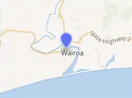
| Coordinates: 39.035°S 177.418°E | |
| Country | New Zealand |
| Region | Hawke's Bay |
| Territorial authority | Wairoa District |
| Government | |
| • Mayor | Craig Little |
| • Deputy Mayor | Hine Flood |
| Area | |
| • Territorial | 4,119.18 km2 (1,590.42 sq mi) |
| Population (June 2020)[1] | |
| • Territorial | 8,960 |
| • Density | 2.2/km2 (5.6/sq mi) |
| • Urban | 4,870 |
| Postcode(s) | 4108 |
| Website | Official website |
History
Early history
Wairoa was originally a Māori settlement. The ancestral waka (canoe) Tākitimu travelled up the river and landed at Mākeakea, near where Tākitimu meeting house stands today. The Wairoa river (full name: Te Wairoa Hōpūpū Hōnengenenge Matangirau) was an important source of food as well as a transport route for the local iwi (people).
Early settlement in the area included a whaling station and trading post, dealing largely in flax. These establishments offered sufficient income and attraction. Its initial name was Clyde, but this was changed largely to avoid confusion with Clive near Napier and Clyde in the South Island. The north part of the town is called North Clyde. The town rose to prominence during the New Zealand Wars, during which time it was a garrison town.
Modern history
In 1990 Wairoa won the last New Zealand Top Town Final in the original Top Town series and were the reigning champs until the series started again in 2009. Unfortunately due to some confusion with a claim by Greymouth to be the last champions, Wairoa was not eligible for the new top town series and unable to defend their title.[3][4]
Demographics
| Year | Pop. | ±% p.a. |
|---|---|---|
| 2006 | 4,314 | — |
| 2013 | 4,089 | −0.76% |
| 2018 | 4,527 | +2.06% |
| Source: [5] | ||
Wairoa had a population of 4,527 at the 2018 New Zealand census, an increase of 438 people (10.7%) since the 2013 census, and an increase of 213 people (4.9%) since the 2006 census. There were 1,548 households. There were 2,223 males and 2,304 females, giving a sex ratio of 0.96 males per female. The median age was 36.4 years (compared with 37.4 years nationally), with 1,116 people (24.7%) aged under 15 years, 861 (19.0%) aged 15 to 29, 1,782 (39.4%) aged 30 to 64, and 768 (17.0%) aged 65 or older.
Ethnicities were 43.0% European/Pākehā, 69.5% Māori, 4.4% Pacific peoples, 3.5% Asian, and 1.1% other ethnicities (totals add to more than 100% since people could identify with multiple ethnicities).
The proportion of people born overseas was 8.3%, compared with 27.1% nationally.
Although some people objected to giving their religion, 34.7% had no religion, 39.4% were Christian, 0.2% were Hindu, 0.9% were Muslim, 0.5% were Buddhist and 15.8% had other religions.
Of those at least 15 years old, 285 (8.4%) people had a bachelor or higher degree, and 1,002 (29.4%) people had no formal qualifications. The median income was $21,500, compared with $31,800 nationally. The employment status of those at least 15 was that 1,341 (39.3%) people were employed full-time, 459 (13.5%) were part-time, and 273 (8.0%) were unemployed.[5]
Culture
Events
Since 2005, Wairoa has been host to the annual Wairoa Māori Film Festival, New Zealand's premiere Maori and indigenous film festival, which has hosted film makers from across the nation and around the world.
In 2015, the festival began to be hosted in part at the newly revitalised Gaiety Theatre, which had recently been fitted out with one of the world's most advanced theatre sound systems.
Marae
The township includes a number of marae (meeting grounds) and wharenui (meeting houses) for the local iwi (tribe) of Ngāti Kahungunu and its hapū (sub-tribes).[6][7]
| Marae | Wharenui | Affiliated hapū |
|---|---|---|
| Hinemihi | Te Poho o Hinemihi | Ngāti Hinemihi |
| Hurumua | Hurumua Memorial Hall | Ngāi Tānemitirangi |
| Iwitea | Te Poho o Tahu | Mātawhaiti |
| Kihitu | Te Rauhina | Ngāti Kahu |
| Ruataniwha | Te Poho o Riria | Ngāi Te Kapuamātotoru |
| Taihoa | Te Otane | Ngāti Kurupakiaka and Te Kāwiti |
| Tākitimu-Waihirere | Tākitimu Wharenui | Ngāi Te Apatu and Ngāti Moewhare |
| Tawhiti A Maru | St Therese’s Church | Catholic church[8] |
| Te Mira, Whetū Mārama and Mill Pā | Mākoro | Ngāti Mākoro |
| Whaakirangi | Whaakirangi | Ngāti Mātangirau |
In October 2020, the Government committed $1,949,075 from the Provincial Growth Fund to upgrade Ruataniwha, Hinemihi, Hurumua, Iwitea, Kihitu, Taihoa, Tākitimu-Waihirere, Tawhiti A Maru, Te Mira and Whakakī, and 14 other Ngāti Kahungunu marae, creating 164 jobs.[9]
Education
Wairoa College is a Year 7–13 co-educational state high school.[10][11] It is a decile 1 school with a roll of 515 as of March 2020.[12][13]
Wairoa Primary School is a Year 1-6 co-educational state primary school.[14] It is a decile 2 school with a roll of 190.[15]
Tiaho Primary School is a Year 1–6 co-educational state primary school.[16] It is a decile 2 school with a roll of 144.[17]
TKKM o Ngati Kahungunu o Te Wairoa is a Year 1-13 co-educational Māori immersion school.[18] It is a decile 1 school with a roll of 122.[19]
St Joseph's School is a Year 1–8 is co-educated state integrated Catholic primary school.[20] It is a decile 3 school with a roll of 72.[21]
Notable people
- Pana Hema Taylor, actor
- Esme Tombleson, politician
References
- "Population estimate tables - NZ.Stat". Statistics New Zealand. Retrieved 22 October 2020.
- "Which is New Zealand's whitest region?"
- Booker, Jarrod (26 November 2008). "Pride at stake for Top Town's title pretenders". The New Zealand Herald.
- "LUSH~Why isn't Wairoa, the 1990 Top Town champions, in the new TVNZ series". RadioLIVE. 25 November 2008.
- "Statistical area 1 dataset for 2018 Census". Statistics New Zealand. March 2020. Wairoa (207800). 2018 Census place summary: Wairoa
- "Te Kāhui Māngai directory". tkm.govt.nz. Te Puni Kōkiri.
- "Māori Maps". maorimaps.com. Te Potiki National Trust.
- "A Journey of Faith: He Hikoi Whakapono". pndiocese.org.nz. Diocese of Palmerston North.
- "Marae Announcements" (Excel). growregions.govt.nz. Provincial Growth Fund. 9 October 2020.
- "Official School Website". wairoacollege.org.
- "Ministry of Education School Profile". educationcounts.govt.nz. Ministry of Education.
- "New Zealand Schools Directory". New Zealand Ministry of Education. Retrieved 26 April 2020.
- "Education Review Office Report". ero.govt.nz. Education Review Office.
- "Ministry of Education School Profile". educationcounts.govt.nz. Ministry of Education.
- "Education Review Office Report". ero.govt.nz. Education Review Office.
- "Ministry of Education School Profile". educationcounts.govt.nz. Ministry of Education.
- "Education Review Office Report". ero.govt.nz. Education Review Office.
- "Ministry of Education School Profile". educationcounts.govt.nz. Ministry of Education.
- "Education Review Office Report". ero.govt.nz. Education Review Office.
- "Ministry of Education School Profile". educationcounts.govt.nz. Ministry of Education.
- "Education Review Office Report". ero.govt.nz. Education Review Office.
External links
- Wairoa Help and Information Centre
- Wairoa i-SITE Visitor Information and Travel Centre
- Official website of Wairoa District Council