Nashua Airport
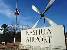
Nashua Airport[2] at Boire Field[1] (IATA: ASH[3], ICAO: KASH, FAA LID: ASH) is a public-use airport located three nautical miles (6 km) northwest of the central business district of Nashua, a city in Hillsborough County, New Hampshire, United States.[1] Owned by the Nashua Airport Authority,[1] It is included in the Federal Aviation Administration (FAA) National Plan of Integrated Airport Systems for 2017–2021, in which it is categorized as a national reliever airport facility.[4]
Nashua Airport Boire Field | |||||||||||
|---|---|---|---|---|---|---|---|---|---|---|---|
 | |||||||||||
| Summary | |||||||||||
| Airport type | Public | ||||||||||
| Owner | Nashua Airport Authority | ||||||||||
| Serves | Nashua, New Hampshire | ||||||||||
| Elevation AMSL | 199 ft / 61 m | ||||||||||
| Coordinates | 42°46′54″N 071°30′53″W | ||||||||||
| Website | nashuaairport | ||||||||||
| Map | |||||||||||
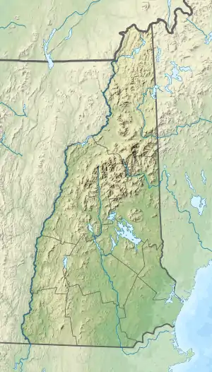
 ASH Location of airport in New Hampshire/United States  ASH ASH (the United States) | |||||||||||
| Runways | |||||||||||
| |||||||||||
| Statistics (2011) | |||||||||||
| |||||||||||
History
The airport dates back to 1934, when the city of Nashua bought a small existing airport, which lacked a hangar and had a grass runway. Over the next several years Nashua, with federal help, paved the 2,000-foot (610 m) runway and put up some buildings. According to the history in the airport web site, the hangar was constructed from bricks reused from a Nashua factory that burned in 1930 in what was known here as the Crown Hill Fire.[5]

In 1943 it was named Boire Field, after Ensign Paul Boire, who was Nashua's first casualty in World War II.
The Nashua Airport Authority was established to oversee the airport in 1961. The New England Aeronautical Institute was founded here in 1965. The NEAI's Daniel Webster Junior College division[6] was founded in 1967. The two schools merged in 1978 to form the Daniel Webster College (DWC). Nashua Airport would become one of the busiest airports in New England in terms of take-offs and landings due to its use by DWC for flight training (the flight training program would eventually be shuttered in 2010).[7]
The airport's control tower was built in 1972.[8] The airport was one of the first to operate with a Non-Federal Control Tower in the early 1990s. This type of air traffic service, called a "contract tower", is common today.
In 2012, runway 14-32 was moved 300 feet (91 m) to the northeast and extended by 500 feet (150 m), to 6,000 feet (1,800 m) to accommodate larger corporate jets. The runway officially opened on August 31, 2012.[9] The original runway was removed. Many taxiways to the new runway were rebuilt during the construction.
In 2016, Southern New Hampshire University (SNHU) agreed to absorb the DWC's faculty and academic programs after its parent company ITT Tech declared bankruptcy. SNHU placed the winning bid for DWC's flight center, tower building, and hangar, and is exploring the viability of reviving DWC's former flight training program.[10]
Facilities and aircraft
Boire Field covers an area of 400 acres (160 ha) at an elevation of 199 feet (61 m) above mean sea level. It has one runway designated 14/32 with an asphalt surface measuring 6,000 by 100 feet (1,829 by 30 m).[1]
For the 12-month period ending December 31, 2011, the airport had 65,965 aircraft operations, an average of 180 per day: 99.7% general aviation, 0.3% air taxi, and <0.1% military. At that time there were 294 aircraft based at this airport: 81% single-engine, 9% multi-engine, 6% jet, 3% helicopter, and 1% glider.[1]
There is space for 441 aircraft located on the field. Air Traffic Control is at the airport from 7:00 a.m. until 9:00 p.m. It has no scheduled commercial service.
Airport services
The airport has private flight schools offering training and certification in fixed-wing airplanes and helicopters. On-demand air charter is offered by providers, including Air Direct Airways and Infinity Aviation, which operates a number of Hawker mid-sized business jet aircraft.
Infinity Aviation Services is a fixed-base operator (FBO) that provides aircraft servicing, fueling and maintenance and flight planning resources. GFW Aeroservices, a former FBO, ceased operation in March 2011.
The second-floor Midfield Cafe is open for breakfast and lunch from 7 a.m. to 2 p.m., six days a week, closed on Tuesdays.
The airport hosts the Southern New Hampshire University Aviation Center, Aviation Operations Management Program,[11] and an accelerated Flight Program.
References
- FAA Airport Form 5010 for ASH PDF. Federal Aviation Administration. Effective June 27, 2013.
- "Nashua Airport - Boire Field". Official site. Retrieved July 18, 2013.
- "IATA Airport Code Search (ASH: Nashua / Boire Field)". International Air Transport Association. Retrieved July 18, 2013.
- "List of NPIAS Airports" (PDF). FAA.gov. Federal Aviation Administration. 21 October 2016. Retrieved 23 November 2016.
- Shalhoup, Dean. "Aviation in Nashua has long, rich history". Nashua Telegraph. November 25, 2012.
- Shalhoup, Dean. "Vagge made mark in Nashua". Nashua Telegraph. July 1, 2007.
- DWC shutters flight program
- "New Hampshire aviation history". New Hampshire Aviation Historical Society. Archived from the original on October 25, 2009.
- Brooks, David. "Longer Nashua Airport runway should be a lure to corporate-jet business". Nashua Telegraph. August 31, 2012.
- Moore, Jim (October 25, 2017). "Nonprofit college aviation program grows". AOPA. Retrieved November 28, 2017.
- https://www.snhu.edu/stem/ceta/aom
External links
- Nashua Airport - Boire Field official site
- Infinity Aviation Services and Nashua Jet Aviation, the fixed-base operators (FBOs)
- New Hampshire Aviation Historical Society
- Aerial image as of April 1998 from USGS The National Map
- FAA Airport Diagram (PDF), effective January 28, 2021
- FAA Terminal Procedures for ASH, effective January 28, 2021
- Resources for this airport:
- FAA airport information for ASH
- AirNav airport information for KASH
- ASN accident history for ASH
- FlightAware airport information and live flight tracker
- NOAA/NWS weather observations: current, past three days
- SkyVector aeronautical chart, Terminal Procedures