Nebraska Highway 52
Nebraska Highway 52 is a highway in central Nebraska. It is 25.89 miles (41.67 km) in length and runs at a southeast-to-northwest angle, though signed north–south. The south terminus is at an intersection with Nebraska Highway 14 north of Fullerton. The northern terminus is located north of Primrose at an intersection with Nebraska Highway 91.
| ||||
|---|---|---|---|---|
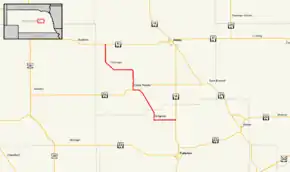 Nebraska Highway 52 highlighted in red | ||||
| Route information | ||||
| Maintained by NDOT | ||||
| Length | 25.89 mi[1] (41.67 km) | |||
| Existed | 1926[2]–present | |||
| Major junctions | ||||
| South end | ||||
| North end | ||||
| Location | ||||
| Counties | Nance, Boone | |||
| Highway system | ||||
| ||||

Route description
Nebraska Highway 52 begins north of Fullerton at Nebraska Highway 14. It goes west through farmland and turns north to pass through Belgrade. Shortly after Belgrade, the highway turns northwest and turns west when it meets Nebraska Highway 56. They overlap into Cedar Rapids, where Highway 52 turns north again. It goes north, then west, then turns northwest to go through Primrose. After passing through Primrose, the highway turns north and ends when it meets Nebraska Highway 91.[1][3]
Major intersections
| County | Location | mi[1] | km | Destinations | Notes |
|---|---|---|---|---|---|
| Nance | | 0.00 | 0.00 | Southern terminus | |
| Boone | Cedar Rapids | 11.20 | 18.02 | South end of N-56 overlap | |
| 12.46 | 20.05 | North end of N-56 overlap | |||
| | 25.89 | 41.67 | Northern terminus | ||
1.000 mi = 1.609 km; 1.000 km = 0.621 mi
| |||||
References
- "Nebraska Highway Reference Log Book" (PDF). Nebraska Department of Roads. 2015. p. 149. Retrieved January 7, 2017.
- "The Nebraska Highways Page: Highways 31 to 60". Archived from the original on 2007-02-08. Retrieved 2007-12-01.
- Google (2010-11-04). "overview of Nebraska Highway 52" (Map). Google Maps. Google. Retrieved 2010-11-04.
